Single jet-powered Shahed (Geran-3) reported transiting northern Rivne Oblast, heading west
What happened
On 20 October 2026, at about 07:29 UTC, a Telegram channel tracked by Intel Mapper, @kpszsu, reported one Russian jet-powered Shahed-type drone, identified as a Geran-3, in northern Rivne Oblast in western Ukraine. The post's original Ukrainian wording describes a jet-type unmanned aerial vehicle in the north of the oblast on a western course. The post does not give a strike location, impact, or casualties, and it does not name a specific settlement as the drone's target. The report is a transit notice from air monitoring, and it is the latest in a sequence of similar notices that began the previous evening. Because the report comes from one channel and gives only a region, the exact track and any endpoint remain unconfirmed.
Context and assessment
Northern Rivne Oblast sits along the Polissia lowlands, a largely forested and marshy corridor that borders Belarus to the north and links central Ukraine with the west. The related events show a steady pattern across roughly twelve hours on 19 and 20 October. Single drones and small groups were reported moving from northern Zhytomyr Oblast into northern Rivne Oblast at 19:22, 23:34, 02:11 and, in one larger group of two or more, at 00:08. A later notice at 06:24 described a drone moving from Rivne Oblast toward the town of Sarny, which lies in the north of the oblast near the Belarusian border. Taken together, these reports suggest a recurring transit route used by Geran-3 drones crossing the region from the east, rather than a single isolated incident. Operationally, such repeated passages could reflect routing toward targets further west, reconnaissance or saturation probing of air defence coverage, or deliberate decoy flights. The data cannot distinguish among these, and no target has been identified in the reports. The jet-powered variant is generally faster than piston-engined Shahed models, which would shorten warning windows for regional air defence and sirens.
Sources and confidence
Only one source is attached to this event, the Telegram channel @kpszsu, which Intel Mapper records as its sole channel. The report has not been cross-confirmed by a second independent outlet or by an official statement with more detail. The confidence score of 8.0 reflects that the channel is an established air-monitoring source with a track record of similar notices, and that the related events are consistent with it. The score is held below the maximum because the post is brief, gives no coordinates, and comes from a single feed. Confidence would rise if another monitoring channel, a regional military administration, or the Ukrainian Air Force reported the same track with timing and direction, or if wreckage or impact were reported. It would fall if later reports contradicted the direction or if the drone was described as leaving Ukrainian airspace without further detail.
Location
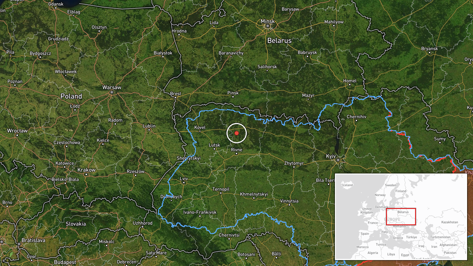
The location is recorded only at region level, northern Rivne Oblast, with a confidence rating of low. The coordinates, about 51.17 north and 26.25 east, are an approximate centre of the northern part of the oblast and do not correspond to any specific settlement or facility. The geographic setting is flat to gently rolling Polissia terrain with extensive forest, wetlands and rivers. Sarny, a town in the north of the oblast, appears in a related event but is not the mapped location for this report.
Related events nearby
- Ukrainian air monitoring: 1 Russian jet-powered Shahed (Geran-3) drone from northern Zhytomyr Oblast toward no2026-10-20 02:11 UTC · Drone Transit · northern Rivne Oblast, Ukraine
- Ukrainian air monitoring: 2+ Russian jet-powered Shahed (Geran-3) drones from Zhytomyr Oblast toward northern 2026-10-20 00:08 UTC · Drone Transit · northern Rivne Oblast, Ukraine
- Ukrainian air monitoring: 1 Russian jet-powered Shahed (Geran-3) drone from Zhytomyr Oblast toward northern Ri2026-10-19 23:34 UTC · Drone Transit · northern Rivne Oblast, Ukraine
- Ukrainian air monitoring: 1 Russian jet-powered Shahed (Geran-3) drone from northern Zhytomyr Oblast toward no2026-10-19 19:22 UTC · Drone Transit · northern Rivne Oblast, Ukraine
- Ukrainian air monitoring: 1 Russian jet-powered Shahed (Geran-3) drone from Rivne Oblast toward Sarny.2026-10-20 06:24 UTC · Drone Transit · Sarny, Ukraine
▶ View this event on the live map

Intel Mapper aggregates open-source reports from monitored Telegram and X channels, geolocates them, cross-checks duplicates across sources and assigns a confidence score. Entries are updated as new confirmations arrive. Read how we verify events.