Ukrainian air monitoring reports one jet-powered Geran-3 drone moving from Ternopil region toward Lviv
What happened
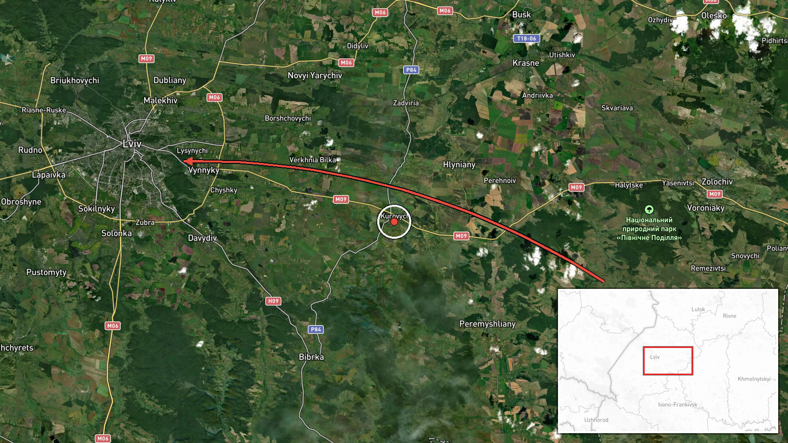
Ukraine's air monitoring reporting, relayed through the Telegram channel @kpszsu, stated at 23:54 UTC on 19 October 2026 that one jet-powered Shahed-type drone, identified as Geran-3, was moving from Ternopil Oblast toward Lviv. The original Ukrainian-language post is brief: a jet-powered UAV from the Ternopil region heading toward Lviv, preceded by a motorcycle emoji. The post does not describe any impact, detonation, or damage, and it does not say whether the drone was intercepted. It is one entry in a series of Lviv-directed drone reports logged across the same day. The event is placed at Lviv city level.
Context and assessment
Lviv is the principal city of western Ukraine, a regional administrative, transport, and logistics hub located about 70 km from the Polish border. Its rail links and road corridors make it a recurring waypoint for traffic moving between Ukraine's interior and western frontier crossings, which is why drone tracks toward the city are closely watched. The related events show a dense sequence on 19 October 2026: an approach from the northern outskirts of Lviv logged at 05:44 UTC, an earlier track over the city at 04:52, an overflight of Lviv Oblast at 19:08, a heading toward Lviv at 19:56, and a track from Volyn Oblast toward Lviv at 20:57. Because the reports describe different origin oblasts and approach directions, they may reflect several separate drones rather than one object reported repeatedly. Operationally, repeated transit reports of this kind suggest that drones are being routed through or around the Lviv area, with the destination unstated in the data. A jet-powered Geran-3 is generally assessed to fly faster than piston-engine Shahed variants, which would shorten warning time for local authorities. The data alone does not establish whether Lviv itself was the intended target.
Sources and confidence
The event rests on a single Telegram channel, @kpszsu, which is the official channel associated with Ukraine's Air Force. The dataset records no independent confirmation from another outlet, regional administration, or wire service, and the corrected flag is false. The confidence score of 8.0 reflects the authority of the channel, the specificity of the drone type and route, and the fact that the wording matches the pattern of earlier official air alerts. It is held below the top of the scale because the report is unverified by any second source and does not record an outcome. Confidence would rise with corroboration from Lviv regional authorities or additional official air-alert channels, and would fall if the track were revised, reattributed, or found to duplicate another report.
Location
The location is recorded at settlement level as Lviv city, with coordinates of 49.84 N and 24.03 E, which approximate the city centre. The location confidence is rated high because the report names the city directly, while the origin is not geolocated and is inferred only from the wording Ternopil region. Lviv sits in western Ukraine on hilly terrain and river valleys, with the historic centre on elevated ground. The city is roughly 70 km from the Polish border, and Ternopil Oblast lies to the east.
Related events nearby
- Ukrainian air monitoring: 1 Russian jet-powered Shahed (Geran-3) drone from Volyn Oblast toward Lviv.2026-10-19 20:57 UTC · Drone Transit · Lviv, Ukraine
- Ukrainian air monitoring: 1 Russian jet-powered Shahed (Geran-3) drone heading toward Lviv.2026-10-19 19:56 UTC · Drone Transit · Lviv, Ukraine
- Ukrainian air monitoring: 1 Russian jet-powered Shahed (Geran-3) drone over Lviv Oblast.2026-10-19 19:08 UTC · Drone Transit · Lviv Oblast, Ukraine
- Ukrainian air monitoring: 1 Russian jet-powered Shahed (Geran-3) drone over Lviv.2026-10-19 04:52 UTC · Drone Transit · Lviv, Ukraine
- Ukrainian air monitoring: another Russian jet-powered Shahed (Geran-3) drone tracked approaching Lviv's suburb2026-10-19 05:44 UTC · Drone Transit · Northern outskirts of Lviv, Lviv Oblast, Ukraine
▶ View this event on the live map

Intel Mapper aggregates open-source reports from monitored Telegram and X channels, geolocates them, cross-checks duplicates across sources and assigns a confidence score. Entries are updated as new confirmations arrive. Read how we verify events.