Ukrainian air monitoring reports 2+ Shahed-type drones moving from Black Sea toward Vylkove
What happened
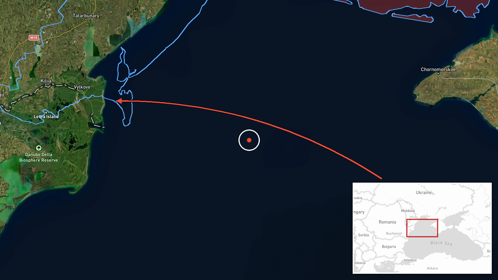
Ukrainian air monitoring channel @kpszsu on Telegram reported on 20 October 2026, at about 01:08 UTC, a group of two or more Russian Shahed-type drones (described in the original Ukrainian post as a group of strike UAVs, 'Група ударних БпЛА') moving toward Vylkove from the Black Sea area. The report is a transit warning rather than a confirmed impact; it does not describe any strike, damage, or casualties. The original wording names Vylkove and the Black Sea water area as the drones' approach, and the English summary frames the event as a drone transit. Vylkove is a town in Odesa Oblast in southwestern Ukraine, and the report was issued as a single-channel alert.
Context and assessment
Vylkove sits in the Danube Delta, close to the Romanian border and the Chilia branch of the river, and it has been part of a recurring pattern of Shahed-type activity along Ukraine's Danube and Black Sea littoral. The related events logged the same night show a sequence moving along this corridor: a single drone from the Black Sea toward Odesa at 18:23 UTC on 19 October, another from Odesa Oblast toward Serhiyivka at 00:56, one toward Sarata at 00:31, and a further group heading toward Kiliya at 01:22, which lies a short distance from Vylkove along the delta. Taken together, the sequence suggests drones routed along the coast and river channels rather than a single isolated flight. Operationally, such routing is often associated with approaches that keep low altitude over water and deltaic terrain, making detection harder and complicating air defence coverage. Reports of this kind are generally read as indicators of intent to probe or strike port and river infrastructure, but the data alone does not establish a target or a specific aim.
Sources and confidence
The event rests on one Telegram channel, @kpszsu, which is a Ukrainian air-monitoring source. No independent outlet or second channel is listed in the data, so cross-confirmation is absent. The confidence score of 8.0 reflects a credible official-style source with specific location and time, but it is held below the top range because it is single-sourced and describes a transit warning, not an observed outcome. Confidence would rise with corroboration from a second monitoring channel, regional military administration statements, or reports of interception or impact. It would fall if later updates retract the drone count or the direction of travel.
Location
The location is recorded at settlement level, with coordinates for Vylkove, Ukraine (approximately 45.40 N, 29.59 E), and location confidence is rated high. The point reflects the town rather than a specific facility. Vylkove lies in the Danube Delta of Odesa Oblast, on the Ukrainian side of the river near the Black Sea coast and the Romanian border. Nearby features include the Danube branches, lakes and wetlands, and the coastal lagoons, which shape the low-lying, water-dominated terrain.
Related events nearby
- Ukrainian air monitoring: 2+ Russian Shahed-type drones heading toward Kiliya.2026-10-20 01:22 UTC · Drone Transit · Kiliya, Ukraine
- Ukrainian air monitoring: 1 Russian Shahed-type drone from Odesa Oblast toward Katlabuh.2026-10-20 01:53 UTC · Drone Transit · Katlabuh, Ukraine
- Ukrainian air monitoring: 1 Russian Shahed-type drone from Odesa Oblast toward Sarata.2026-10-20 00:31 UTC · Drone Transit · Sarata, Ukraine
- Ukrainian air monitoring: 1 Russian Shahed-type drone passing Bolhrad district, heading south.2026-10-20 01:37 UTC · Drone Transit · Bolhrad district, Ukraine
- Ukrainian air monitoring: 1 Russian Shahed-type drone from Odesa Oblast toward Serhiyivka.2026-10-20 00:56 UTC · Drone Transit · Serhiyivka, Ukraine
▶ View this event on the live map

Intel Mapper aggregates open-source reports from monitored Telegram and X channels, geolocates them, cross-checks duplicates across sources and assigns a confidence score. Entries are updated as new confirmations arrive. Read how we verify events.