Ukrainian air monitoring reports at least two Shahed-type drones heading toward Kiliya, Odesa Oblast
What happened
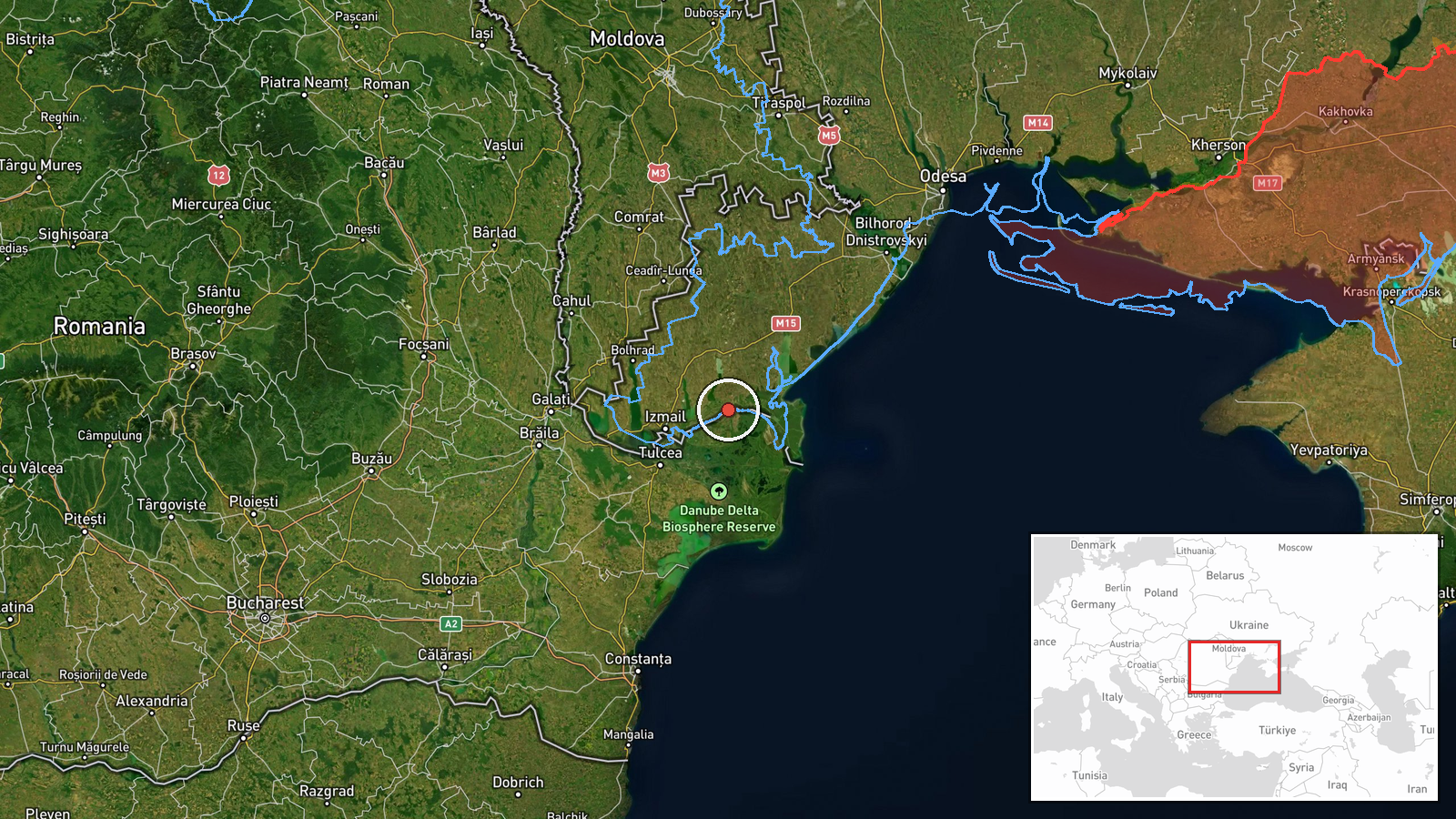
Ukrainian air monitoring, relayed through the Telegram channel @kpszsu, reported at 01:22 UTC on 20 October 2026 that at least two Russian Shahed-type drones were heading toward Kiliya, a settlement in Odesa Oblast in southwestern Ukraine on the Danube delta. The original Ukrainian-language post, headed with the phrase 'a group of strike UAVs toward Kiliya', describes the drones as a group but gives no firm count beyond the two-or-more threshold in the summary, and reports no impact, casualties or damage. The event is classed as a drone transit, meaning a track toward a location rather than a confirmed strike. Three related transit reports from the same night, at Sarata, Serhiyivka and Vylkove, are logged between 00:31 and 01:08 UTC. Attribution to Russia reflects the channel's framing of Shahed-type systems rather than independent identification.
Context and assessment
Kiliya sits on the Kilia branch of the Danube near the Romanian border, and the river corridor is strategically significant for Ukraine because it carries grain and other cargo through port facilities in the delta to the Black Sea and Europe. Earlier in the Russia-Ukraine war, Danube ports and border towns have been reported affected by drone activity, which is why transit tracks in this area draw close attention. The related reports form a chain. A track from Odesa Oblast reached Sarata at 00:31 UTC, a second reached Serhiyivka at 00:56, a Black Sea track was reported toward Vylkove at 01:08, and the Kiliya report followed at 01:22. The sequence moves progressively from the Odesa coastal area toward the delta, which may indicate one or more drones following the river axis, or may reflect overlapping tracking of separate aircraft rather than a single coordinated push. Shahed-type drones can change heading, so a report of heading toward a settlement does not establish the intended target. Operationally, the pattern may suggest that the delta and its port and border infrastructure were of interest, but the data do not identify any specific facility, and no conclusion about intent should be drawn from the transit reports alone.
Sources and confidence
The report rests on a single Telegram channel, @kpszsu, which is the official channel of Ukraine's Air Force, so the confidence score of 8.0 reflects an authoritative but unverified primary source with no second outlet in the data. The related transit reports are logged without a channel breakdown, so cross-confirmation within the chain cannot be assessed from the record provided. Confidence would rise with independent corroboration from Odesa regional authorities, Izmail district officials, Romanian border or Danube port authorities, or a later air-defence statement confirming the track. It would fall if a correction were issued, if the track was later attributed to a different aircraft type, or if no further sightings or impacts followed.
Location
The coordinates are settlement-level with high location confidence, placing the point at the centre of Kiliya rather than at any specific facility. Kiliya lies in Izmail Raion of Odesa Oblast, on the Kilia arm of the Danube delta close to the Romanian frontier. Nearby features include the wide river channels and wetlands of the delta, the Black Sea coastline to the south and east, and the town of Vylkove, which is also on the delta. Across the river lies Romania's Tulcea County.
Related events nearby
- Ukrainian air monitoring: 2+ Russian Shahed-type drones from Black Sea toward Vylkove.2026-10-20 01:08 UTC · Drone Transit · Vylkove, Ukraine
- Ukrainian air monitoring: 1 Russian Shahed-type drone from Odesa Oblast toward Katlabuh.2026-10-20 01:53 UTC · Drone Transit · Katlabuh, Ukraine
- Ukrainian air monitoring: 1 Russian Shahed-type drone passing Bolhrad district, heading south.2026-10-20 01:37 UTC · Drone Transit · Bolhrad district, Ukraine
- Ukrainian air monitoring: 1 Russian Shahed-type drone from Odesa Oblast toward Sarata.2026-10-20 00:31 UTC · Drone Transit · Sarata, Ukraine
- Ukrainian air monitoring: 1 Russian Shahed-type drone from Odesa Oblast toward Serhiyivka.2026-10-20 00:56 UTC · Drone Transit · Serhiyivka, Ukraine
▶ View this event on the live map

Intel Mapper aggregates open-source reports from monitored Telegram and X channels, geolocates them, cross-checks duplicates across sources and assigns a confidence score. Entries are updated as new confirmations arrive. Read how we verify events.