Russian Geran-3 drone tracked from Zhytomyr Oblast toward Chudniv, Ukraine
What happened
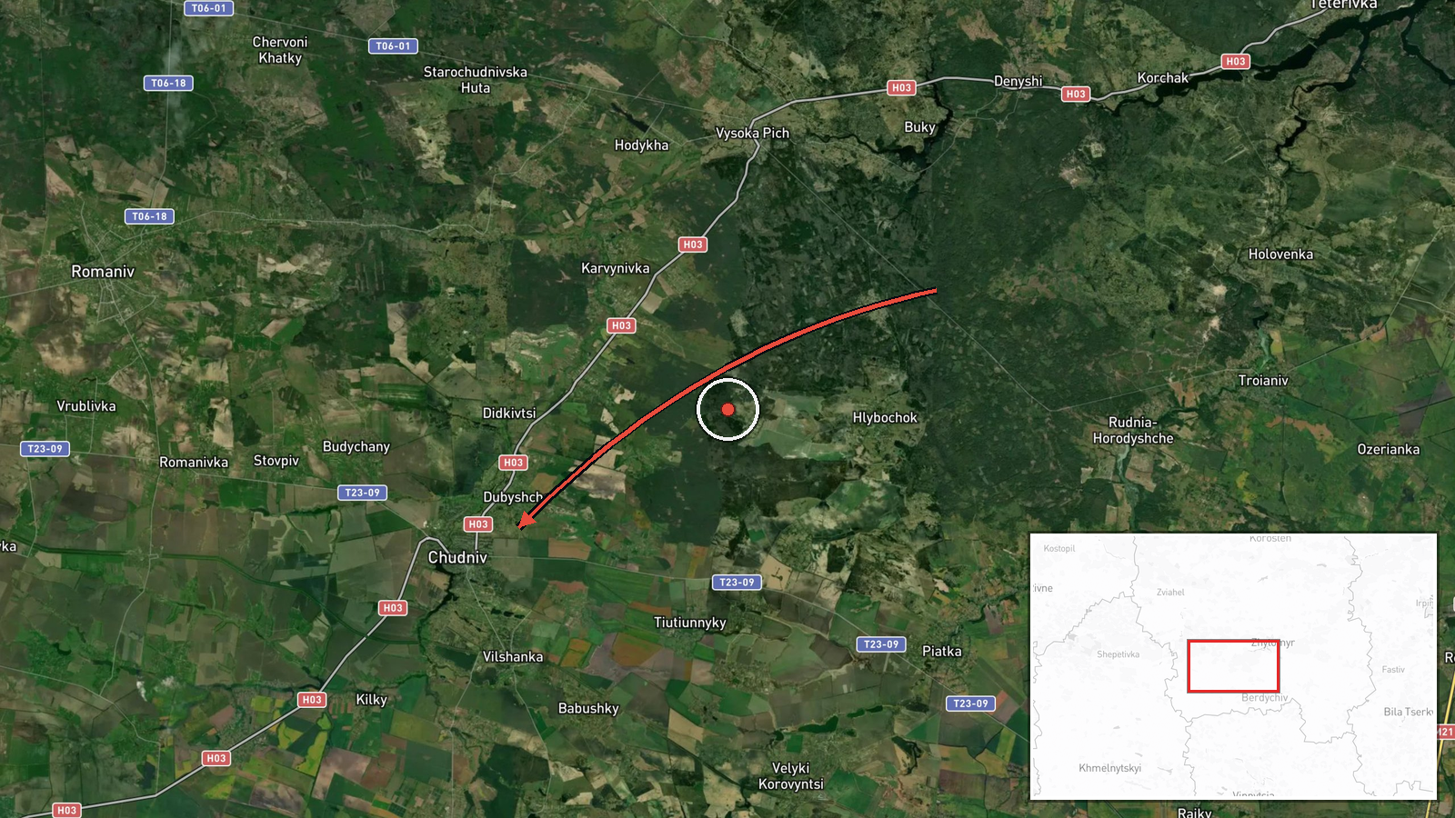
Ukrainian air monitoring, relayed by the Telegram channel @kpszsu, which is generally understood to be the Ukrainian Air Force channel, reported one jet-powered Shahed-type drone, identified as a Geran-3, moving from Zhytomyr Oblast toward Chudniv in northwestern Ukraine at 01:38 UTC on 20 October 2026. The original Ukrainian-language post, which translates roughly as 'jet-powered UAV toward Chudniv/Romaniv in Zhytomyr region,' names both settlements, while the event record places the track on Chudniv. The report describes a transit track rather than a strike. Neither the post nor the event data states any impact, damage or casualties. The alert is one of several Geran-3 transit reports logged over Zhytomyr Oblast in the preceding day.
Context and assessment
Chudniv sits in Zhytomyr Oblast, a northern oblast that lies along one of the routes Russian long-range drones have used to cross from the north toward central and western Ukraine. The five related events show a sequence of single-drone transit reports from the evening of 19 October into the early hours of 20 October. The track moves from Kyiv Oblast toward Zhytomyr Oblast at 21:00 UTC, then through Zhytomyr city at 00:19, past Piskivka at 00:40, and toward Liubar and Baranivka earlier in the day. Chudniv's report follows the same pattern. Operationally, a cluster of single-airframe alerts across one oblast within about five hours may indicate a sustained series of launches or drones being tracked across multiple overflight corridors. It could also reflect routine air-defence monitoring rather than a deliberate attempt on any one settlement. The data alone cannot confirm whether Chudniv was a target or simply lay on the flight path.
Sources and confidence
The event rests on one channel, the Telegram account @kpszsu, which is generally regarded as an official Ukrainian air monitoring source. No second outlet, regional military administration or independent monitor in the data corroborates the track. The confidence score of 8.0 reflects the channel's institutional role, the specific aircraft type, and the precise settlement reference, but it is held below the top of the scale because the report is unconfirmed by any second source. Confidence would rise with corroboration from another official source or from an independent tracking account. It would fall if later reporting revised the aircraft type, the direction of travel, or the Chudniv and Romaniv naming.
Location
The location is recorded at settlement level, with coordinates of approximately 50.0525 N, 28.1206 E, which correspond to the town of Chudniv rather than to any specific facility. The location confidence is rated high because the source names the settlement directly. Chudniv lies in the Polissia lowlands of northwestern Zhytomyr Oblast, an area of forests, wetlands and rivers. The Romaniv named in the original post is a nearby settlement and is not separately geolocated in this record.
Related events nearby
- Ukrainian air monitoring: 1 Russian jet-powered Shahed (Geran-3) drone from Zhytomyr Oblast toward Liubar.2026-10-19 14:00 UTC · Drone Transit · Liubar, Ukraine
- Ukrainian air monitoring: 1 Russian jet-powered Shahed (Geran-3) drone from Zhytomyr Oblast toward Baranivka.2026-10-19 16:46 UTC · Drone Transit · Baranivka, Ukraine
- Ukrainian air monitoring: 1 Russian Shahed-type drone passing Piskivka, heading toward Zhytomyr Oblast.2026-10-20 00:40 UTC · Drone Transit · Zhytomyr Oblast, Ukraine
- Ukrainian air monitoring: 1 Russian jet-powered Shahed (Geran-3) drone heading toward Zhytomyr.2026-10-20 00:19 UTC · Drone Transit · Zhytomyr, Ukraine
- Ukrainian air monitoring: 1 Russian jet-powered Shahed (Geran-3) drone from Kyiv Oblast toward Zhytomyr Oblast2026-10-19 21:00 UTC · Drone Transit · Zhytomyr Oblast, Ukraine
▶ View this event on the live map

Intel Mapper aggregates open-source reports from monitored Telegram and X channels, geolocates them, cross-checks duplicates across sources and assigns a confidence score. Entries are updated as new confirmations arrive. Read how we verify events.