Ukrainian air monitoring reports Russian jet-powered Shahed drone tracked toward Dobrotvir, Lviv Oblast
What happened
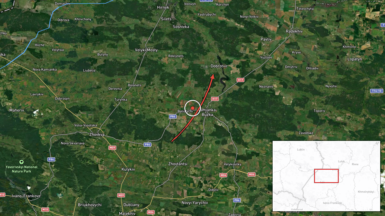
Ukraine's Air Force monitoring channel on Telegram, @kpszsu, reported at 07:52 UTC on 20 October 2026 a single jet-powered unmanned aerial vehicle in Lviv Oblast flying on a course toward Dobrotvir. The original Ukrainian post described it simply as a jet-type UAV heading for Dobrotvir, while the event summary attributes it to Russia and identifies it as a Shahed-type drone of the Geran-3 variant. The report does not describe impact, damage, casualties, or any interception. It is classified as a drone transit, meaning the aircraft was tracked in flight rather than confirmed striking a target. Related entries from the same morning place drones of the same description over Horokhiv, Lviv, Rohatyn and Dobrotvir, beginning at 02:36 UTC.
Context and assessment
Dobrotvir is a small settlement in Lviv Oblast in western Ukraine, roughly 50 kilometres northeast of Lviv city. It is widely reported to host a large thermal power plant, which would make energy infrastructure the most plausible reason for repeated attention to the area, though no source in this entry names a specific facility as a target. The related entries show a pattern of drone tracks passing through several settlements across Lviv Oblast in the early hours, with Dobrotvir recurring at 02:41, 03:21, 05:31 and 07:52 UTC. Repeated appearances over the same settlement may reflect a drone loitering or being re-tasked, several aircraft following similar routes, or multiple tracking updates on one or more aircraft. The Geran-3 is a jet-powered variant of the Shahed family, generally faster than the piston-engined models, and its use across western Ukraine is consistent with long-range strike campaigns aimed at deep rear areas. Operationally, the sequence suggests sustained airborne activity over western Ukraine that day, but the data alone does not establish intent or a specific objective.
Sources and confidence
Only one channel, the Telegram account @kpszsu, is attached to this entry, so there is no cross-confirmation from a second outlet. The account is associated with Ukraine's Air Force air-monitoring reporting, which is generally the primary official source for airborne threat tracking. The confidence score of 8.0 out of 10 reflects that institutional origin and the internal consistency of the related entries, but it stops short of the top of the scale because there is no independent corroboration, no imagery, and no follow-up statement. Confidence would rise with a second outlet or an official post describing the track or its outcome. It would fall if the repeated Dobrotvir timestamps were shown to be duplicate reports of a single aircraft.
Location
The location is tagged at settlement precision, meaning the coordinates of 50.205 N, 24.384 E mark the centre of Dobrotvir rather than a specific facility, and location confidence is rated high. The settlement lies in Lviv Oblast in western Ukraine, in relatively open, gently rolling terrain typical of the region. Because the aircraft was reported in flight, the point reflects the reported destination area rather than a confirmed impact point.
Related events nearby
- Ukrainian air monitoring: 1 Russian jet-powered Shahed (Geran-3) drone from Lviv Oblast toward Dobrotvir.2026-10-20 05:31 UTC · Drone Transit · Dobrotvir, Ukraine
- Ukrainian air monitoring: 1 Russian jet-powered Shahed (Geran-3) drone from Lviv Oblast toward Dobrotvir.2026-10-20 03:21 UTC · Drone Transit · Dobrotvir, Ukraine
- Ukrainian air monitoring: 1 Russian jet-powered Shahed (Geran-3) drone from Lviv Oblast toward Lopatyn.2026-10-20 08:16 UTC · Drone Transit · Lopatyn, Ukraine
- Ukrainian air monitoring: 1 Russian jet-powered Shahed (Geran-3) drone passing Rohatyn, heading toward Lviv Ob2026-10-20 02:49 UTC · Drone Transit · Lviv Oblast, Ukraine
- Ukrainian air monitoring: 1 Russian jet-powered Shahed (Geran-3) drone passing Dobrotvir, heading toward Lviv.2026-10-20 02:41 UTC · Drone Transit · Lviv, Ukraine
▶ View this event on the live map

Intel Mapper aggregates open-source reports from monitored Telegram and X channels, geolocates them, cross-checks duplicates across sources and assigns a confidence score. Entries are updated as new confirmations arrive. Read how we verify events.