Ukrainian air monitoring reports one jet-powered Shahed drone heading from Lviv Oblast toward Lopatyn
What happened
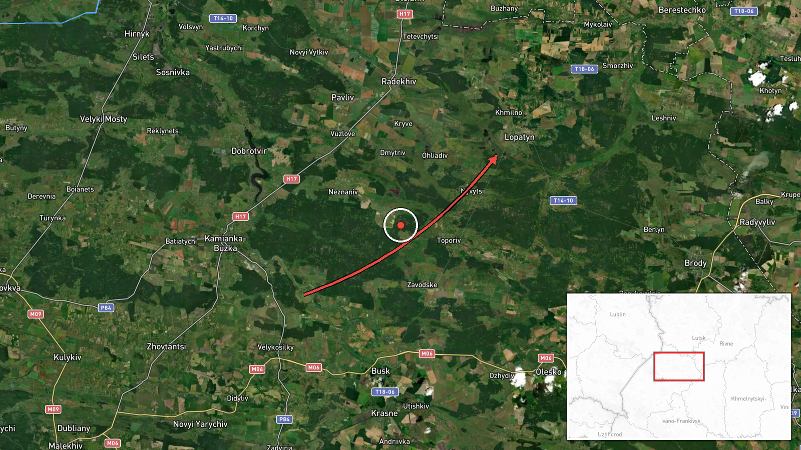
Ukrainian air monitoring reported one Russian jet-powered Shahed, designated Geran-3, moving from Lviv Oblast toward Lopatyn. The original Ukrainian-language post also names Krasne as a heading. The report was posted at 08:16 UTC on 20 October 2026 and is recorded as a drone transit rather than a confirmed strike, so no impact, damage or casualties are described. The message was published on the Telegram channel @kpszsu and has no independent corroboration in the data provided. The phrase 'курсом на' indicates a course or heading, so the drone's intended endpoint is inferred from direction rather than observed. Earlier alerts that morning tracked similar drones toward nearby Dobrotvir and Torchyn, and one passed Volyn Oblast heading west.
Context and assessment
Lviv Oblast sits in western Ukraine, close to the border with Poland, and drone tracks through this region are of interest because they show how far west Russian long-range strikes can be routed. The sequence here is notable for its regularity. Alerts tied to Dobrotvir were logged at 03:21, 05:31 and 07:52 UTC, a Torchyn-bound track appeared at 07:44, a drone was seen crossing Volyn Oblast at 04:47, and the Lopatyn report followed at 08:16. Taken together, these describe repeated single-drone flights along a similar western axis over a single morning rather than one isolated event. Dobrotvir hosts energy infrastructure, which may explain why the same settlement recurs in alerts, though the data itself does not state a target. The Geran-3 is a jet-powered variant of the Shahed family, generally faster and harder to intercept than the older piston-engine models. Operationally, a steady stream of individual drones on related headings could reflect reconnaissance, decoy or saturation tactics, or routing toward target sets further west. The available data does not establish intent, and the pattern may also reflect routine monitoring rather than a coordinated campaign.
Sources and confidence
All information comes from one Telegram channel, @kpszsu, which is a Ukrainian air-monitoring feed. No second outlet, official statement or wire service reports this specific track in the data provided, so cross-confirmation is absent. The confidence score of 8.0 reflects a specific, time-stamped report from a monitoring source with a clear track description, offset by the single-channel basis and the inferred heading. Confidence would rise with corroboration from a second monitoring feed, an official Ukrainian Air Force statement, or reports of impact or interception near the stated route. It would fall if the channel issued a correction, revised the heading, or other sources contradicted the track.
Location
The location is a settlement-level point for Lopatyn, Ukraine, with high location confidence, placed at the settlement centre rather than at any specific facility. The area lies in western Ukraine within the broader Lviv region, where terrain is typically rolling farmland with forest belts and river valleys. Nearby settlements such as Dobrotvir appear in the same alert sequence. The precision means the point is approximate to the settlement and should not be read as a precise target location.
Related events nearby
- Ukrainian air monitoring: 1 Russian jet-powered Shahed (Geran-3) drone from Lviv Oblast toward Dobrotvir.2026-10-20 07:52 UTC · Drone Transit · Dobrotvir, Ukraine
- Ukrainian air monitoring: 1 Russian jet-powered Shahed (Geran-3) drone from Lviv Oblast toward Dobrotvir.2026-10-20 05:31 UTC · Drone Transit · Dobrotvir, Ukraine
- Ukrainian air monitoring: 1 Russian jet-powered Shahed (Geran-3) drone from Lviv Oblast toward Dobrotvir.2026-10-20 03:21 UTC · Drone Transit · Dobrotvir, Ukraine
- Ukrainian air monitoring: 1 Russian jet-powered Shahed (Geran-3) drone heading toward Torchyn.2026-10-20 07:44 UTC · Drone Transit · Torchyn, Ukraine
- Ukrainian air monitoring: 1 Russian jet-powered Shahed (Geran-3) drone passing Volyn Oblast, heading west.2026-10-20 04:47 UTC · Drone Transit · Volyn Oblast, Ukraine
▶ View this event on the live map

Intel Mapper aggregates open-source reports from monitored Telegram and X channels, geolocates them, cross-checks duplicates across sources and assigns a confidence score. Entries are updated as new confirmations arrive. Read how we verify events.