Ukrainian air monitoring reports one jet-powered Shahed drone heading toward Rivne
What happened
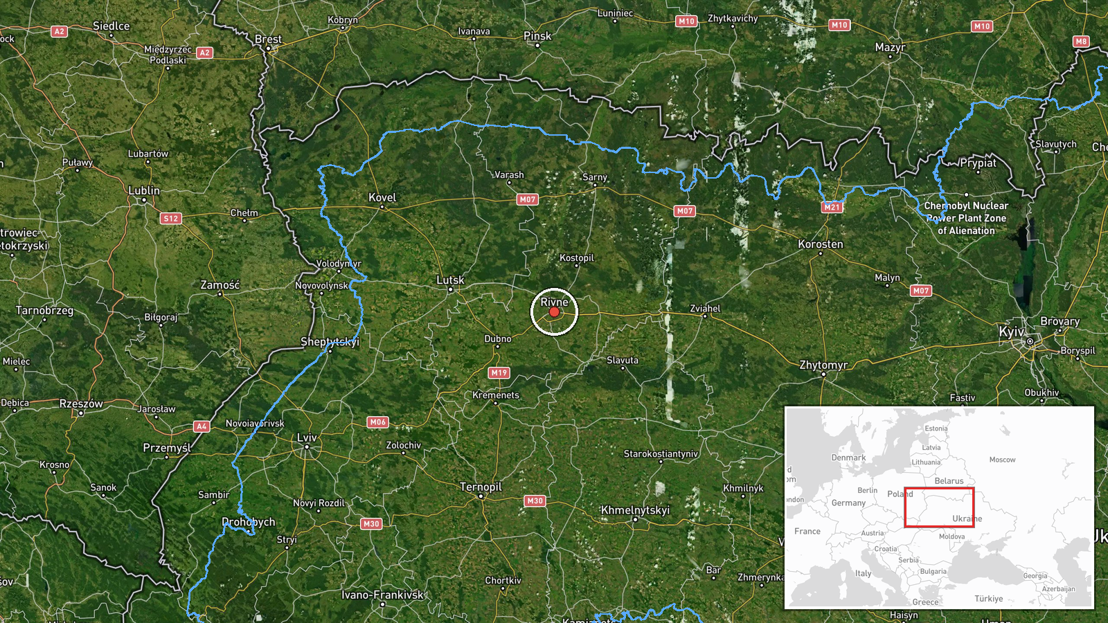
Ukrainian air monitoring reported one Russian jet-powered Shahed drone, identified as a Geran-3, heading toward Rivne at about 12:59 UTC on 20 October 2026. The alert was posted in Ukrainian on the Telegram channel @kpszsu, which carries official Ukrainian Air Force aerial threat bulletins. The original wording, translated, reads roughly as 'jet UAV heading toward Rivne.' The report describes a track in progress rather than a confirmed strike and gives no impact point, casualties, or damage. The event is recorded at settlement level, with coordinates placed on Rivne city. It is the latest entry in a series of drone transit reports for the Rivne area earlier that day, all published on the same channel.
Context and assessment
Rivne matters as the administrative and economic centre of Rivne Oblast in northwestern Ukraine, a region close to the Polish and Belarusian borders and an established transit corridor for long-range drones. The related reports show a steady pattern through the early morning. At 02:06 and 03:10 single drones were reported heading toward Rivne, while at 03:06 one was reported passing Horodnytsia toward Rivne Oblast. At 04:35 two or more were reported passing Olevsk, and at 06:18 two or more were reported moving from western Zhytomyr Oblast toward Rivne Oblast, with the count partly truncated in the source. Taken together, this suggests repeated flights along a northwest corridor from Zhytomyr toward Rivne rather than a single isolated track. Operationally, sustained transits of this kind may indicate routing toward infrastructure in the region, a deliberate effort to stretch air defence, or decoy and route-testing activity, though the reports alone cannot establish intent. Jet-powered Geran-3 variants are generally reported to be faster than piston-engine Shaheds, which would shorten warning time for local authorities.
Sources and confidence
All reporting comes from a single channel, Telegram @kpszsu, the official Ukrainian Air Force feed, and no independent outlet has yet corroborated the track. The score of 8.0 reflects the high reliability of an official military monitoring source and the consistency of the report with the surrounding series, but it is held below the top range because there is only one source and no confirmation of the drone's fate. Confidence would rise with independent corroboration, regional authority statements, or reports of debris or impact in Rivne Oblast. It would fall if the channel issued a correction, revised the drone type, or if later official updates contradicted the track.
Location
The coordinates match the centre of Rivne city and are assigned at settlement precision, with high location confidence because the source names the city directly. Rivne lies in the Volhynia-Polissia region of northwestern Ukraine, an area of low-lying plains, forests, and wetlands with river valleys that shape flight routing. The city is a regional hub for transport, industry, and public services, and its surroundings include the northwestern approaches toward the Polish and Belarusian frontiers.
Related events nearby
- Ukrainian air monitoring: 2+ Russian jet-powered Shahed (Geran-3) drones from western Zhytomyr Oblast toward R2026-10-20 06:18 UTC · Drone Transit · Rivne Oblast, Ukraine
- Ukrainian air monitoring: 2+ Russian jet-powered Shahed (Geran-3) drones passing Olevsk, heading toward Rivne 2026-10-20 04:35 UTC · Drone Transit · Rivne Oblast, Ukraine
- Ukrainian air monitoring: 1 Russian jet-powered Shahed (Geran-3) drone heading toward Rivne.2026-10-20 03:10 UTC · Drone Transit · Rivne, Ukraine
- Ukrainian air monitoring: 1 Russian jet-powered Shahed (Geran-3) drone passing Horodnytsia, heading toward Riv2026-10-20 03:06 UTC · Drone Transit · Rivne Oblast, Ukraine
- Ukrainian air monitoring: 1 Russian jet-powered Shahed (Geran-3) drone heading toward Rivne.2026-10-20 02:06 UTC · Drone Transit · Rivne, Ukraine
▶ View this event on the live map

Intel Mapper aggregates open-source reports from monitored Telegram and X channels, geolocates them, cross-checks duplicates across sources and assigns a confidence score. Entries are updated as new confirmations arrive. Read how we verify events.