Two or more jet-powered Shahed drones reported passing Boryspil toward Kyiv
What happened
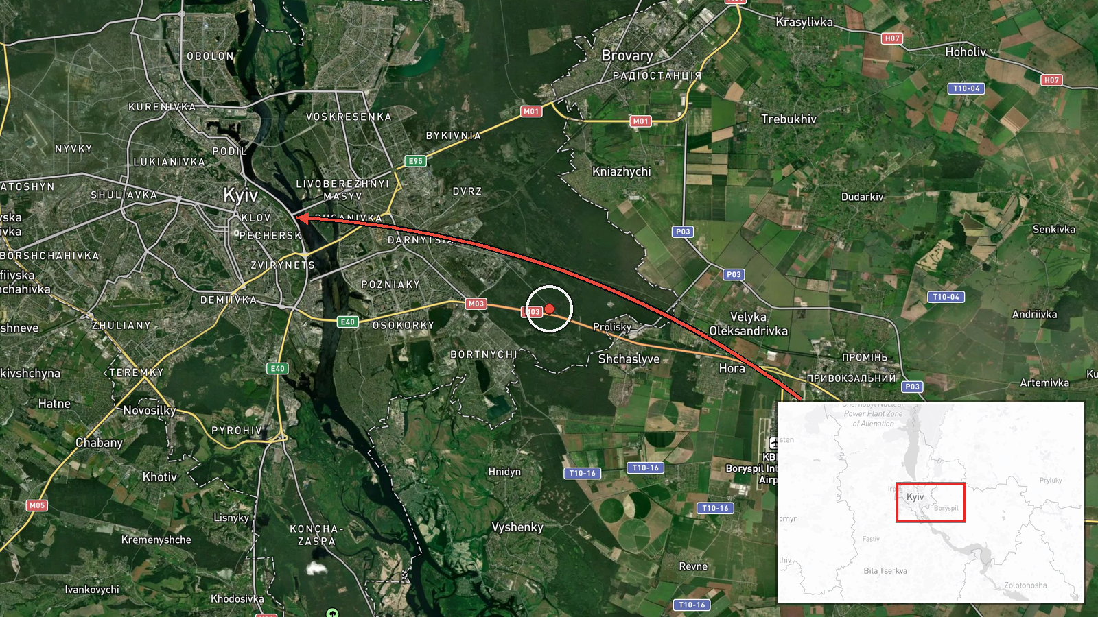
Ukrainian air monitoring reported that two or more jet-powered unmanned aerial vehicles were passing through the Boryspil and Vyshneve areas on a course toward Kyiv on 20 October 2026, timestamped 17:18 UTC. The original Ukrainian-language post, published on the Telegram channel @kpszsu, refers only to "jet-powered UAVs" (реактивні БпЛА) and does not name a model. The Shahed (Geran-3) identification, along with the attribution to Russia, comes from the event summary and is not stated in the post itself. The report is a short tracking update rather than a description of impacts, and it does not mention any strike, casualties or damage. Boryspil and Vyshneve are both in the Kyiv area, so the report places the drones on the approach to the capital.
Context and assessment
Kyiv is Ukraine's political and military centre, so drones tracked on approach to the city draw attention whatever their eventual target. Boryspil, home to the main international airport serving the capital, lies east of the city, and the reported path suggests a corridor from the east and southeast. Earlier the same afternoon, the same channel reported one jet-powered drone passing Boryspil at 15:55 UTC and two or more passing Lubny, in Poltava Oblast, heading toward Kyiv Oblast at 15:36 UTC. Read together, these updates may indicate a sequence of separate groups moving along a similar axis, which would fit a sustained wave rather than a single isolated launch. Jet-powered Geran-3 variants are generally faster than the piston-engine Geran-2, which may shorten warning time and make interception harder, though the post itself names no model. Flight path alone cannot show intent, and drones in transit do not always strike the area they overfly. Zelensky statements at 17:24 and 17:26 UTC, on early warning enabled by US intelligence sharing and on Russia's role in the Iran conflict, were posted in the same window, and a 15:26 UTC meeting with US envoy Steve Witkoff in Norway addressed ending the war. These items are context, not evidence about this flight.
Sources and confidence
Only one channel, Telegram @kpszsu, carried this report, so the source count is 1. The channel is associated with Ukraine's air force monitoring, which supports a confidence score of 8.0 on the platform's scale. The score stops short of the top because no second outlet, radar record or official statement in the data corroborates the track, and the Shahed model identification is an inference not made in the original text. Confidence would rise with confirmation from other monitoring feeds, local Kyiv officials, or reports of interceptions or impacts. It would fall if the update were corrected, withdrawn, or shown to describe a different aircraft type.
Location
The point is geocoded at settlement level to central Kyiv (50.45, 30.52), not to any drone's position, because the post names Boryspil and Vyshneve rather than coordinates. Boryspil, site of the main airport, lies roughly 30 kilometres east of central Kyiv. Vyshneve is a town in Kyiv Oblast on the capital's outskirts. The Dnipro River runs through the city, and a path from the east would cross it before reaching central districts.
Related events nearby
- Ukrainian air monitoring: 2+ Russian jet-powered Shahed (Geran-3) drones passing Olyshivka, heading toward Kyi2026-10-20 17:32 UTC · Drone Transit · Kyiv Oblast, Ukraine
- Zelensky says Putin is helping Iran and that Russia is on the Iranian side in the ongoing Iran conflict.2026-10-20 17:26 UTC · Statement · Kyiv, Ukraine
- Zelensky says Ukraine is currently receiving U.S. intelligence, enabling early warning of incoming ballistic m2026-10-20 17:24 UTC · Statement · Kyiv, Ukraine
- Ukrainian air monitoring: 1 Russian jet-powered Shahed (Geran-3) drone passing Boryspil, heading toward Kyiv.2026-10-20 15:55 UTC · Drone Transit · Kyiv, Ukraine
- Ukrainian air monitoring: 2+ Russian jet-powered Shahed (Geran-3) drones passing Lubny, heading toward Kyiv Ob2026-10-20 15:36 UTC · Drone Transit · Kyiv Oblast, Ukraine
▶ View this event on the live map

Intel Mapper aggregates open-source reports from monitored Telegram and X channels, geolocates them, cross-checks duplicates across sources and assigns a confidence score. Entries are updated as new confirmations arrive. Read how we verify events.