Single Russian Geran-3 drone reported tracked toward Sosnivka, Lviv Oblast, on 21 October 2026
What happened
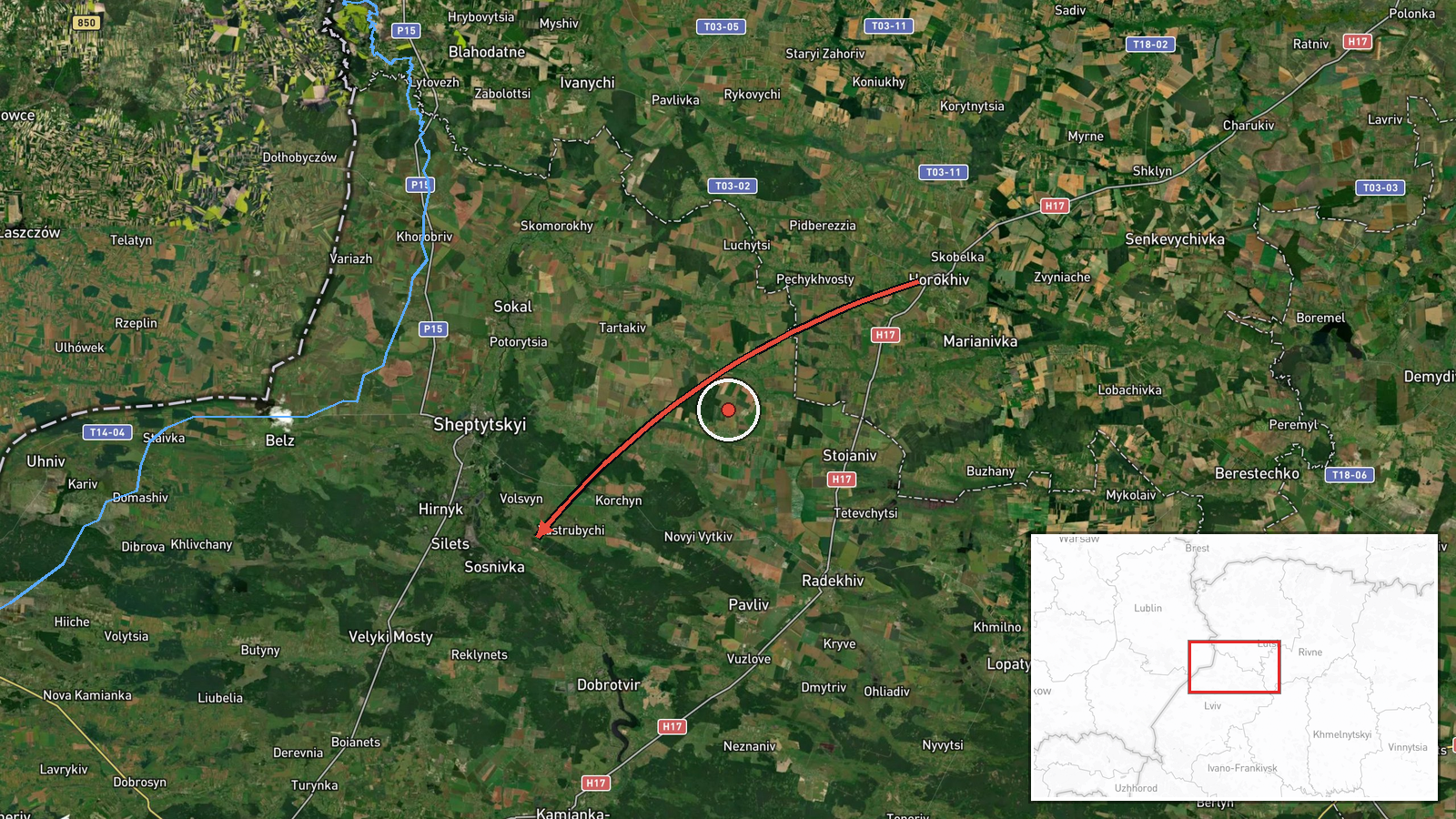
Ukrainian air monitoring, as posted on the Telegram channel @kpszsu, reported one Russian jet-powered Shahed, designated Geran-3, moving toward Sosnivka, a settlement in Lviv Oblast. The post is timestamped 02:18 UTC on 21 October 2026. The original Ukrainian wording describes a jet drone flying from Volyn into the Lviv region on a course for Sosnivka. It does not mention impacts, casualties or damage, and no strike outcome is stated. A related entry timestamped one minute earlier, at 02:17 UTC, describes the same type of drone coming from northern Lviv Oblast toward the same settlement, so the reported origin differs between the two posts.
Context and assessment
Sosnivka matters in this record less for what it is than for where it sits in a recurring pattern. Five Geran-3 transits are logged in the period leading up to this report, four of them on 20 October 2026 between 03:21 and 10:02 UTC, each tied to Dobrotvir or the Lviv Oblast corridor leading toward it. Taken together, the entries suggest drones repeatedly crossing western Ukraine along a similar axis, with monitoring focused on that same stretch of airspace. Lviv Oblast borders Poland and hosts rail, logistics and energy infrastructure, so frequent tracking there is consistent with air defence prioritising the region. Operationally, repeated transits along one corridor could reflect routing choices, saturation or decoy tactics, or simply the concentration of monitoring. The data itself does not identify intended targets. Jet-powered variants are generally faster than the older piston-engine Shahed models, which would shorten the time available for interception. These inferences remain tentative because each entry records a track, not an outcome.
Sources and confidence
The report comes from a single channel, @kpszsu, which is widely recognised as the official Telegram channel of the Ukrainian Air Force. No independent outlet, monitoring group or second channel in the data confirms this specific track. The confidence score of 8.0 reflects a credible official source with a clear, specific report, tempered by the fact that it is single-sourced and that a related entry gives a different origin. Confidence would rise with corroboration from another official Ukrainian body, a regional military administration, or an independent tracking service. It would fall if later official updates revised the origin, the track, or the drone type.
Location
The location is recorded at settlement level, with Sosnivka given as the named point and coordinates of approximately 50.29 N, 24.25 E. Location confidence is rated high because the report names the settlement directly rather than a broad area. Sosnivka lies in Lviv Oblast in western Ukraine, a region that borders Poland to the west. The report does not name a facility or specific installation, so the coordinates should be read as the settlement centre rather than a point of impact.
Related events nearby
- Ukrainian air monitoring: 1 Russian jet-powered Shahed (Geran-3) drone from northern Lviv Oblast toward Sosniv2026-10-21 02:17 UTC · Drone Transit · Sosnivka, Ukraine
- Ukrainian air monitoring: 1 Russian jet-powered Shahed (Geran-3) drone over Dobrotvir.2026-10-20 10:02 UTC · Drone Transit · Dobrotvir, Ukraine
- Ukrainian air monitoring: 1 Russian jet-powered Shahed (Geran-3) drone from Lviv Oblast toward Dobrotvir.2026-10-20 07:52 UTC · Drone Transit · Dobrotvir, Ukraine
- Ukrainian air monitoring: 1 Russian jet-powered Shahed (Geran-3) drone from Lviv Oblast toward Dobrotvir.2026-10-20 05:31 UTC · Drone Transit · Dobrotvir, Ukraine
- Ukrainian air monitoring: 1 Russian jet-powered Shahed (Geran-3) drone from Lviv Oblast toward Dobrotvir.2026-10-20 03:21 UTC · Drone Transit · Dobrotvir, Ukraine
▶ View this event on the live map

Intel Mapper aggregates open-source reports from monitored Telegram and X channels, geolocates them, cross-checks duplicates across sources and assigns a confidence score. Entries are updated as new confirmations arrive. Read how we verify events.