Ukrainian monitoring reports one jet-powered Geran-3 drone over Kyiv
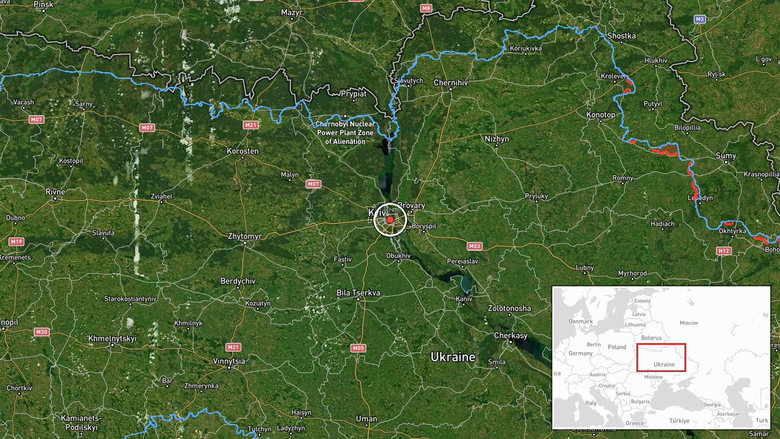
What happened
Ukraine's Air Force monitoring channel, Telegram account @kpszsu, reported at 02:25 UTC on 21 October 2026 that a single jet-powered drone was over Kyiv. The original Ukrainian post reads, in translation, 'Kyiv - jet-powered UAV over the city.' The summary classifies the aircraft as a Russian Shahed-type drone, specifically a Geran-3. The post does not give a flight path, altitude, target or outcome. Because it describes a drone over the city rather than a strike, the report is best read as a transit or overflight notice. No casualties, damage or interception are described in the source material.
Context and assessment
Kyiv is the national capital and seat of government, so even a single drone reported over the city carries weight beyond its immediate battlefield effect. The event fits a pattern visible in the related reporting from the preceding hours on 20 October. At 15:55 UTC a single Geran-3 was reported passing Boryspil toward Kyiv. At 17:18 UTC two or more were reported passing the same area, and at 17:32 at least two were reported passing Olyshivka toward Kyiv Oblast. Taken together, these reports suggest a sustained stream of jet-powered drones moving through the approaches to the capital over several hours. Separate statements that afternoon linked Russia to Iran in the wider Iran conflict and described U.S. intelligence supporting Ukrainian early warning of ballistic missiles. These are political or policy remarks and do not bear directly on this drone. Operationally, a lone drone reported over the city could be a stray, a decoy, a reconnaissance or pathfinding element, or a tracked transit within a larger raid. The source does not allow a choice among these explanations.
Sources and confidence
Only one channel reported this event: Telegram account @kpszsu, which is widely understood to be the Ukrainian Air Force's monitoring channel. No second outlet, official statement or independent observation in the dataset confirms a drone over Kyiv at that time. The confidence score of 8.0 reflects an official-type source, a clear time-stamped post and a high-precision location. It is held below the top range by the lack of independent corroboration and the brevity of the post. Confidence would rise with a second official, wire or city-authority confirmation. It would fall if the report were retracted or if the aircraft were identified as a different system.
Location
The location is at settlement level. The coordinates (50.45, 30.52) mark the centre of Kyiv because the post names only the city, not a district or facility. Kyiv sits on the Dnipro River, with higher Right Bank terrain to the west and lower Left Bank land to the east. The point should be read as the city as a whole, not a specific building or neighbourhood. The Boryspil airport area, named in related reports, lies to the southeast of the city.
Related events nearby
- Ukrainian air monitoring: 2+ Russian jet-powered Shahed (Geran-3) drones over Kyiv.2026-10-21 02:37 UTC · Drone Transit · Kyiv, Ukraine
- Ukrainian air monitoring: 2+ Russian jet-powered Shahed (Geran-3) drones passing Olyshivka, heading toward Kyi2026-10-20 17:32 UTC · Drone Transit · Kyiv Oblast, Ukraine
- Zelensky says Putin is helping Iran and that Russia is on the Iranian side in the ongoing Iran conflict.2026-10-20 17:26 UTC · Statement · Kyiv, Ukraine
- Zelensky says Ukraine is currently receiving U.S. intelligence, enabling early warning of incoming ballistic m2026-10-20 17:24 UTC · Statement · Kyiv, Ukraine
- Ukrainian air monitoring: 2+ Russian jet-powered Shahed (Geran-3) drones passing Boryspil, heading toward Kyiv2026-10-20 17:18 UTC · Drone Transit · Kyiv, Ukraine
▶ View this event on the live map

Intel Mapper aggregates open-source reports from monitored Telegram and X channels, geolocates them, cross-checks duplicates across sources and assigns a confidence score. Entries are updated as new confirmations arrive. Read how we verify events.