Jet-powered Shahed-type drone tracked heading south over Mena, Chernihiv Oblast, Ukraine
What happened
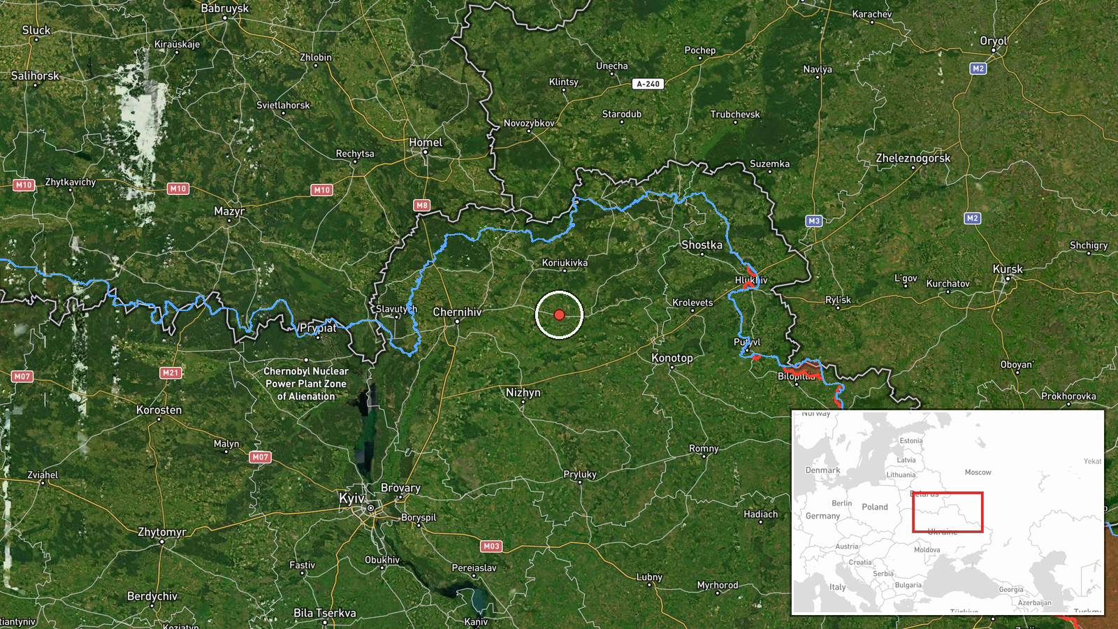
Ukraine's air monitoring channel on Telegram (@kpszsu) reported a single Russian jet-powered Shahed, identified in the summary as the Geran-3, tracked over the Mena area of Chernihiv Oblast at 07:21 UTC on 21 October 2026, on a southerly course. The original Ukrainian-language post describes a jet-type unmanned aerial vehicle in the Mena area heading south. The notice does not mention impacts, casualties, or damage, and it does not say whether the drone was engaged. Because it is a monitoring alert rather than a strike report, the event is recorded as a drone transit. It is the single-drone entry in a cluster of overflight and cruise missile alerts logged across northern Ukraine over the preceding hours.
Context and assessment
Mena sits in the northern part of Chernihiv Oblast, close to the Desna corridor and within reach of the Russian and Belarusian borders, which makes it a recurring point on the routes that drones and missiles take into Ukrainian airspace from the north. The related events show that Mena was already under pressure the previous afternoon, when two or more Geran-3 drones were reported heading toward the town at 17:14 UTC on 20 October. Overnight and into the morning, similar jet-powered drones were logged passing Mykhailo-Kotsiubynske heading south at 04:18 and heading toward Nosivka at 05:22, while Banderol mini cruise missiles were reported from Sumy Oblast toward Krolevets at 04:53 and toward Chernihiv at 05:10. Taken together, the sequence suggests multiple air corridors being used in parallel across the north. Operationally, this pattern may indicate an effort to saturate air defenses, to probe alert coverage, or to route aerial weapons toward targets further south. Those readings remain tentative, since monitoring alerts do not reveal intended targets.
Sources and confidence
The event rests on one Telegram channel, @kpszsu, which is the only source listed and the only source cited in the data. No independent outlet, official statement, or second monitoring feed is recorded as confirming the sighting. Its confidence score of 8.0 is relatively high because the channel is associated with Ukraine's air force monitoring and its alerts are typically issued in near real time, but the score is capped by the single-source basis and the absence of corroborating detail. Confidence would rise with confirmation from a second official or independent monitoring source, radar or video evidence, or consistent reporting from neighboring regional channels. It would fall if the channel later corrected or withdrew the alert, or if other sources contradicted the track.
Location
The location is recorded at settlement level, with coordinates of approximately 51.5333 N, 32.2 E for Mena, Chernihiv Oblast. The data gives no separate location confidence rating, and the coordinates correspond to the town as a whole rather than a specific site. Mena lies in northern Ukraine near the Desna river valley, in a largely rural and forested landscape. The town's position close to the northern borders explains its frequent appearance in drone and missile tracks.
Related events nearby
- Ukrainian air monitoring: 2+ Russian jet-powered Shahed (Geran-3) drones heading toward Mena.2026-10-20 17:14 UTC · Drone Transit · Mena, Ukraine
- Ukrainian air monitoring: Russian Banderol mini cruise munitions tracked near Bakhmach, Chernihiv Oblast, head2026-10-21 07:58 UTC · Cruise Missile · Bakhmach, Chernihiv Oblast, Ukraine
- Ukrainian air monitoring: 1 Russian Banderol mini cruise missile heading toward Chernihiv.2026-10-21 05:10 UTC · Cruise Missile · Chernihiv, Ukraine
- Ukrainian air monitoring: 2+ Russian jet-powered Shahed (Geran-3) drones passing Mykhailo-Kotsiubynske, headin2026-10-21 04:18 UTC · Drone Transit · Mykhailo-Kotsiubynske, Ukraine
- Ukrainian air monitoring: 2+ Russian jet-powered Shahed (Geran-3) drones heading toward Nosivka.2026-10-21 05:22 UTC · Drone Transit · Nosivka, Ukraine
▶ View this event on the live map

Intel Mapper aggregates open-source reports from monitored Telegram and X channels, geolocates them, cross-checks duplicates across sources and assigns a confidence score. Entries are updated as new confirmations arrive. Read how we verify events.