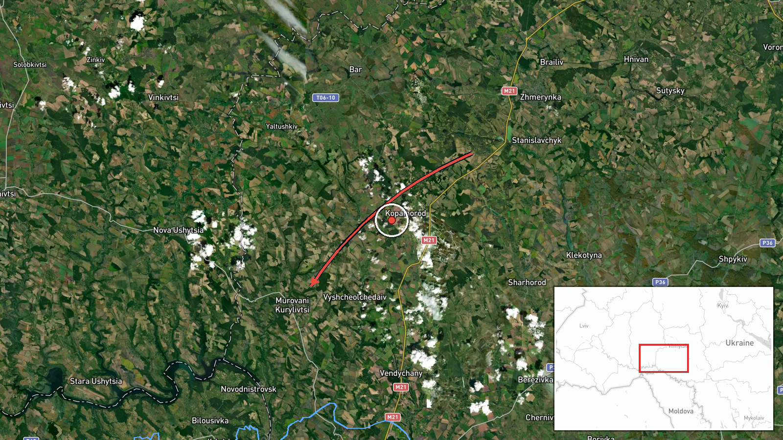
Jet-powered Shahed (Geran-3) drone tracked toward Murovani Kurylivtsi, Vinnytsia Oblast
What happened
Ukraine's Air Force monitoring channel on Telegram, @kpszsu, reported on 21 October 2026 at 09:43 UTC that one Russian jet-powered Shahed, identified in the post as a Geran-3, was moving toward Murovani Kurylivtsi in Vinnytsia Oblast from the east. The original Ukrainian wording, "Реактивний БпЛА," translates as jet-powered unmanned aerial vehicle, and the post describes a single track rather than a group. The notice is a transit alert. It records the drone's approach and the named settlement, but it does not report any impact, damage, or casualties, and it does not state whether the drone was intercepted. The entry is one of a run of similar single-drone alerts across Vinnytsia Oblast over roughly the previous seventeen hours, and Murovani Kurylivtsi appears as the most recent point in that sequence.
Context and assessment
Vinnytsia Oblast sits in west-central Ukraine, between the Dnipro and Carpathian regions, and it carries major road and rail links, including the Zhmerynka junction, which makes it a recurring transit corridor for aircraft and drones moving westward. The related alerts show a pattern: single Geran-3 tracks were logged near Bar and Zhmerynka on 20 October, then near Sharhorod later that day and in the early hours of 21 October, followed by a track toward Nova Ushytsya at 05:23 UTC. The heading changes across these reports suggest that the drones were moving through the oblast on different routes rather than striking one fixed point. Operationally, a series of individual jet-powered drones spaced hours apart could indicate a sustained, low-volume approach designed to probe air defence coverage or to stretch alert resources, although the data alone cannot confirm intent. Transit alerts of this kind are typically issued before a drone's final target is known, so the named settlement marks the reported direction of travel rather than a confirmed objective. Readers should treat the sequence as a pattern of movement and not as evidence of particular damage.
Sources and confidence
The report comes from a single Telegram channel, @kpszsu, which is the official Ukrainian Air Force channel for aerial threat monitoring. No second independent source appears in the data for this specific alert, so cross-confirmation is absent. The confidence score of 8.0 reflects a credible official channel with a consistent reporting format and corroboration from the wider sequence of similar alerts in the same oblast. It is held below the maximum because the post is a short transit notice and contains no independent imagery or follow-up. Confidence would rise with a second official or media confirmation of the track, or with a Ukrainian Air Force update on the drone's outcome. It would fall if later alerts retracted or corrected the heading.
Location
The coordinates place the event at the settlement level, consistent with the source naming Murovani Kurylivtsi directly, and the location confidence is recorded as high. The point sits in western Vinnytsia Oblast, a largely rural and agricultural area of farmland, villages, and scattered small towns. The settlement lies in the broader lowland region of the western Podolia area. Notable nearby features include the rail and road network through the Zhmerynka corridor, which links the oblast to western Ukraine. The data does not specify any facility at the location.
Related events nearby
- Ukrainian air monitoring: 1 Russian jet-powered Shahed (Geran-3) drone heading toward Nova Ushytsya.2026-10-21 05:23 UTC · Drone Transit · Nova Ushytsya, Ukraine
- Ukrainian air monitoring: 1 Russian jet-powered Shahed (Geran-3) drone heading toward Sharhorod.2026-10-21 02:55 UTC · Drone Transit · Sharhorod, Ukraine
- Ukrainian air monitoring: 1 Russian jet-powered Shahed (Geran-3) drone heading toward Sharhorod.2026-10-20 15:02 UTC · Drone Transit · Sharhorod, Ukraine
- Ukrainian air monitoring: 1 Russian jet-powered Shahed (Geran-3) drone heading toward Bar.2026-10-20 12:19 UTC · Drone Transit · Bar, Ukraine
- Ukrainian air monitoring: 1 Russian jet-powered Shahed (Geran-3) drone heading toward Zhmerynka.2026-10-20 13:41 UTC · Drone Transit · Zhmerynka, Ukraine
▶ View this event on the live map

Intel Mapper aggregates open-source reports from monitored Telegram and X channels, geolocates them, cross-checks duplicates across sources and assigns a confidence score. Entries are updated as new confirmations arrive. Read how we verify events.