Single Russian Geran-3 jet drone reported on course toward Sharhorod, Vinnytsia Oblast
What happened
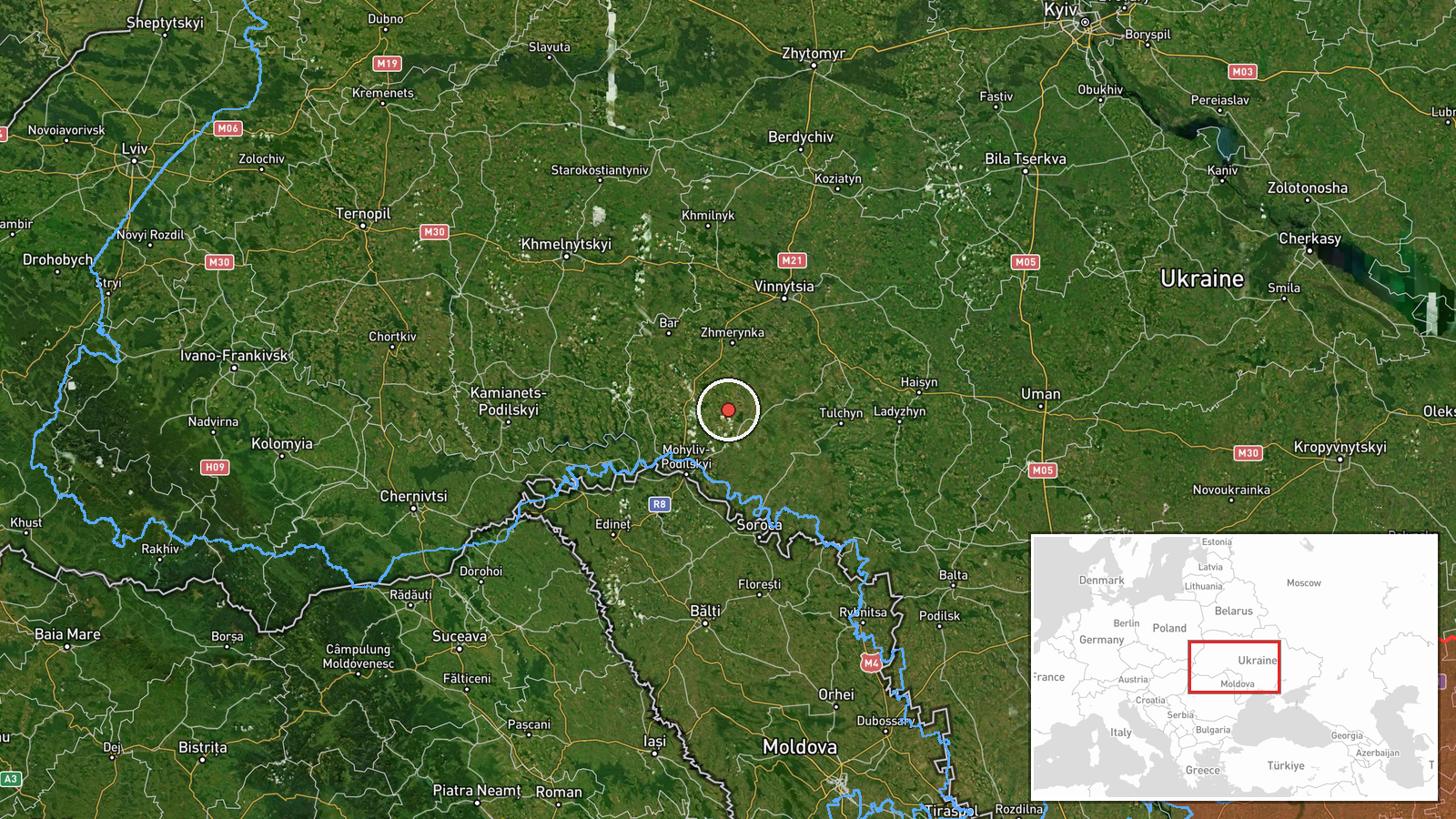
Ukraine's Air Force monitoring channel on Telegram (@kpszsu) reported on 21 October 2026 at 02:55 UTC that one jet-powered Shahed-type drone, identified as a Geran-3, was heading toward Sharhorod in Vinnytsia Oblast from the southeast. The original Ukrainian post describes a 'реактивний БпЛА' (jet-powered unmanned aerial vehicle) on a course toward Sharhorod. It reports only a heading. It does not describe an impact, damage, casualties, or interception. The event is recorded as a Drone Transit, meaning an air-alert trajectory warning rather than a confirmed strike. Attribution to Russia reflects the source's identification of the weapon as a Russian design. The dataset contains no follow-up report.
Context and assessment
Sharhorod lies in the Podilia part of Vinnytsia Oblast, in central-western Ukraine. The area is well away from the front line, but it sits along routes that long-range drones have repeatedly used to cross Ukrainian territory toward western and central regions. The related events show a dense sequence on 20 October 2026, when the same channel logged at least five single-drone transits through the oblast. These were Klembivka at 06:57 UTC, a track from Odesa Oblast into southern Vinnytsia at 06:48, Vendychany at 07:46, Zhmerynka at 13:41, and Sharhorod at 15:02. Zhmerynka is a significant rail junction, which may explain its inclusion in the sequence. The pattern is of serial, single-object tracks moving across many named settlements over a full day. Operationally, this could reflect distributed launches, decoy use, or probing of air-defence coverage and mobile fire-group positions. The data alone cannot distinguish between these possibilities. The renewed Sharhorod warning hours after the afternoon track suggests the town lies on a route being revisited, though this is an inference rather than a confirmed finding.
Sources and confidence
The event rests on a single Telegram channel, @kpszsu, which is widely associated with Ukraine's Air Force monitoring reports. No other outlet, official channel, or independent observer in the dataset corroborates the track. The confidence score of 8.0 reflects the channel's established role, the specific settlement-level geolocation, and the consistency of the report with the earlier warnings that day. It is held below the maximum because the report is single-sourced and contains no outcome. Confidence would rise with corroboration from other Ukrainian official channels or regional military administration, independent radar or flight-tracking evidence, or reports of debris or impact. It would fall if the report were retracted, corrected, or contradicted by later official statements. The record is not marked as corrected.
Location
The location is geocoded at settlement level to the town of Sharhorod in Vinnytsia Oblast, with a location confidence rated high. The coordinates point to the town rather than to any specific facility, so the warning refers to the settlement's airspace rather than a named target. The surrounding terrain is rolling upland typical of the Podilia region, cut by river valleys, with agricultural land and scattered small settlements. The town is far from the front line in eastern and southern Ukraine.
Related events nearby
- Ukrainian air monitoring: 1 Russian jet-powered Shahed (Geran-3) drone heading toward Sharhorod.2026-10-20 15:02 UTC · Drone Transit · Sharhorod, Ukraine
- Ukrainian air monitoring: 1 Russian jet-powered Shahed (Geran-3) drone heading toward Vendychany.2026-10-20 07:46 UTC · Drone Transit · Vendychany, Ukraine
- Ukrainian air monitoring: 1 Russian jet-powered Shahed (Geran-3) drone from Odesa Oblast toward southern Vinny2026-10-20 06:48 UTC · Drone Transit · southern Vinnytsia Oblast, Ukraine
- Ukrainian air monitoring: 1 Russian jet-powered Shahed (Geran-3) drone heading toward Zhmerynka.2026-10-20 13:41 UTC · Drone Transit · Zhmerynka, Ukraine
- Ukrainian air monitoring: 1 Russian jet-powered Shahed (Geran-3) drone from Vinnytsia Oblast toward Klembivka.2026-10-20 06:57 UTC · Drone Transit · Klembivka, Ukraine
▶ View this event on the live map

Intel Mapper aggregates open-source reports from monitored Telegram and X channels, geolocates them, cross-checks duplicates across sources and assigns a confidence score. Entries are updated as new confirmations arrive. Read how we verify events.