One Geran-3 jet drone tracked toward Klembivka, Vinnytsia Oblast, per Ukrainian air monitoring
What happened
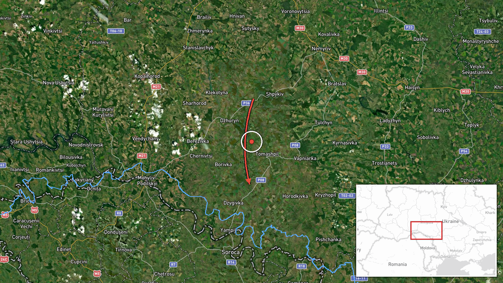
Ukrainian air monitoring, relayed through the Telegram channel @kpszsu, reported at 06:57 UTC on 20 October 2026 that one Russian jet-powered Shahed, designated Geran-3, was moving toward the settlement of Klembivka in Vinnytsia Oblast. The Ukrainian-language post described the drone as flying on a westward course. It did not report impacts, damage, casualties, or detonations, and its wording describes a tracked transit rather than a strike. The event is classified as a drone transit. Because the account comes from a single channel, it rests on one monitoring message that has not yet been independently corroborated.
Context and assessment
Klembivka sits within a cluster of drone reports in Vinnytsia Oblast over roughly 24 hours. On 19 October, a group of two or more Geran-3 drones was tracked from Vinnytsia Oblast toward Kryzhopil at 14:08 UTC, and another group of two or more was reported toward Tyvriv at 07:45 UTC. That evening, jet-powered drones were tracked heading west near Murovani Kurylivtsi and Mohyliv-Podilskyi at 18:10 UTC. On 20 October, single drones entered from Odesa Oblast, one toward Rudnytsya at 02:31 UTC and another toward southern Vinnytsia Oblast at 06:48 UTC, before the Klembivka track. The recurring pattern of single or small groups moving west through the oblast suggests routine transit along a corridor, possibly intended for targets farther west or for drawing air defence attention. Such an inference remains hedged, since the data show movement but not intended targets or outcomes.
Sources and confidence
The report appears on one Telegram channel, @kpszsu, which carries Ukrainian air monitoring messages. No second outlet, regional authority, or independent monitoring source is cited for this specific track. Confidence is set at 8.0 because the message is in a consistent format, the classification matches a sustained cluster of similar reports, and the location is specified. It is held below the maximum because there is only one source and no independent corroboration. Confidence would rise with confirmation from additional monitoring channels or regional officials, and would fall if the track were later reclassified or attributed to a different drone type.
Location
The location was geocoded at settlement level, with coordinates placed at the approximate centre of Klembivka, and location confidence is rated high. The point does not represent a specific facility or impact site. Vinnytsia Oblast lies in west-central Ukraine, with mostly agricultural, rolling terrain and river valleys. The Southern Bug river runs through the region and is a prominent regional landmark. The oblast borders Odesa Oblast to the south, which is consistent with several of the related drone entries.
Related events nearby
- Ukrainian air monitoring: 1 Russian jet-powered Shahed (Geran-3) drone from Odesa Oblast toward southern Vinny2026-10-20 06:48 UTC · Drone Transit · southern Vinnytsia Oblast, Ukraine
- Ukrainian air monitoring: 2+ Russian jet-powered Shahed (Geran-3) drones from Vinnytsia Oblast toward Kryzhopi2026-10-19 14:08 UTC · Drone Transit · Kryzhopil, Ukraine
- Ukrainian air monitoring: 1 Russian jet-powered Shahed (Geran-3) drone from Odesa Oblast toward Rudnytsya.2026-10-20 02:31 UTC · Drone Transit · Rudnytsya, Ukraine
- Ukrainian air monitoring: 2+ Russian jet-powered Shahed (Geran-3) drones from Vinnytsia Oblast toward Tyvriv.2026-10-19 07:45 UTC · Drone Transit · Tyvriv, Ukraine
- Ukrainian air monitoring: jet-powered Shahed (Geran-3) drones tracked near Murovani Kurylivtsi and Mohyliv-Pod2026-10-19 18:10 UTC · Drone Transit · Murovani Kurylivtsi, Ukraine
▶ View this event on the live map

Intel Mapper aggregates open-source reports from monitored Telegram and X channels, geolocates them, cross-checks duplicates across sources and assigns a confidence score. Entries are updated as new confirmations arrive. Read how we verify events.