Ukrainian Air Force reports one jet-powered Shahed drone transiting Odesa Oblast toward Vinnytsia Oblast
What happened
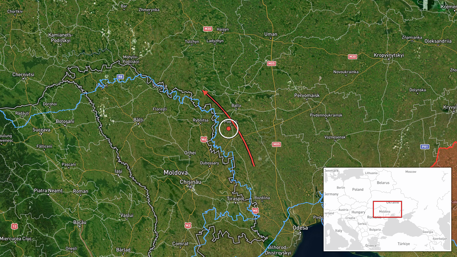
Ukraine's Air Force, through its official Telegram channel (@kpszsu), reported on 20 October 2026 at about 02:31 UTC a single jet-powered unmanned aerial vehicle moving past Kodyma in Odesa Oblast and onward into Vinnytsia Oblast, with Rudnytsya given as the endpoint. The original Ukrainian post describes a jet-type UAV passing Kodyma and heading toward Vinnytsia Oblast, with Rudnytsya in parentheses. The summary classifies it as a Shahed-type Geran-3 drone. The report does not describe impact, damage, or casualties. Its wording points to a tracked transit rather than a confirmed strike, and Russia is listed as the actor based on the system type and the surrounding launch pattern.
Context and assessment
Rudnytsya matters less as a target than as a point on a track. The related reports form a sequence across central and southwestern Ukraine. On 19 October, Haysyn and Tulchyn were reported with drones passing or heading toward them, and later that day Kryzhopil in Vinnytsia Oblast was reported with two or more drones. Early on 20 October, Bershad was reported twice, first with two or more drones from Kirovohrad Oblast heading toward it, then with drones passing it heading west. The Rudnytsya report fits that westward-moving pattern. Operationally, transit reports of this kind usually indicate routing corridors rather than specific aim points. Drones following these paths may be bound for western Ukraine or nearer the border regions, may be diverted or decoyed, or may simply be reported at the last point where monitors saw them. The mention of jet-powered variants suggests higher speeds and shorter warning windows, which would make such tracks more relevant for air defense planning than for local damage assessment. These inferences rest on a small set of reports and should be treated as provisional.
Sources and confidence
The event rests on one channel, the Air Force-linked @kpszsu Telegram account, and the data contains no independent cross-confirmation from other outlets, regional administrations, or monitoring groups. The confidence score of 8.0 reflects the official origin of the channel, the precise timestamp, and consistency with other drone-transit reports in the same time window. It is held below the maximum because the report is single-source, describes transit rather than impact, and does not independently verify the drone type or endpoint. Confidence would rise with corroboration from Air Force statements, regional military administration updates, or independent track data. It would fall if later official or independent reporting contradicted the route, the endpoint, or the drone classification.
Location
The location is recorded at settlement precision, with coordinates for Rudnytsya in Vinnytsia Oblast, and location confidence is rated high. Rudnytsya is the named endpoint, and the name is shared by several settlements in Ukraine, so identification depends on the Vinnytsia reference in the report. The surrounding terrain is rural and largely agricultural, with open plains typical of central-western Ukraine. Kodyma, the reference point in Odesa Oblast, lies on the route to the south and is part of the same regional corridor.
Related events nearby
- Ukrainian air monitoring: 1 Russian jet-powered Shahed (Geran-3) drone heading toward Kryzhopil.2026-10-20 11:12 UTC · Drone Transit · Kryzhopil, Ukraine
- Ukrainian air monitoring: 1 Russian jet-powered Shahed (Geran-3) drone from Vinnytsia Oblast toward Kryzhopil.2026-10-20 08:58 UTC · Drone Transit · Kryzhopil, Ukraine
- Ukrainian air monitoring: 2+ Russian jet-powered Shahed (Geran-3) drones from Vinnytsia Oblast toward Kryzhopi2026-10-19 14:08 UTC · Drone Transit · Kryzhopil, Ukraine
- Ukrainian air monitoring: 1 Russian jet-powered Shahed (Geran-3) drone from Vinnytsia Oblast toward Klembivka.2026-10-20 06:57 UTC · Drone Transit · Klembivka, Ukraine
- Ukrainian air monitoring: 1 Russian jet-powered Shahed (Geran-3) drone from Kirovohrad Oblast toward Bershad.2026-10-20 04:32 UTC · Drone Transit · Bershad, Ukraine
▶ View this event on the live map

Intel Mapper aggregates open-source reports from monitored Telegram and X channels, geolocates them, cross-checks duplicates across sources and assigns a confidence score. Entries are updated as new confirmations arrive. Read how we verify events.