Russian Geran-3 jet-powered drone reported heading toward Kryzhopil, Vinnytsia Oblast
What happened
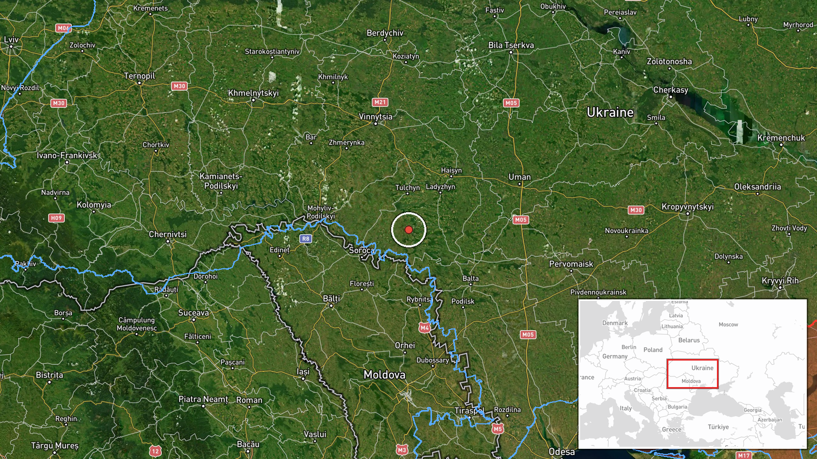
Ukrainian air monitoring, relayed through the Telegram channel @kpszsu, reported on 20 October 2026 at 11:12 UTC a single Russian jet-powered Shahed, designated Geran-3, flying toward Kryzhopil in Vinnytsia Oblast. The Ukrainian-language original names Kryzhopil and Tomashpil together as the drone's heading, while the English summary names only Kryzhopil. The report does not describe impact, damage, casualties or interception. It is a transit alert, meaning it records a drone's track and direction rather than a confirmed strike. The entry is tagged Drone Transit and sits within a cluster of five related monitoring reports from 19 and 20 October in the same part of southern Ukraine.
Context and assessment
Kryzhopil matters less as a fixed target than as a point on a recurring flight path. Related entries show a pattern: on 19 October at 14:08 UTC, two or more jet-powered Shahed drones were reported moving from Vinnytsia Oblast toward Kryzhopil, and on 20 October a single drone was tracked from Vinnytsia toward Kryzhopil at 08:58 UTC. Other same-day reports describe drones entering from Odesa Oblast toward Rudnytsya and southern Vinnytsia Oblast, and another moving from Vinnytsia toward Klembivka. Taken together, these reports suggest drones crossing from the Black Sea region into the interior of Vinnytsia Oblast along a corridor that passes near several small settlements. This may indicate routing toward more distant objectives, or simply the way air-defense tracking and alert issuance follow a drone's path. The single-drone counts in this series also suggest a sustained low-volume pattern rather than a single mass salvo. Because the reports describe trajectories and not impacts, they should be read as evidence of movement and alert activity, not of where damage occurred or what the drones were aimed at.
Sources and confidence
Only one channel, Telegram @kpszsu, carried this report, so the event has a source count of one and is not independently cross-confirmed. The handle is associated with Ukrainian air-force monitoring, which gives the channel a plausible official basis, and the confidence score of 8.0 reflects that institutional role together with the specific, time-stamped wording. The score is held below the maximum because no second outlet, radar-based account or wreckage report confirms the track. Confidence would rise with corroboration from another Ukrainian official source, regional military administration statements, or reports of an actual impact or interception. It would fall if later updates revised the heading or showed the drone was misidentified.
Location
The coordinates are placed at the settlement level for Kryzhopil, a small town in southern Vinnytsia Oblast, which is why location confidence is rated high. The point marks the settlement centre rather than any facility, because the report names the town as the drone's heading and does not identify a specific site. The area is largely flat agricultural land of the Podillia region, lying close to the Odesa Oblast border to the south. Tomashpil, also named in the original text, lies in the same general district.
Related events nearby
- Ukrainian air monitoring: 1 Russian jet-powered Shahed (Geran-3) drone from Vinnytsia Oblast toward Kryzhopil.2026-10-20 08:58 UTC · Drone Transit · Kryzhopil, Ukraine
- Ukrainian air monitoring: 2+ Russian jet-powered Shahed (Geran-3) drones from Vinnytsia Oblast toward Kryzhopi2026-10-19 14:08 UTC · Drone Transit · Kryzhopil, Ukraine
- Ukrainian air monitoring: 1 Russian jet-powered Shahed (Geran-3) drone from Odesa Oblast toward Rudnytsya.2026-10-20 02:31 UTC · Drone Transit · Rudnytsya, Ukraine
- Ukrainian air monitoring: 1 Russian jet-powered Shahed (Geran-3) drone from Vinnytsia Oblast toward Klembivka.2026-10-20 06:57 UTC · Drone Transit · Klembivka, Ukraine
- Ukrainian air monitoring: 1 Russian jet-powered Shahed (Geran-3) drone from Odesa Oblast toward southern Vinny2026-10-20 06:48 UTC · Drone Transit · southern Vinnytsia Oblast, Ukraine
▶ View this event on the live map

Intel Mapper aggregates open-source reports from monitored Telegram and X channels, geolocates them, cross-checks duplicates across sources and assigns a confidence score. Entries are updated as new confirmations arrive. Read how we verify events.