Jet-powered Shahed drones tracked over Vinnytsia Oblast near Murovani Kurylivtsi, heading west
What happened
Ukraine's Air Force monitoring channel on Telegram, @kpszsu, reported on 19 October 2026 at 18:10 UTC that jet-powered Shahed (Geran-3) drones were being tracked in the area of Murovani Kurylivtsi and Mohyliv-Podilskyi in Vinnytsia Oblast, with their course given as west. The original Ukrainian post describes the aircraft as jet-powered unmanned aerial vehicles and does not give a count, so the number of drones in this entry is not specified. The post reports aerial transit, not impact. It does not describe any strike, damage, casualties or interception at either settlement. The event record names Russia as the actor, in line with attribution commonly applied to Shahed-type systems in Ukraine. The report is a single-channel alert and has not been independently confirmed by a second source.
Context and assessment
Vinnytsia Oblast lies in west-central Ukraine, well inside the country rather than along the front line, so drone activity there is typically read as transit through a wider corridor. Mohyliv-Podilskyi sits on the Dniester in the Podolia region, and Zhmerynka is a major rail junction, both of which make the oblast a recurring point on flight paths. Five related Drone Transit reports dated 19 October alone place Shahed-type aircraft at Mohyliv-Podilskyy in the early morning, at Zhmerynka and Voronovytsya around 05:17, at Tyvriv with two or more drones around 07:45, at Vinkivtsi in the afternoon, and west of Zhmerynka at 18:21, where the course was given as north. The pattern suggests several aircraft moving through the oblast over the course of a day, with headings varying. Monitoring alerts of this kind usually track flight paths and do not identify intended targets, so the westward course here should not be read as a confirmed destination. Jet-powered variants are generally described as faster than older piston-engine models, which may shorten warning times for local communities.
Sources and confidence
The report comes from one Telegram channel, @kpszsu, which is the Ukrainian Air Force's official air monitoring feed and is widely relied on for real-time alerts. Its origin is institutional, which supports the score, and the location is given at settlement level with high location confidence. The confidence score of 8.0 is nonetheless below the maximum because no second source has confirmed the track, and no impact or outcome is reported. Confidence would rise with corroboration from regional military administration statements, other official Ukrainian channels, or independent flight-tracking data, and with any geolocated imagery. It would fall if the Air Force issued a correction or if the track were revised, since the record is marked as not corrected at present.
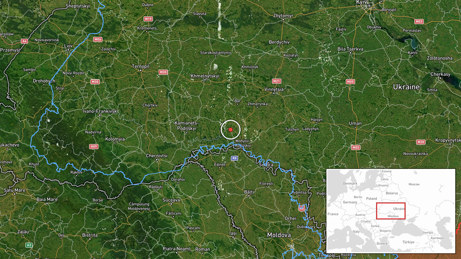
Location
The coordinates, 48.718 north and 27.531 east, are set at settlement level for Murovani Kurylivtsi, the first place named in the alert, and the location confidence is high. The alert also names Mohyliv-Podilskyi, which lies to the south-east of that point, so the pin marks the first location rather than the full track. The setting is the Podolia area of Vinnytsia Oblast, a region of rolling farmland and small towns. The Dniester River runs close to the Mohyliv-Podilskyi area, and the wider oblast is crossed by rail and road routes.
Related events nearby
- Ukrainian air monitoring: 1 Russian jet-powered Shahed (Geran-3) drone heading toward Mohyliv-Podilskyy.2026-10-19 06:56 UTC · Drone Transit · Mohyliv-Podilskyy, Ukraine
- Ukrainian air monitoring: 1 Russian jet-powered Shahed (Geran-3) drone from Vinnytsia Oblast toward Vinkivtsi.2026-10-19 14:25 UTC · Drone Transit · Vinkivtsi, Ukraine
- Ukrainian air monitoring: one Russian jet-powered Shahed (Geran-3) drone tracked west of Zhmerynka in Vinnytsi2026-10-19 18:21 UTC · Drone Transit · West of Zhmerynka, Vinnytsia Oblast, Ukraine
- Ukrainian air monitoring: 1 Russian jet-powered Shahed (Geran-3) drone passing Voronovytsya, heading toward Zh2026-10-19 05:17 UTC · Drone Transit · Zhmerynka, Ukraine
- Ukrainian air monitoring: 2+ Russian jet-powered Shahed (Geran-3) drones from Vinnytsia Oblast toward Tyvriv.2026-10-19 07:45 UTC · Drone Transit · Tyvriv, Ukraine
▶ View this event on the live map

Intel Mapper aggregates open-source reports from monitored Telegram and X channels, geolocates them, cross-checks duplicates across sources and assigns a confidence score. Entries are updated as new confirmations arrive. Read how we verify events.