Single jet-powered Shahed drone tracked heading north west of Zhmerynka, Vinnytsia Oblast
What happened
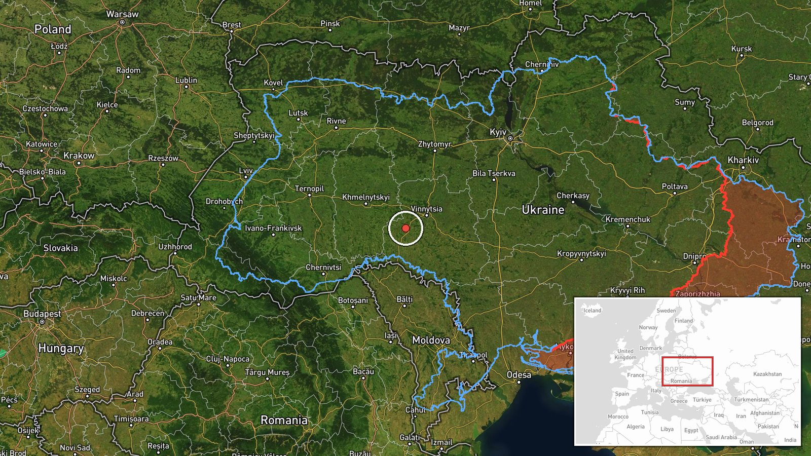
Ukrainian air monitoring reported on Telegram that one Russian jet-powered Shahed, designated Geran-3, was tracked west of Zhmerynka in Vinnytsia Oblast on 19 October 2026, at about 18:21 UTC, travelling on a northern heading. The original post, from the Ukrainian Air Force monitoring channel @kpszsu, uses the shorthand 'Реактивний БпЛА' (jet UAV) and the phrase 'курс північний' (heading north), and describes the drone only as a region-level sighting. The report does not mention impacts, casualties, or any detonation. Its brevity means the track is recorded as a transit observation rather than a strike.
Context and assessment
Vinnytsia Oblast, in west-central Ukraine, has repeatedly appeared in air alerts as drones cross from the south toward the western part of the country. Zhmerynka is a railway junction, and the rail corridor through the area makes it a recurring reference point in monitoring reports. Earlier on the same day, the related reports show a steady sequence of Geran-3 tracks: one passing Voronovytsya toward Zhmerynka in the early morning, groups of two or more moving from Odesa Oblast toward Vinnytsia Oblast, and a single drone heading toward Vinnytsia city. The pattern suggests a sustained air campaign routing drones northward through the oblast rather than a single isolated incursion. Operationally, such tracks are commonly associated with long-range flights toward targets further north or west, though the data here does not identify an intended target. The northward heading in this report fits that transit pattern, but the single channel and region-level location limit how far that inference should go.
Sources and confidence
The report comes from one Telegram channel, @kpszsu, which relays Ukrainian air monitoring messages. No second independent outlet is listed for this event, so cross-confirmation is absent and the confidence score of 8.0 reflects that single-source status. Such monitoring posts are usually timely and specific about drone type and direction, which supports credibility, but the score remains low because it cannot be checked against wire services, official statements, or independent tracking. Confidence would rise with corroboration from a second monitoring feed, a regional military administration, or reports of impacts. It would fall if later official updates contradicted the track or the drone type.
Location
The location is approximate. The data gives a region-level precision and a low location confidence, placing the point at 49.03 N, 27.95 E, west of Zhmerynka, rather than at a surveyed site. The original text names only Zhmerynka as the reference, so the position should be read as a general area near that railway town. Zhmerynka lies in the Vinnytsia Oblast in western Ukraine, on the Dnipro-to-Lviv rail line, in gently rolling farmland and river valleys. Its landscape is largely agricultural, with forests and small rivers, and no specific facility is named in the report.
Related events nearby
- Ukrainian air monitoring: 1 Russian jet-powered Shahed (Geran-3) drone passing Voronovytsya, heading toward Zh2026-10-19 05:17 UTC · Drone Transit · Zhmerynka, Ukraine
- Ukrainian air monitoring: 2+ Russian jet-powered Shahed (Geran-3) drones from Vinnytsia Oblast toward Tyvriv.2026-10-19 07:45 UTC · Drone Transit · Tyvriv, Ukraine
- Ukrainian air monitoring: 1 Russian jet-powered Shahed (Geran-3) drone from Odesa Oblast toward Vinnytsia Obla2026-10-19 17:50 UTC · Drone Transit · Vinnytsia Oblast, Ukraine
- Ukrainian air monitoring: 2+ Russian jet-powered Shahed (Geran-3) drones from Odesa Oblast toward Vinnytsia Ob2026-10-19 14:04 UTC · Drone Transit · Vinnytsia Oblast, Ukraine
- Ukrainian air monitoring: 1 Russian jet-powered Shahed (Geran-3) drone heading toward Vinnytsia.2026-10-19 05:22 UTC · Drone Transit · Vinnytsia, Ukraine
▶ View this event on the live map

Intel Mapper aggregates open-source reports from monitored Telegram and X channels, geolocates them, cross-checks duplicates across sources and assigns a confidence score. Entries are updated as new confirmations arrive. Read how we verify events.