Jet-powered Shahed drones reported moving from Odesa Oblast toward Vinnytsia Oblast
What happened
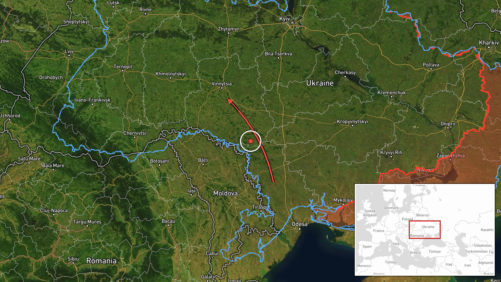
Ukrainian air monitoring reported on Telegram that at least two jet-powered Shahed (Geran-3) drones were moving from Odesa Oblast toward Vinnytsia Oblast, passing near Balta, at 14:04 UTC on 19 October 2026. The post from @kpszsu is brief; its Ukrainian wording translates roughly as jet drones past Balta in Odesa Oblast, heading to Vinnytsia Oblast. It gives no impact, damage or casualty information, names no target, and does not say whether the drones were intercepted. The event is classed as a Drone Transit, meaning it records the aircraft's movement rather than a confirmed strike.
Context and assessment
Vinnytsia Oblast sits in central-west Ukraine, north-west of Odesa and along transport routes linking the south with Kyiv and western regions. Rail junctions and road hubs such as Zhmerynka, Khmilnyk and Vinnytsia city itself appear repeatedly in this event cluster, which is why the region draws attention when drones are tracked northward. The related reports form a sequence across 18 and 19 October 2026. A Banderol mini cruise missile was logged near Kalynivka the evening before, and during the morning several Geran-3 jet drones were tracked over or toward Voronovytsya, Khmilnyk, Zhmerynka, Vinnytsia and Tyvriv. Tracks that begin in Odesa Oblast and cross Vinnytsia suggest a multi-axis flight path rather than a single target. Jet-powered Shaheds are generally reported to be faster than the older piston-engined variants, which may shorten warning times and complicate interception. Operationally, the pattern may indicate routing toward strike or saturation targets further north or west, or deliberate probing of air defence coverage. These readings remain inference: the open reporting does not identify a destination, and transit tracks often end without a publicly confirmed impact.
Sources and confidence
Only one channel, the Telegram account @kpszsu, carries this report. The related events share the same drone-transit category but do not independently confirm this track. The confidence score of 8.0 reflects a credible military monitoring source with a clear, timestamped post, offset by single-source status and a regional-only destination. Confidence would rise if regional authorities, Ukrainian Air Force statements, or independent flight tracking confirmed the route, or if local reports of impacts appeared. It would fall if the channel corrected or retracted the post, or if later official updates contradicted the trajectory.
Location
The location is approximate. The record carries only a regional tag for Vinnytsia Oblast, with coordinates of 49.23 N, 28.47 E set at region level rather than at a settlement or facility, so it is a placeholder and not the drones' actual path. Vinnytsia Oblast lies in central-west Ukraine, largely rolling farmland and river valleys, and the Southern Bug river crosses its territory. The origin reference, Balta, is a town in Odesa Oblast to the south-east.
Related events nearby
- Ukrainian air monitoring: 1 Russian jet-powered Shahed (Geran-3) drone heading toward Vinnytsia.2026-10-19 05:22 UTC · Drone Transit · Vinnytsia, Ukraine
- Ukrainian air monitoring: 2+ Russian jet-powered Shahed (Geran-3) drones from Vinnytsia Oblast toward Tyvriv.2026-10-19 07:45 UTC · Drone Transit · Tyvriv, Ukraine
- Ukrainian air monitoring: 1 Russian Banderol mini cruise missile heading toward Kalynivka.2026-10-18 19:18 UTC · Cruise Missile · Kalynivka, Ukraine
- Ukrainian air monitoring: 1 Russian jet-powered Shahed (Geran-3) drone passing Voronovytsya, heading toward Zh2026-10-19 05:17 UTC · Drone Transit · Zhmerynka, Ukraine
- Ukrainian air monitoring: 2+ Russian jet-powered Shahed (Geran-3) drones heading toward Khmilnyk.2026-10-19 06:27 UTC · Drone Transit · Khmilnyk, Ukraine
▶ View this event on the live map

Intel Mapper aggregates open-source reports from monitored Telegram and X channels, geolocates them, cross-checks duplicates across sources and assigns a confidence score. Entries are updated as new confirmations arrive. Read how we verify events.