Single jet-powered Shahed-type drone reported transiting Vinnytsia Oblast heading west
What happened
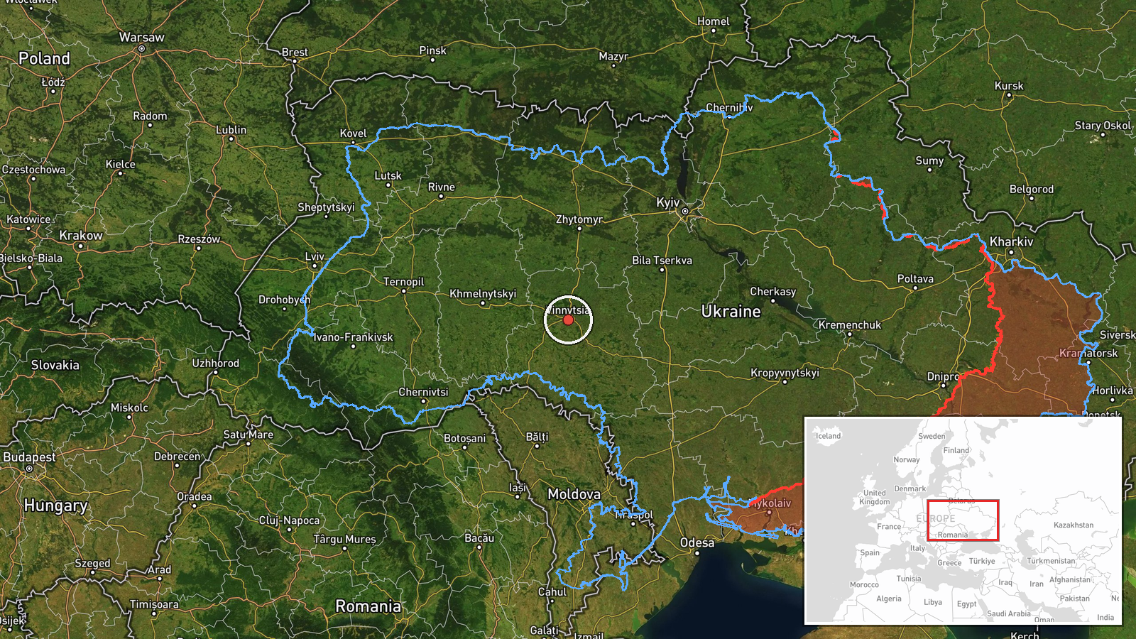
Ukraine's air monitoring channel on Telegram, @kpszsu, reported on 20 October 2026 at 08:13 UTC that a single Russian jet-powered Shahed-type drone, identified in the summary as the Geran-3, was passing near Vendychany in Vinnytsia Oblast on a western heading. The original Ukrainian wording describes a jet-type UAV flying past Vendychany in the Vinnytsia region on a western course. The report does not state any impact, casualties, or intended target, and it does not say whether the drone was intercepted or continued out of the area. It is a transit notice rather than a strike report. The settlement is named in the text, but the map point is set at regional level, so the exact position within the oblast is not established by this report alone.
Context and assessment
Vinnytsia Oblast sits in west-central Ukraine, and it has repeatedly appeared on air-alert routes for drones moving from the south and east toward western Ukraine. The related events on this page show a sequence of Drone Transit reports tagged to the oblast on the same day: an early sighting near Illintsi at 01:23 UTC, a single drone passing the oblast heading west at 03:14, two or more drones at 05:49 on a similar heading, a single drone past Podilsk district at 07:29 heading toward the oblast, and a group of two or more drones moving from Odesa Oblast toward Vinnytsia at 08:13. The pattern suggests a sustained flight path crossing the oblast over several hours rather than an isolated sighting. Jet-powered Geran-3 variants are generally assessed as faster and harder to intercept than the older piston-engined Shahed design, which may explain why monitors track them closely. Operationally, the sequence could reflect long-range drones routed across central Ukraine toward targets further west, or could include decoys or reconnaissance flights, though these reports alone do not show which. The notices do not describe alerts, interceptions, or damage.
Sources and confidence
Only one channel is listed for this event: the Telegram account @kpszsu, which carries Ukrainian Air Force monitoring updates. No second outlet has been linked, so cross-confirmation is absent. The confidence score of 8.0 is relatively high for a single source, reflecting a credible official monitoring channel and clear wording, but it is not higher because nothing independent verifies the sighting and the position is only approximate. Confidence would rise if a second monitoring source, a regional military administration, or a reliable open-source tracker corroborated the transit, or if radar data confirmed the flight path. It would fall if the channel issued a correction or later reporting showed the sighting was misidentified.
Location
The location comes from the Ukrainian text naming Vendychany, a village in Vinnytsia Oblast, but the coordinates (49.23, 28.47) are region-level and flagged low confidence, so the marker reflects the oblast rather than the village. Vinnytsia Oblast lies in west-central Ukraine, with the Southern Bug river crossing the broader region and rolling farmland dominating much of the landscape. Vendychany is a small rural settlement, so the marker should be read as approximate.
Related events nearby
- Ukrainian air monitoring: 2+ Russian jet-powered Shahed (Geran-3) drones from Odesa Oblast toward Vinnytsia Ob2026-10-20 08:13 UTC · Drone Transit · Vinnytsia Oblast, Ukraine
- Ukrainian air monitoring: 1 Russian jet-powered Shahed (Geran-3) drone passing Podilsk district, heading towar2026-10-20 07:29 UTC · Drone Transit · Vinnytsia Oblast, Ukraine
- Ukrainian air monitoring: 2+ Russian jet-powered Shahed (Geran-3) drones passing Vinnytsia Oblast, heading wes2026-10-20 05:49 UTC · Drone Transit · Vinnytsia Oblast, Ukraine
- Ukrainian air monitoring: 1 Russian jet-powered Shahed (Geran-3) drone passing Vinnytsia Oblast, heading west.2026-10-20 03:14 UTC · Drone Transit · Vinnytsia Oblast, Ukraine
- Ukrainian air monitoring: 1 Russian Shahed-type drone passing Illintsi, heading toward Vinnytsia.2026-10-20 01:23 UTC · Drone Transit · Vinnytsia, Ukraine
▶ View this event on the live map

Intel Mapper aggregates open-source reports from monitored Telegram and X channels, geolocates them, cross-checks duplicates across sources and assigns a confidence score. Entries are updated as new confirmations arrive. Read how we verify events.