Jet-powered Geran-3 drone reported on course toward Vendychany, Vinnytsia Oblast
What happened
At 07:46 UTC on 20 October 2026, the Telegram channel @kpszsu, which carries Ukrainian air monitoring reports, posted that a single jet-powered Shahed drone, designated Geran-3 in the English summary, was heading toward Vendychany in Vinnytsia Oblast. The original Ukrainian post reads in translation roughly as 'Vinnytsia region: jet-powered UAV on course toward Vendychany,' using the generic term for unmanned aerial vehicle. The Geran-3 designation appears only in the English summary, not the original wording. The report gives no information on impact, damage, or casualties, and it does not say whether the drone was intercepted, lost, or continued on its course. The event is classed as a drone transit rather than a confirmed strike.
Context and assessment
Vendychany lies in Vinnytsia Oblast, a central-western region that Ukrainian air monitoring has tracked closely over the past two days. The settlement is small and does not appear as a military or industrial target in the event data, so the report most plausibly marks its position as a waypoint along a flight heading rather than an intended point of impact. The related events describe a sequence over roughly fourteen hours on 19 and 20 October. Drones were tracked near Murovani Kurylivtsi and Mohyliv-Podilskyi heading west, another west of Zhmerynka heading north, and one from Odesa Oblast toward southern Vinnytsia Oblast. A group of two or more passed Bar heading northwest, and a further drone moved from Vinnytsia Oblast toward Klembivka shortly before this report. The pattern shows drones entering the oblast from the south and moving through it on changing headings. That may reflect routing adjustments, attempts to avoid air defense concentrations, or individual airframes being redirected. Such reports are typically used to issue air alerts, so their main operational value lies in warning local populations and defenders rather than in identifying targets.
Sources and confidence
The event rests on a single source, the Telegram channel @kpszsu, which is identified in the data as Ukrainian air monitoring. No second channel, wire service, or official statement in the record independently confirms this specific track. The related events come from the same type of channel, so they add pattern context but not independent verification of this track. The confidence score of 8.0 out of 10 reflects a timestamped, settlement-level feed from an established monitoring source, tempered by single-channel reliance and the absence of follow-up. Confidence would rise with corroboration from a second monitoring source, an official air alert, or a later report confirming the drone's path. It would fall if the track were revised, withdrawn, or contradicted by subsequent reporting.
Location
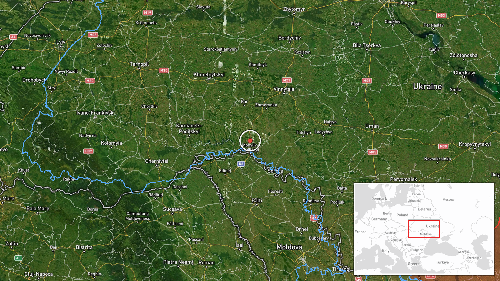
The coordinates correspond to the settlement of Vendychany, recorded at settlement precision with high location confidence. The point marks the village rather than a facility, and it does not represent the drone's exact position at the time of posting. The setting is rural Podillia within Vinnytsia Oblast, characterized by farmland, scattered villages, and river valleys. The wider route recorded in related events passes near Bar, Zhmerynka, Mohyliv-Podilskyi, and Klembivka.
Related events nearby
- Ukrainian air monitoring: jet-powered Shahed (Geran-3) drones tracked near Murovani Kurylivtsi and Mohyliv-Pod2026-10-19 18:10 UTC · Drone Transit · Murovani Kurylivtsi, Ukraine
- Ukrainian air monitoring: one Russian jet-powered Shahed (Geran-3) drone tracked west of Zhmerynka in Vinnytsi2026-10-19 18:21 UTC · Drone Transit · West of Zhmerynka, Vinnytsia Oblast, Ukraine
- Ukrainian air monitoring: 1 Russian jet-powered Shahed (Geran-3) drone from Odesa Oblast toward southern Vinny2026-10-20 06:48 UTC · Drone Transit · southern Vinnytsia Oblast, Ukraine
- Ukrainian air monitoring: 2+ Russian jet-powered Shahed (Geran-3) drones passing Bar, heading northwest.2026-10-20 04:30 UTC · Drone Transit · Bar, Ukraine
- Ukrainian air monitoring: 1 Russian jet-powered Shahed (Geran-3) drone from Vinnytsia Oblast toward Klembivka.2026-10-20 06:57 UTC · Drone Transit · Klembivka, Ukraine
▶ View this event on the live map

Intel Mapper aggregates open-source reports from monitored Telegram and X channels, geolocates them, cross-checks duplicates across sources and assigns a confidence score. Entries are updated as new confirmations arrive. Read how we verify events.