Jet-powered Russian Shahed drone tracked from northern Kyiv Oblast toward Zhytomyr Oblast
What happened
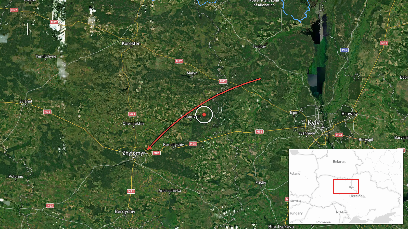
Ukrainian air monitoring reported a single Russian jet-powered Shahed, designated Geran-3, moving from northern Kyiv Oblast into Zhytomyr Oblast on a western heading. The report was posted at 13:42 UTC on 21 October 2026 and is categorized as a drone transit, meaning the object was tracked in flight rather than a confirmed impact. The original Ukrainian-language post describes a jet-powered UAV moving from the north of Kyiv region toward Zhytomyr region on a western course. The post names no impact site, casualties, or damage, and it does not say whether the drone was intercepted or left the area. The event rests on a single Telegram channel and attributes the drone to Russia as the launching side.
Context and assessment
Zhytomyr Oblast lies west of Kyiv, borders Belarus to the north-west, and sits on corridors that long-range drones have used when moving toward western Ukraine. Related events show a dense sequence on the same date. The earliest report, at 04:26 UTC, placed a single Geran-3 passing Cherniakhiv and heading west. At 06:37 a drone was reported moving from northern Kyiv Oblast toward Zhytomyr Oblast, followed by reports toward Zhytomyr city at 07:05 and 07:55, and another toward Zhytomyr Oblast at 13:35, before this 13:42 report. Across roughly nine hours the reports describe the same drone type along a similar north-to-west corridor, with wording shifting between city and oblast level. This could reflect separate drones launched in successive waves along one route, or repeated tracking of one or a few airframes by different monitoring posts. The sequence alone does not reveal a target. Operationally, a repeated corridor may indicate routine transit toward targets further west, or sustained pressure on the region. Transit warnings of this kind mainly prompt air defense activity and civil alerts, and they do not establish intent or outcome.
Sources and confidence
The report comes from one channel, Telegram @kpszsu, which is associated with Ukraine's Air Force and is generally treated as an official military source for aerial threat warnings. Its wording is consistent with the related transit posts from the same day, which adds some internal coherence but no independent confirmation. No second outlet, regional authority, or imagery source in the data corroborates this specific track. The confidence score of 8.0 reflects the official origin and consistent format, offset by single-channel sourcing and the absence of impact or geolocation detail. Confidence would rise with independent corroboration from other monitors, regional military administration statements, or flight-path data. It would fall if later posts revised the track or conflicted with the timeline.
Location
The location is region-level, placed at approximately 50.25 N, 28.66 E, which is roughly the centre of Zhytomyr Oblast. The source names only the oblast, not a settlement or facility, so the point is a placeholder rather than a precise track position, which explains the low location confidence. The oblast lies in north-western Ukraine, largely in the Polissia lowlands with forests, wetlands, and river valleys. The Teteriv River flows through Zhytomyr city, the oblast's main urban centre. Cherniakhiv, named in an earlier related report, lies in the north of the oblast.
Related events nearby
- Ukrainian air monitoring: 1 Russian jet-powered Shahed (Geran-3) drone from northern Vinnytsia Oblast toward Z2026-10-21 15:07 UTC · Drone Transit · Zhytomyr Oblast, Ukraine
- Ukrainian air monitoring: 1 Russian jet-powered Shahed (Geran-3) drone heading toward Zhytomyr Oblast.2026-10-21 13:35 UTC · Drone Transit · Zhytomyr Oblast, Ukraine
- Ukrainian air monitoring: 1 Russian jet-powered Shahed (Geran-3) drone heading toward Zhytomyr.2026-10-21 07:55 UTC · Drone Transit · Zhytomyr, Ukraine
- Ukrainian air monitoring: 1 Russian jet-powered Shahed (Geran-3) drone heading toward Zhytomyr.2026-10-21 07:05 UTC · Drone Transit · Zhytomyr, Ukraine
- Ukrainian air monitoring: 1 Russian jet-powered Shahed (Geran-3) drone from northern Kyiv Oblast toward Zhytom2026-10-21 06:37 UTC · Drone Transit · Zhytomyr Oblast, Ukraine
▶ View this event on the live map

Intel Mapper aggregates open-source reports from monitored Telegram and X channels, geolocates them, cross-checks duplicates across sources and assigns a confidence score. Entries are updated as new confirmations arrive. Read how we verify events.