Ukrainian air monitoring reports jet-powered Shahed drones moving over Zhytomyr and toward Rivne Oblast
What happened
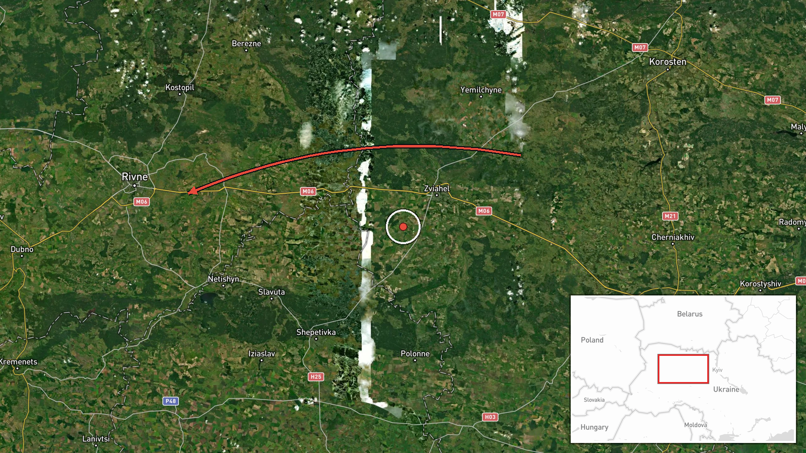
Ukrainian air monitoring channel @kpszsu reported on 21 October 2026 at about 15:37 UTC that a single Russian jet-powered Shahed, designated Geran-3, was heading toward Zhytomyr from the northwest. The same post said two or more similar jet-powered drones were moving across the north of Zhytomyr Oblast on a course toward neighbouring Rivne Oblast. The original Ukrainian-language wording describes these as jet-type UAVs (БпЛА) in the Zhytomyr area and to the north, with no mention of impacts, casualties or damage. The report is a movement notice rather than a strike report, and it does not state where any drone was located at the time of posting.
Context and assessment
Zhytomyr sits on the main west-northwest approach toward Kyiv and the Polissia corridor, and it lies between Kyiv and the Polish border, so drones routed through it are often tracking toward western Ukraine. The related events show a sustained run of single-drone transit notices through Zhytomyr Oblast on the same day, beginning at 07:05 UTC and continuing through 13:35, 13:42 and 15:07, with several drones arriving from northern Kyiv and Vinnytsia Oblasts. That pattern suggests a steady stream of Geran-3 flights moving across central-northern Ukraine rather than one isolated incursion. Operationally, jet-powered variants are faster than the older piston-engined Shahed models and are harder to intercept with slow guns, so frequent jet transit warnings may reflect either route testing or an effort to saturate air defence. Because the notices describe movement rather than targets, the intended destinations cannot be read from them. The shift toward Rivne Oblast in the final line may indicate a westward routing, though this remains inference from a single message.
Sources and confidence
The report comes from one Telegram channel, @kpszsu, which is linked to Ukraine's air force monitoring and is generally used for real-time drone warnings. No second independent outlet in the provided data confirms the same movements, so cross-confirmation is absent. The confidence score of 8.0 reflects an official-linked channel with a consistent track record of timely, specific alerts, tempered by the single-source status and the lack of a confirmed location for each drone. Confidence would rise if regional military administrations, Ukrainian air force statements or open-source tracking of the same routes corroborated the transit. It would fall if later updates contradicted the direction of travel or if the drones were reported as downed or diverted elsewhere.
Location
The event is mapped to Zhytomyr city at settlement-level precision, with high location confidence, because the source names the city directly. The coordinates reflect the city centre, while the Rivne Oblast reference in the message refers to a region rather than a point and is not separately mapped. Zhytomyr sits on the Teteriv River in northwestern Ukraine, within the Polissia lowlands, an area of forest, marsh and rivers that is relatively open to low-altitude flight. The city lies roughly 140 kilometres west of Kyiv on the road and rail corridor toward Rivne and Lviv.
Related events nearby
- Ukrainian air monitoring: 1 Russian jet-powered Shahed (Geran-3) drone from northern Vinnytsia Oblast toward Z2026-10-21 15:07 UTC · Drone Transit · Zhytomyr Oblast, Ukraine
- Ukrainian air monitoring: 1 Russian jet-powered Shahed (Geran-3) drone from northern Kyiv Oblast toward Zhytom2026-10-21 13:42 UTC · Drone Transit · Zhytomyr Oblast, Ukraine
- Ukrainian air monitoring: 1 Russian jet-powered Shahed (Geran-3) drone heading toward Zhytomyr Oblast.2026-10-21 13:35 UTC · Drone Transit · Zhytomyr Oblast, Ukraine
- Ukrainian air monitoring: 1 Russian jet-powered Shahed (Geran-3) drone heading toward Zhytomyr.2026-10-21 07:55 UTC · Drone Transit · Zhytomyr, Ukraine
- Ukrainian air monitoring: 1 Russian jet-powered Shahed (Geran-3) drone heading toward Zhytomyr.2026-10-21 07:05 UTC · Drone Transit · Zhytomyr, Ukraine
▶ View this event on the live map

Intel Mapper aggregates open-source reports from monitored Telegram and X channels, geolocates them, cross-checks duplicates across sources and assigns a confidence score. Entries are updated as new confirmations arrive. Read how we verify events.