Jet-powered Shahed (Geran-3) drone reported heading toward Zvenyhorodka, Ukraine
What happened
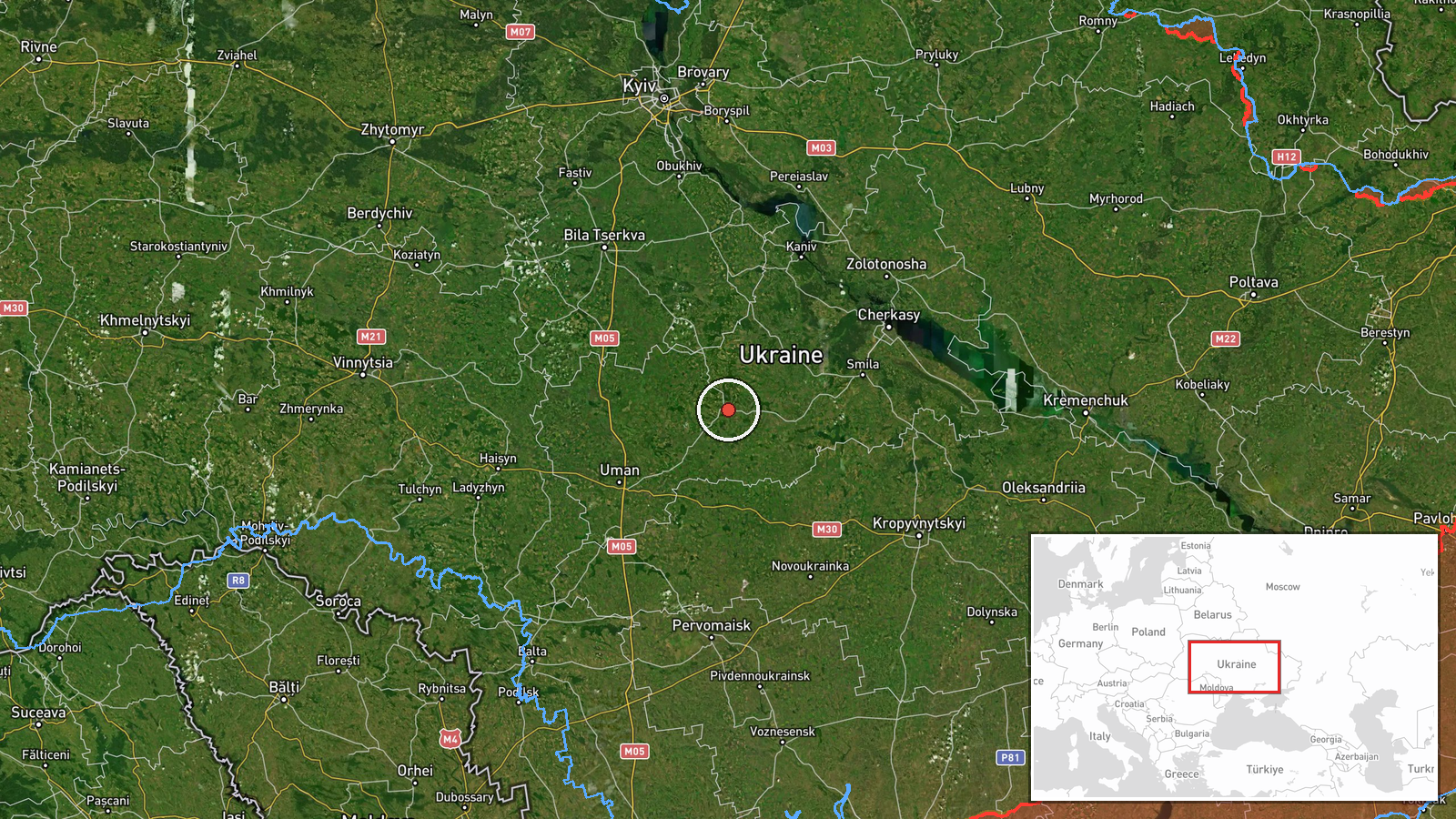
Ukrainian air monitoring reported one jet-powered Shahed-type drone, identified as a Geran-3, moving on a course toward Zvenyhorodka in Cherkasy Oblast, central Ukraine. The alert was posted at 07:18 UTC on 22 October 2026 by the Telegram channel @kpszsu. The original Ukrainian post is brief and reads roughly as 'Cherkasy region: jet-powered UAV on course to Zvenyhorodka.' It describes a direction of travel only and does not report an impact, casualties, or damage. The report attributes the drone to Russia, consistent with how Ukrainian monitoring describes Shahed-family systems. Because the post describes a track in progress, the drone's final target and outcome are not stated in the source material.
Context and assessment
Zvenyhorodka is a district centre in Cherkasy Oblast, a region that has appeared repeatedly in recent air-monitoring traffic. The most relevant precursor is a report from the previous evening, when a single jet-powered Shahed was logged moving from Cherkasy Oblast toward Horodyshche, another town in the same oblast. Taken together, the two tracks suggest drones are being routed across the oblast on a sustained basis rather than appearing as isolated incidents. Earlier on 21 October, a Ukrainian Navy mobile fire group reportedly destroyed a Shahed using a Sting interceptor drone, though the location of that engagement was not specified. The same day also brought ballistic missile alerts that Ukrainian monitoring tied to launches from Bryansk and Voronezh in Russia, showing that air-defense attention was divided across threat types. A separate headline that day referenced a group of Shahed-type drones, but its body is missing, so it cannot be linked to this track. Operationally, single-drone transit reports like this one often point to reconnaissance, route testing, or preparation for larger salvos rather than a confirmed target. The pattern is best read as a continuing transit corridor, not as evidence of a specific planned strike on Zvenyhorodka.
Sources and confidence
The report comes from a single channel, Telegram @kpszsu, and no independent outlet or second channel had confirmed the track when it was logged. The confidence score of 8.0 reflects a credible official monitoring source, a clear and specific message, and high location precision. It stops short of the maximum because there is no cross-confirmation and the post does not describe what happened after the track was reported. Confidence would rise if regional military authorities, the air force, or a second monitoring source confirmed the drone's course or reported an impact. It would fall if later updates retracted or revised the track. With a source count of one, the event should be treated as reported rather than verified.
Location
The location is a settlement-level match. Coordinates of 49.078 N, 30.961 E correspond to Zvenyhorodka, the town named in the report, and location confidence is recorded as high. The town sits in Cherkasy Oblast in central Ukraine, on the agricultural plains of the region. The precision reflects a named town rather than a specific facility, so it should not be read as identifying a target site.
Related events nearby
- Ukrainian air monitoring: 1 Russian jet-powered Shahed (Geran-3) drone from Cherkasy Oblast toward Horodyshche2026-10-21 18:33 UTC · Drone Transit · Horodyshche, Ukraine
- Ukrainian Navy mobile fire group Sargan 3000 destroyed a Russian Shahed drone using the Sting interceptor dron2026-10-21 14:20 UTC · Air Defense · Ukraine (location not reported)
- Ukrainian air monitoring issues all-clear, ending the ballistic missile threat reportedly launched from Bryans2026-10-21 21:25 UTC · Siren · Ukraine
- Ukrainian air monitoring announces all-clear, ending the ballistic missile threat reportedly launched from Vor2026-10-21 19:59 UTC · Siren · Ukraine (location not reported)
- Headline 'Дед не приходит одна' (Shahed slang: 'Grandpa never comes alone') suggests a group of Russian Shahed2026-10-21 17:46 UTC · Drone Transit · Ukraine (location not reported)
▶ View this event on the live map

Intel Mapper aggregates open-source reports from monitored Telegram and X channels, geolocates them, cross-checks duplicates across sources and assigns a confidence score. Entries are updated as new confirmations arrive. Read how we verify events.