Single jet-powered Geran-3 drone reported heading toward Vasylkiv, Kyiv Oblast
What happened
Ukrainian air monitoring channel @kpszsu reported on Telegram on 22 October 2026 at 08:44 UTC that one Russian jet-powered Shahed, described as a Geran-3, was heading toward Vasylkiv in Kyiv Oblast. The original post, written in Ukrainian, labels the object a jet-type unmanned aerial vehicle (реактивний БпЛА) and names Vasylkiv as its heading, with the region given as Kyiv region. The report describes a transit track rather than an impact, and it does not mention any explosion, casualties, or damage. The event rests on a single-source report from one channel, so the account of the drone's direction reflects that channel's monitoring at the time of posting. Any later assessment of its path or outcome would need to be checked against this entry.
Context and assessment
Vasylkiv lies south of the Ukrainian capital and hosts military infrastructure, which gives it relevance within a wider air-defence picture even though a transit report does not establish a target. The entry sits within a dense cluster of Geran-3 tracks logged between 07:16 and 08:48 UTC on the same morning. Earlier reports describe groups of two or more drones moving from Belarus toward Kyiv Oblast, while the Boyarka track at 07:16 and the Vasylkiv track at 08:44 show individual drones assigned to separate headings around the capital. A 08:27 report places a drone over Kyiv itself, and a 08:48 report places one passing Chabany while heading toward the city. Taken together, the sequence suggests a sustained air raid in which drones were dispersed across several approach corridors instead of converging on one point. Operationally, this pattern may indicate attempts to saturate air defence, to split defensive response across districts, or to test routes, though a single transit report cannot confirm intent. The jet-powered variant is faster than older propeller-driven models, which shortens warning times for districts on each track.
Sources and confidence
The entry rests on one Telegram channel, @kpszsu, and the dataset records no independent confirmation from another outlet or official statement at the time of recording. The confidence score of 8.0 reflects a clear, specific, and detailed post from an established monitoring source, offset by the single-channel basis and the absence of cross-checking. Confidence would rise with corroboration from official Ukrainian air force statements, other monitoring accounts, or consistent track data from multiple channels. It would fall if the channel later issued a correction, if the heading changed in subsequent updates, or if other reports contradicted the track. The entry is currently uncorrected.
Location
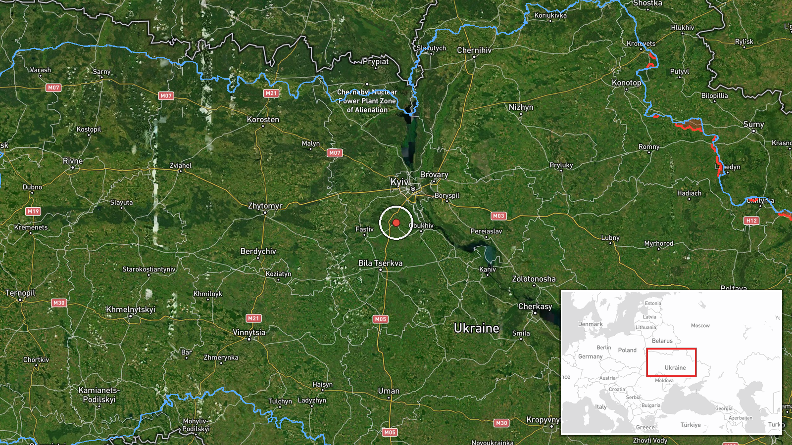
The location is recorded at settlement precision with high location confidence, using coordinates for Vasylkiv at approximately 50.18 north and 30.31 east. The point refers to the town rather than a specific facility or airfield. Vasylkiv sits in Kyiv Oblast roughly 40 kilometres south of central Kyiv, in the flat, low-lying Dnipro basin. Nearby features include farmland, forest belts, and river valleys typical of the region, which offer little natural terrain cover against low-altitude aerial threats.
Related events nearby
- Ukrainian air monitoring: 1 Russian jet-powered Shahed (Geran-3) drone heading toward Boyarka.2026-10-22 07:16 UTC · Drone Transit · Boyarka, Ukraine
- Ukrainian air monitoring: 1 Russian jet-powered Shahed (Geran-3) drone passing Chabany, heading toward Kyiv.2026-10-22 08:48 UTC · Drone Transit · Kyiv, Ukraine
- Ukrainian air monitoring: 1 Russian jet-powered Shahed (Geran-3) drone over Kyiv.2026-10-22 08:27 UTC · Drone Transit · Kyiv, Ukraine
- Ukrainian air monitoring: 2+ Russian jet-powered Shahed (Geran-3) drones from Belarus toward Kyiv Oblast.2026-10-22 07:48 UTC · Drone Transit · Kyiv Oblast, Ukraine
- Ukrainian air monitoring: 2+ Russian jet-powered Shahed (Geran-3) drones from Belarus toward Kyiv Oblast.2026-10-22 07:16 UTC · Drone Transit · Kyiv Oblast, Ukraine
▶ View this event on the live map

Intel Mapper aggregates open-source reports from monitored Telegram and X channels, geolocates them, cross-checks duplicates across sources and assigns a confidence score. Entries are updated as new confirmations arrive. Read how we verify events.