Single jet-powered Shahed (Geran-3) drone reported transiting Poltava region heading west
What happened
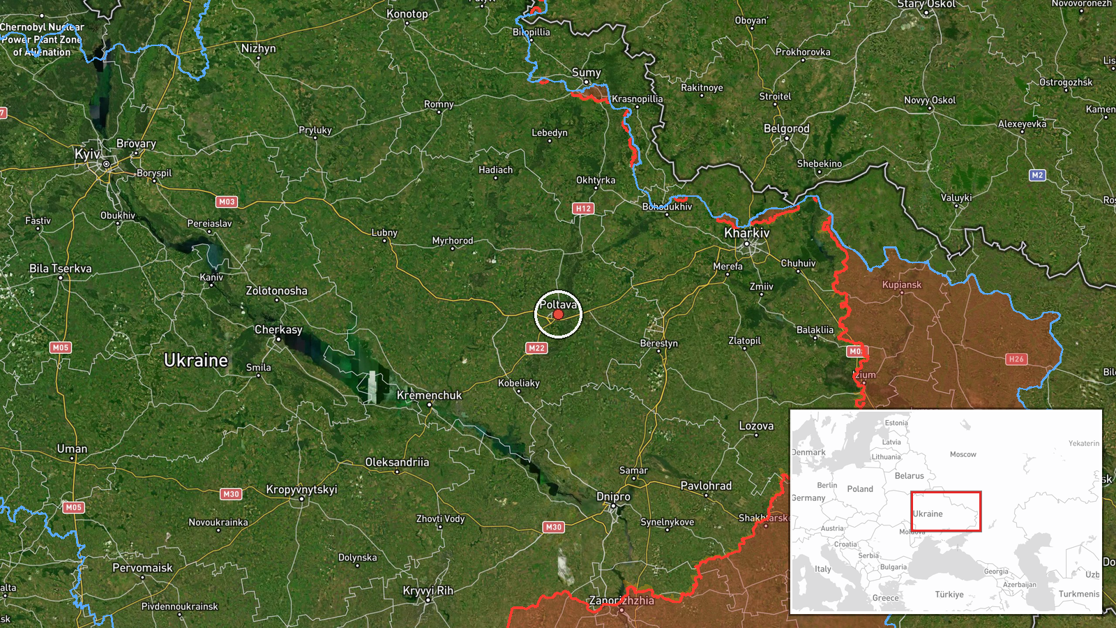
Ukrainian air monitoring reported on Telegram channel @kpszsu that a single Russian jet-powered Shahed, designated Geran-3, was passing Poltava and flying on a western heading. The original Ukrainian-language post describes a jet-type unmanned aerial vehicle in the Poltava region, noting it was passing around the city with a course to the west. The report was logged at 00:20 UTC on 23 October 2026 and is attributed to Russia as the launching side. The post does not mention impact, damage, casualties, or interception, and the event is recorded as a transit rather than a strike. Because the data rests on one channel, the report is treated as provisional until other monitoring or official sources corroborate it.
Context and assessment
Poltava sits in central Ukraine, on the route between eastern frontline oblasts and the western part of the country, which is why Russian long-range drones and missiles often cross it. The related events show a dense overnight and morning pattern. Earlier on 22 October, a Banderol mini cruise missile group was reported heading toward Poltava at 08:17 UTC, while jet-powered Geran-3 drones were tracked toward Kharkiv and Dnipro in the same morning window. A guided glide bomb was also reported over Kharkiv Oblast about a minute before this Poltava report. Taken together, the sequence suggests coordinated raids spreading across several oblasts rather than a single targeted attack. A lone drone heading west may be a stray or a redirected airframe, a route-testing element, or part of a wider wave that has already been partly intercepted. The data alone cannot distinguish these, so the event is best read as one indicator of ongoing activity in central Ukraine.
Sources and confidence
The only source listed is the Telegram channel @kpszsu, which is the Ukrainian Air Force's official account. Its status as an official military channel supports a baseline of credibility, but the post is a short operational alert without independent confirmation. The confidence score of 8.0 reflects this official origin and the clarity of the Ukrainian-language wording, tempered by the single-source status and the absence of follow-up reporting. Confidence would rise with corroboration from other Ukrainian air monitoring channels, regional military administration statements, or open-source flight tracking. It would fall if later updates revised the drone type, count, or direction, or if the report could not be matched to any subsequent event.
Location
The location is recorded at settlement level for the city of Poltava, with a location confidence of high. The coordinates (49.59 N, 34.55 E) correspond to the city centre and represent the reference point of the report rather than a confirmed track. Poltava lies on the Vorskla River in the Poltava Oblast of central-eastern Ukraine, on relatively flat steppe terrain with river valleys and forest belts to the north and west. The city has a major rail junction and airfield infrastructure, which are commonly associated with military and logistics targeting, though the post itself does not name any facility.
Related events nearby
- Ukrainian air monitoring: 2+ Russian Banderol mini cruise missiles heading toward Poltava.2026-10-22 08:17 UTC · Cruise Missile · Poltava, Ukraine
- Ukrainian air monitoring: 1 Russian guided glide bomb (KAB) over Kharkiv Oblast.2026-10-23 00:19 UTC · Airstrike · Kharkiv Oblast, Ukraine
- Ukrainian air monitoring: 2+ Russian jet-powered Shahed (Geran-3) drones heading toward Kharkiv.2026-10-22 08:46 UTC · Drone Transit · Kharkiv, Ukraine
- Ukrainian air monitoring: 1 Russian jet-powered Shahed (Geran-3) drone heading toward Kharkiv.2026-10-22 07:15 UTC · Drone Transit · Kharkiv, Ukraine
- Ukrainian air monitoring: 2+ Russian jet-powered Shahed (Geran-3) drones heading toward Dnipro.2026-10-22 08:07 UTC · Drone Transit · Dnipro, Ukraine
▶ View this event on the live map

Intel Mapper aggregates open-source reports from monitored Telegram and X channels, geolocates them, cross-checks duplicates across sources and assigns a confidence score. Entries are updated as new confirmations arrive. Read how we verify events.