Two or more Russian Geran-3 drones reported passing Olevsk in Zhytomyr region, heading west
What happened
Ukrainian air monitoring reported on 23 October 2026 at 01:42 UTC that at least two Russian jet-powered Shahed drones, designated Geran-3, were passing Olevsk in Zhytomyr region and moving west. The report was posted on Telegram by the channel @kpszsu, which is widely understood to be linked to Ukraine's air force monitoring. The original Ukrainian wording describes jet-powered UAVs passing Olevsk on a westward course, a brief transit notice rather than an account of impact. The message does not describe explosions, damage, casualties or interceptions, and it does not state whether the drones were tracked to a specific target. The event is classified as a drone transit.
Context and assessment
Olevsk sits in the forested Polissia region of northwestern Ukraine, and the transit lies on a corridor that the related reports trace across the Zhytomyr and Rivne areas over the previous day. Earlier on 22 October a single drone was reported near Berezne heading north, and later that day two or more were noted passing Korosten heading west. Further single-drone reports followed near Korosten and Sarny during the early hours of 23 October, with a Sarny report at 00:54 UTC describing a westward course. The pattern is a series of small, staggered movements through the same northwestern belt rather than a concentrated strike package, and the repeated westward headings suggest the drones were crossing this part of the country, not necessarily aimed at Olevsk itself. Operationally, such transits may reflect routing decisions, decoy or saturation tactics, or reconnaissance of air defence coverage, but the data does not confirm any of these. The sequence is best read as a monitoring signal of drone movement across the northwest rather than evidence of a specific target.
Sources and confidence
Only one channel, Telegram @kpszsu, carries this report, so cross-confirmation is absent from the record. The related events share similar wording, which suggests a common monitoring origin but does not add independent confirmation. The confidence score of 8.0 reflects a clear, specific and timestamped notice from a channel with a plausible institutional role, offset by reliance on a single source and the lack of independent imagery or official statements. Confidence would rise if a second monitoring channel, a regional military administration or a media outlet confirmed the flight path, or if wreckage or impact reports appeared. It would fall if later corrections changed the drone count or heading, or if the timing could not be reconciled with other feeds.
Location
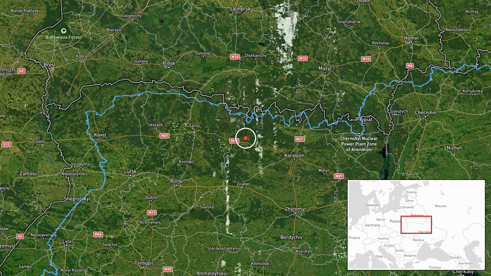
The coordinates match Olevsk, a town in Zhytomyr region, and were assigned at settlement level with high location confidence, so the marker shows the settlement rather than a precise flight position. Olevsk lies in the Polissia lowlands of northwestern Ukraine, a setting of forests, marshes and rivers, and sits northwest of Korosten. Sarny lies to the west in Rivne oblast, and the broader area is relatively close to the Belarus border.
Related events nearby
- Ukrainian air monitoring: 1 Russian jet-powered Shahed (Geran-3) drone passing Berezne, heading north.2026-10-22 09:17 UTC · Drone Transit · Berezne, Ukraine
- Ukrainian air monitoring: 1 Russian jet-powered Shahed (Geran-3) drone passing Sarny, heading west.2026-10-23 00:54 UTC · Drone Transit · Sarny, Ukraine
- Ukrainian air monitoring: 1 Russian jet-powered Shahed (Geran-3) drone heading toward Sarny.2026-10-22 16:57 UTC · Drone Transit · Sarny, Ukraine
- Ukrainian air monitoring: 1 Russian jet-powered Shahed (Geran-3) drone heading toward Korosten.2026-10-23 00:18 UTC · Drone Transit · Korosten, Ukraine
- Ukrainian air monitoring: 2+ Russian jet-powered Shahed (Geran-3) drones passing Korosten, heading west.2026-10-22 17:30 UTC · Drone Transit · Korosten, Ukraine
▶ View this event on the live map

Intel Mapper aggregates open-source reports from monitored Telegram and X channels, geolocates them, cross-checks duplicates across sources and assigns a confidence score. Entries are updated as new confirmations arrive. Read how we verify events.