Ukrainian air monitoring reports one jet-powered Shahed drone heading toward Balakliya
What happened
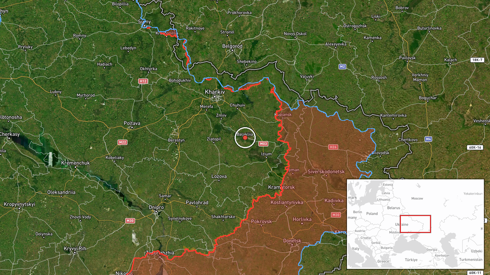
Ukraine's air monitoring channel on Telegram, @kpszsu, reported on 23 October 2026 at 04:30 UTC that a single Russian jet-powered Shahed-type drone, identified in the report as a Geran-3, was heading toward Balakliya, a city in Kharkiv Oblast in northeastern Ukraine. The original Ukrainian wording, which translates roughly as a jet-type unmanned aerial vehicle heading to Balakliya from the southeast, describes the object's approach direction but does not state whether it struck, was intercepted, or changed course. The notice is a warning of an aerial track rather than a confirmed impact. No casualties, damage, or responsible unit are named. The event is recorded as a drone transit, and the attribution to Russia rests on the drone type and the wider campaign pattern in the region rather than on any direct claim.
Context and assessment
Balakliya is a rail junction and town on the Oskil River corridor southeast of Kharkiv, and its transport links give it a logistical role that makes it a recurring point of interest in the Kharkiv area. The track fits a short but dense sequence. Roughly sixteen hours earlier, the same monitoring channel reported a Banderol mini cruise missile heading toward Balakliya, which suggests the town was targeted by more than one weapon type within a single day. Around the same period, Shahed-type drones were reported moving from Kharkiv Oblast toward Barvinkove and over Kharkiv city, indicating a broader pattern of drone activity across the oblast rather than a single isolated approach. Ground reports from Kupiansk, to the east, describe underground movements and close-quarters fighting, though attribution in those reports is unconfirmed and they do not directly concern Balakliya. Operationally, a single jet-powered drone may be a reconnaissance or saturation element, a decoy, or part of a larger combined strike, and the available data cannot distinguish among these roles. Its higher speed relative to older piston-engined Shaheds reduces the warning window for local air defence, which is one reason such reports are treated as time-sensitive.
Sources and confidence
The report comes from a single Ukrainian Telegram channel, @kpszsu, which is the official air monitoring feed used for real-time threat warnings. No second independent channel is listed for this event, so cross-confirmation is absent. The confidence score of 8.0 reflects the channel's established role in issuing air alerts and the consistency of its reports with the other drone and missile events logged the same day, but it stops short of the maximum because the track is an observed heading rather than a confirmed outcome. Confidence would rise with corroboration from local military administration statements, wire agencies, or post-event reports of impact or interception. It would fall if later alerts retracted the track, reclassified the object, or showed it moving away from Balakliya.
Location
The location is recorded at settlement level for Balakliya, Ukraine, with a location confidence rated high, so the pin reflects the town centre rather than a specific facility. Balakliya lies in the Kharkiv Oblast flatlands, where open agricultural land and river valleys are typical. The Oskil River runs through the wider area, and the town's rail infrastructure is a prominent feature. The report names a direction of approach from the southeast, which matches the general geography of the oblast, though the drone's precise flight path is not recorded.
Related events nearby
- Ukrainian air monitoring: 1 Russian Banderol mini cruise missile heading toward Balakliya.2026-10-22 08:04 UTC · Cruise Missile · Balakliya, Ukraine
- Ukrainian forces moved over 15 km through underground tunnels during recent counteroffensive actions to bypass2026-10-22 10:55 UTC · Combat · Kupiansk, Kharkiv Oblast, Ukraine
- Footage shared of underground close-quarters clashes between Russian and Ukrainian soldiers in the Kupiansk di2026-10-22 19:10 UTC · Combat · Kupiansk, Kharkiv Oblast, Ukraine
- Ukrainian air monitoring: 2+ Russian Shahed-type drones from Kharkiv Oblast toward Barvinkove.2026-10-23 03:17 UTC · Drone Transit · Barvinkove, Ukraine
- Ukrainian air monitoring: 2+ Russian jet-powered Shahed (Geran-3) drones over Kharkiv.2026-10-23 03:13 UTC · Drone Transit · Kharkiv, Ukraine
▶ View this event on the live map

Intel Mapper aggregates open-source reports from monitored Telegram and X channels, geolocates them, cross-checks duplicates across sources and assigns a confidence score. Entries are updated as new confirmations arrive. Read how we verify events.