Footage of underground fighting near Kupiansk, attacking side unconfirmed
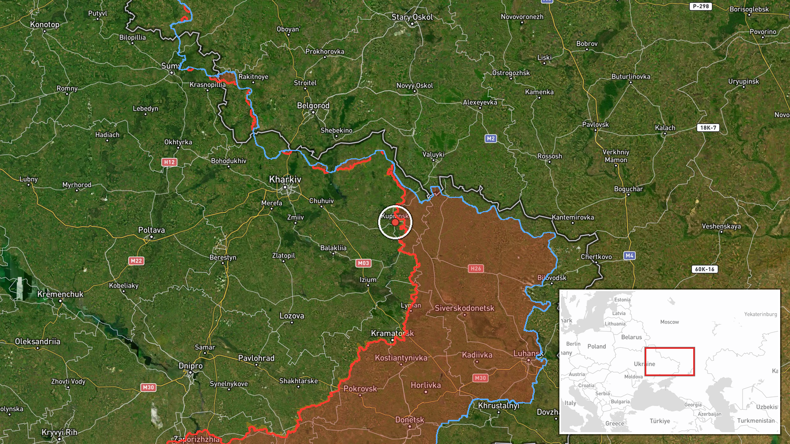
What happened
A post on X from the account @ConflictTR shared footage of close-quarters clashes underground between Russian and Ukrainian soldiers in the Kupiansk direction of Kharkiv Oblast, Ukraine. The item was timestamped 22 October 2026 at 19:10 UTC. The original Turkish-language text describes the footage as showing clashes in underground spaces between the two sides and links to the post. The footage itself does not establish the time or exact position of the fighting, and the summary notes that which side launched the attack remains unconfirmed. The report describes no casualties, damage, or territorial change, and no independent account of the specific clashes was found in the available data.
Context and assessment
Kupiansk has been one of the most contested points on the northeastern front. Control of the town and its crossings over the Oskil River has been fought over repeatedly, and its ruined urban fabric makes close-quarters and subterranean fighting plausible. A related report from the same day says Ukrainian forces moved more than 15 km through underground tunnels during recent counteroffensive actions to bypass Russian positions near Kupiansk, which suggests that tunnel networks were part of the operational picture there. If the footage does show tunnel fighting, it would fit that pattern, although the link cannot be confirmed from one clip. Nearby activity on the same date adds to the picture of pressure across the Kharkiv axis. Ukrainian General Staff reporting describes eleven clashes in the Sloboda-Northern direction near Izbytske, Radkivka and Vilkhuvatka over 24 hours, with one still ongoing. Separate air-monitoring alerts record a guided glide bomb heading toward northeastern Kharkiv Oblast and a Banderol mini cruise missile heading toward Balakliya. Taken together, these items indicate sustained ground action alongside long-range strike activity, though they do not show how the Kupiansk clashes relate to the wider front.
Sources and confidence
The event rests on a single channel, @ConflictTR on X, and no second outlet has reported the same footage. The confidence score of 5.7 reflects that single-source status, along with the lack of a verifiable date, location, or attribution for the clip itself. The related items are useful for context but do not confirm this specific encounter. Confidence would rise if geolocated or chronolocated imagery matched a Kupiansk underground site, if Ukrainian or Russian official channels acknowledged fighting there, or if independent war-monitoring outlets published corroborating material. It would fall if reverse image searches traced the footage to an earlier conflict or to another location.
Location
The point is placed at the settlement centre of Kupiansk, which the data classifies as settlement-level precision rather than an exact street or facility. Footage of underground fighting cannot be pinned to a specific building from the available information. Kupiansk sits on the Oskil River in Kharkiv Oblast, close to the Russian border region, and the river and surrounding floodplain have shaped crossings and military movement in the area.
Related events nearby
- Ukrainian forces moved over 15 km through underground tunnels during recent counteroffensive actions to bypass2026-10-22 10:55 UTC · Combat · Kupiansk, Kharkiv Oblast, Ukraine
- Ukrainian General Staff reports 11 combat clashes in the Sloboda-Northern direction near Izbytske, Radkivka an2026-10-22 19:02 UTC · Combat · Izbytske, Kharkiv Oblast, Ukraine
- Ukrainian air monitoring: 1 Russian Banderol mini cruise missile heading toward Balakliya.2026-10-22 08:04 UTC · Cruise Missile · Balakliya, Ukraine
- Ukrainian Defense Forces repelled five Russian attacks on the Lyman axis near Katerynivka, Kolodyazi and Lyman2026-10-22 19:03 UTC · Combat · Lyman, Donetsk Oblast, Ukraine
- Ukrainian air monitoring: 1 Russian guided glide bomb (KAB) heading toward northeastern Kharkiv Oblast.2026-10-22 07:15 UTC · Airstrike · northeastern Kharkiv Oblast, Ukraine
▶ View this event on the live map

Intel Mapper aggregates open-source reports from monitored Telegram and X channels, geolocates them, cross-checks duplicates across sources and assigns a confidence score. Entries are updated as new confirmations arrive. Read how we verify events.