Ukraine reports 11 clashes in Sloboda-Northern direction near Izbytske, Kharkiv Oblast
What happened
Ukraine's General Staff reported on Telegram that 11 combat clashes took place in the Sloboda-Northern direction over the 24 hours to 22:00 on 22 October 2026, with activity concentrated around Izbytske, Radkivka and Vilkhuvatka. The original Ukrainian wording refers to 'бойових зіткнень' and states that one clash was still ongoing at the time of reporting. The post does not identify the attacking side, the weapons used, any casualties, or any change in control of terrain. This page attributes the action to Russia, reflecting the General Staff's framing of Russian forces in the sector, although the report itself names places rather than parties. The entry was logged at 19:02 UTC on 22 October, and the source is a single official channel.
Context and assessment
Izbytske lies in the border belt north-east of Kharkiv city, an area where Ukrainian and Russian forces have fought for much of the war, and clusters of clashes here often signal pressure on settlements that anchor the wider front. The related reports from the same day describe a layered pattern. At 05:07 Russian forces reportedly conducted two aviation strikes using six guided aerial bombs and 47 shellings of Ukrainian positions and settlements in the North Slobozhansky direction. At 07:15 air monitoring flagged a single guided glide bomb heading toward the north-east of the oblast, and at 08:46 jet-powered Shahed-type drones were reported moving toward Kharkiv. Separately, footage from the Kupiansk direction, about 60 kilometres to the south, showed close-quarters underground fighting, though attribution of the attacking side is unconfirmed. Taken together, the sequence of glide bombs, artillery and drones suggests sustained fire support for ground assaults rather than a single isolated incident. Operationally, this may indicate an effort to fix Ukrainian units along several axes at once, but the data alone cannot show whether the clashes represent a broader offensive or routine positional fighting.
Sources and confidence
Only one channel is cited, the official Telegram account of the Ukrainian General Staff, and no independent outlet, imagery or geolocated footage has been added to the record. The confidence score of 8.0 reflects the channel's institutional standing and the specificity of its timing and place names, but it is not higher because the claim is unverified by any second source and the post gives no detail on the parties involved. Confidence would rise with corroboration from regional Ukrainian military administrations, independent monitoring groups, or geolocated video from the named settlements. It would fall if the General Staff later revised its figures or if Russian sources contradicted the sequence of events.
Location
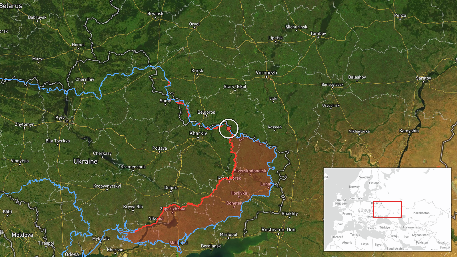
The coordinates correspond to the approximate centre of Izbytske in Kharkiv Oblast, not to a verified frontline position, and the location confidence is recorded as low with region-level precision. The General Staff named three settlements, so the point marks the most prominent of them rather than an exact site of fighting. The terrain is largely open agricultural steppe with shallow river valleys, tree belts and scattered villages, which offers limited cover and tends to make movement visible. Kupiansk lies roughly 60 kilometres to the south.
Related events nearby
- Ukrainian air monitoring: 1 Russian guided glide bomb (KAB) heading toward northeastern Kharkiv Oblast.2026-10-22 07:15 UTC · Airstrike · northeastern Kharkiv Oblast, Ukraine
- Russian forces conducted two aviation strikes using six guided aerial bombs (KAB) and 47 shellings of Ukrainia2026-10-22 05:07 UTC · Airstrike · North Slobozhansky direction, Kharkiv Oblast, Ukra
- Ukrainian forces moved over 15 km through underground tunnels during recent counteroffensive actions to bypass2026-10-22 10:55 UTC · Combat · Kupiansk, Kharkiv Oblast, Ukraine
- Footage shared of underground close-quarters clashes between Russian and Ukrainian soldiers in the Kupiansk di2026-10-22 19:10 UTC · Combat · Kupiansk, Kharkiv Oblast, Ukraine
- Ukrainian air monitoring: 2+ Russian jet-powered Shahed (Geran-3) drones heading toward Kharkiv.2026-10-22 08:46 UTC · Drone Transit · Kharkiv, Ukraine
▶ View this event on the live map

Intel Mapper aggregates open-source reports from monitored Telegram and X channels, geolocates them, cross-checks duplicates across sources and assigns a confidence score. Entries are updated as new confirmations arrive. Read how we verify events.