Russian glide bomb reported heading toward northeastern Kharkiv Oblast, single-source report
What happened
Ukrainian air monitoring reported on Telegram that one Russian guided glide bomb, known as a KAB, was heading toward northeastern Kharkiv Oblast at about 07:15 UTC on 22 October 2026. The original post, written in Ukrainian by the channel @kpszsu, refers to repeated KAB launches toward the northeast of the region, a phrasing that suggests a series of launches, although the structured summary records a single bomb. The report names no impact point, casualties, or damage. It is logged as an airstrike attributed to Russia, and that attribution rests on the channel's characterization of the launch source rather than on independent confirmation.
Context and assessment
Kharkiv Oblast has been a recurring target for Russian aviation-delivered munitions, and KABs are typically released by aircraft at standoff distance, which lets the launching platform stay outside the range of many air defense systems. The related events show a dense sequence within roughly thirty hours. On 21 October, Russian forces reportedly attacked Ukrainian positions three times on the Southern Slobozhanshchyna axis near Starytsia, Vovchanski Khutory and toward Izbytske. Early on 22 October, two aviation strikes using six KABs and 47 shellings were recorded in the North Slobozhansky direction. Separate Shahed-type drone transits crossed northern and eastern parts of the oblast the previous morning, and a jet-powered Geran-3 was tracked heading toward Kharkiv city at 07:15 UTC. Taken together, this suggests a coordinated effort that combines ground pressure on the border axis with glide bombs and long-range drones. It could indicate preparation for a push, an attempt to stretch air defenses, or simply a routine tempo in an active sector. The data alone does not show which.
Sources and confidence
The report rests on one Telegram channel, @kpszsu, which is associated with the Ukrainian Air Force and is widely used for air threat alerts. No other outlet or channel in the dataset independently reports this specific launch. The confidence score of 8.0 reflects the official-channel origin and the specific, time-stamped wording, offset by the single-source status, the absence of imagery, and the lack of any impact confirmation. Confidence would rise with corroborating air alerts from other monitoring sources, regional military administration statements, or geolocated footage of impact. It would fall if the channel corrected or withdrew the report, or if later reporting contradicted the reported launch.
Location
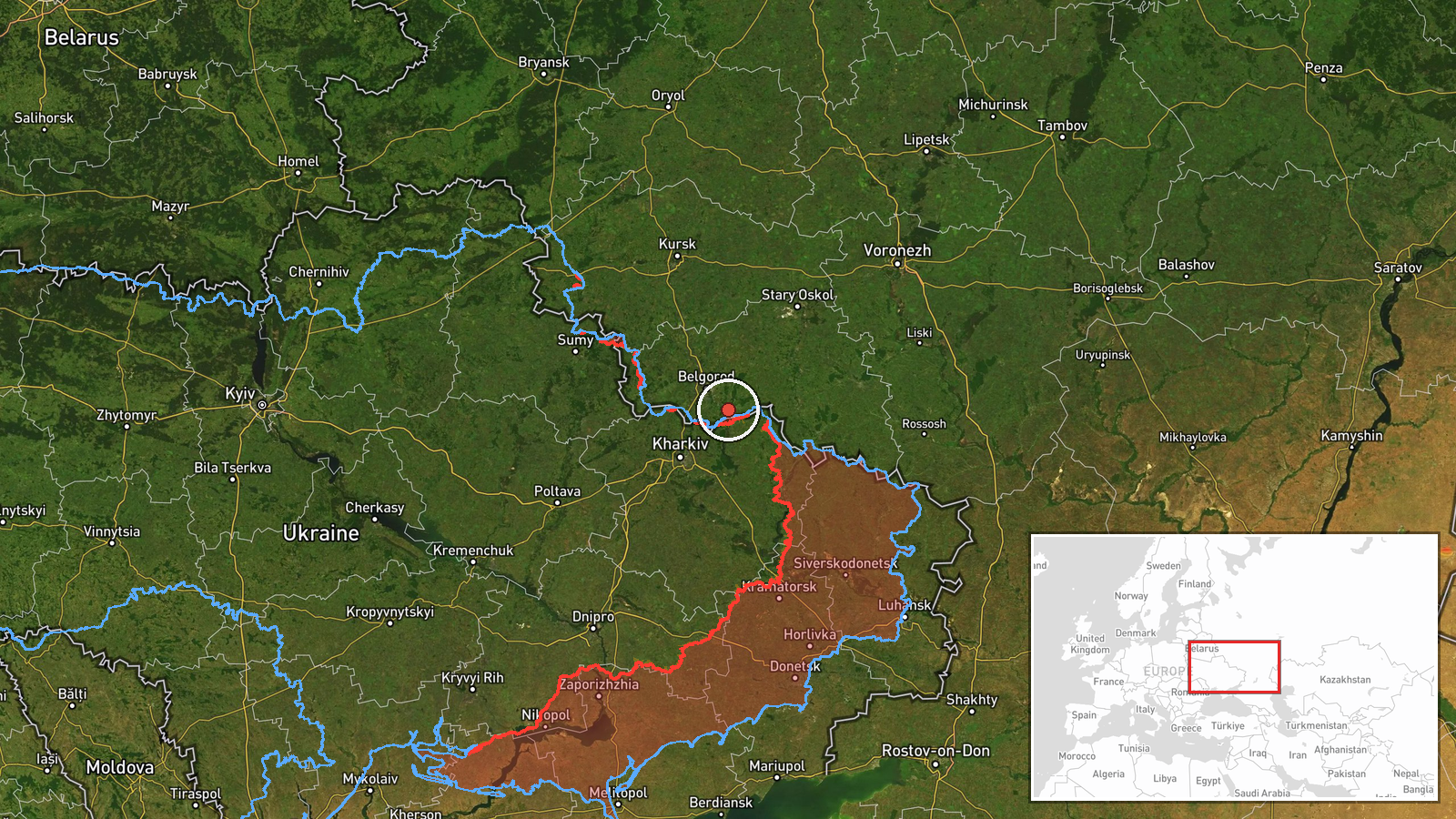
Location is recorded at regional precision, with low location confidence. The coordinates mark an approximate point within northeastern Kharkiv Oblast rather than a named settlement or confirmed impact site. The oblast is largely flat steppe and farmland, bordered to the north and east by Russia's Belgorod region, and the area lies within the frontline zone along the Slobozhanshchyna axis. Nearby reference points include the Siverskyi Donets river valley and the regional center of Kharkiv to the southwest.
Related events nearby
- Russian forces attacked Ukrainian positions three times on the Southern Slobozhanshchyna axis near Starytsia, 2026-10-21 19:03 UTC · Combat · Starytsia, Kharkiv Oblast, Ukraine
- Russian forces conducted two aviation strikes using six guided aerial bombs (KAB) and 47 shellings of Ukrainia2026-10-22 05:07 UTC · Airstrike · North Slobozhansky direction, Kharkiv Oblast, Ukra
- Ukrainian air monitoring: 1 Russian Shahed-type drone passing northern Kharkiv Oblast, heading southwest.2026-10-21 09:38 UTC · Drone Transit · northern Kharkiv Oblast, Ukraine
- Ukrainian air monitoring: 1 Russian Shahed-type drone passing eastern Kharkiv Oblast, heading south.2026-10-21 09:50 UTC · Drone Transit · eastern Kharkiv Oblast, Ukraine
- Ukrainian air monitoring: 1 Russian jet-powered Shahed (Geran-3) drone heading toward Kharkiv.2026-10-22 07:15 UTC · Drone Transit · Kharkiv, Ukraine
▶ View this event on the live map

Intel Mapper aggregates open-source reports from monitored Telegram and X channels, geolocates them, cross-checks duplicates across sources and assigns a confidence score. Entries are updated as new confirmations arrive. Read how we verify events.