Single Russian Shahed-type drone reported transiting eastern Kharkiv Oblast heading south
What happened
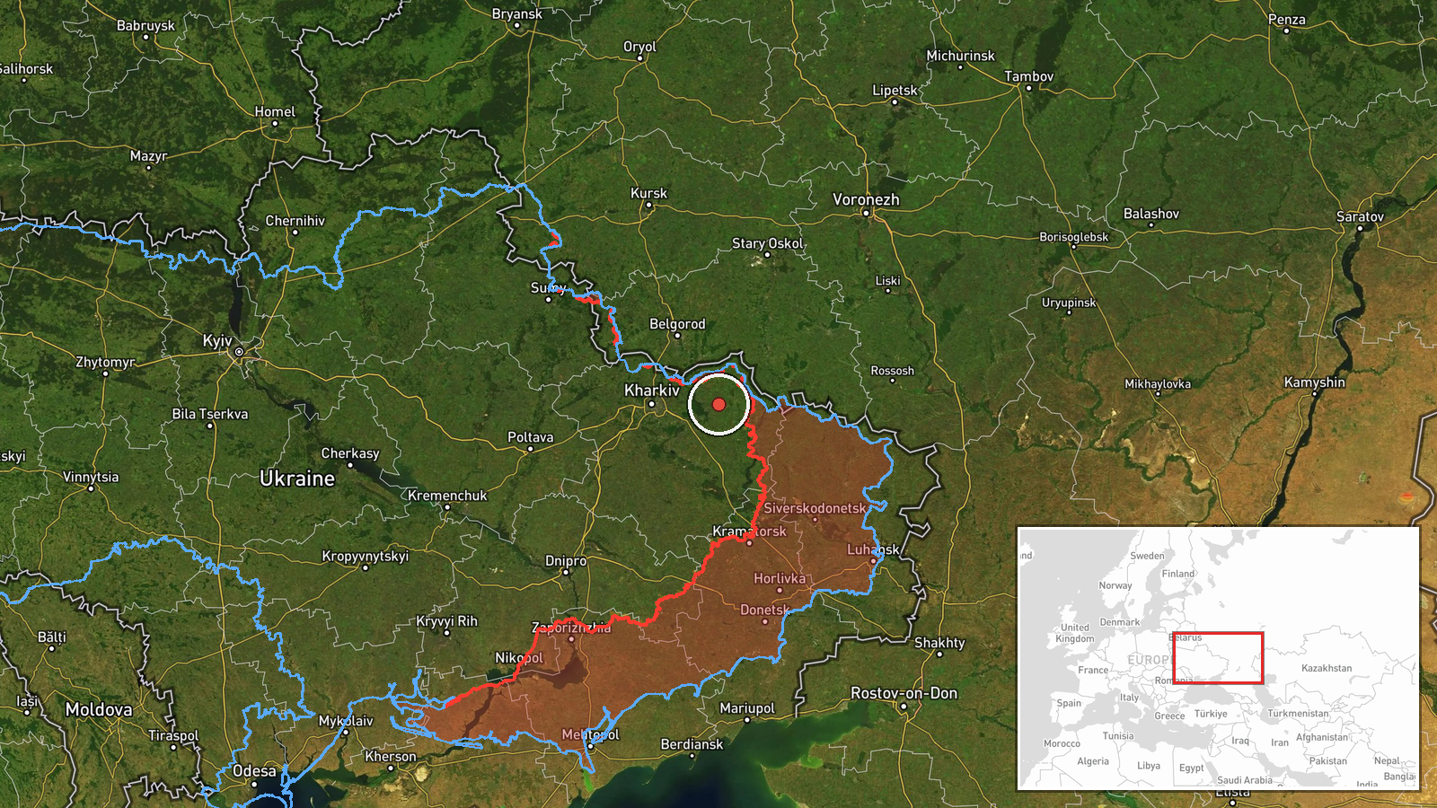
Ukrainian air monitoring, as relayed by the Telegram channel @kpszsu, reported one Russian Shahed-type drone (UAV) passing over eastern Kharkiv Oblast on 21 October 2026 at about 09:50 UTC, travelling on a southerly heading. The original post, written in Ukrainian, uses the abbreviation БпЛА (unmanned aerial vehicle) and the phrase 'курс на південь,' meaning 'course to the south.' The post does not state a target, impact, or damage, and it does not specify a precise track or altitude. The report is a transit notice rather than a strike report, so the event's significance rests on the drone's route and the wider air activity in the region that morning.
Context and assessment
Eastern Kharkiv Oblast sits close to the active front line, and the surrounding settlements have seen a steady run of ground attacks in the hours before this report. Related entries from 20 and 21 October describe Russian assaults toward Vovchanski Khutory, Ternova, Radkivka and Zarichne, with Ukrainian units reporting that they repelled a number of them. Air monitoring from the same day also logged several Geran-3 jet-powered drones, including one over Kharkiv city at 02:43 UTC and a group of two or more heading toward the oblast at 08:06 UTC. A single southbound drone in this sequence may be a reconnaissance or decoy element, a component of a larger wave that has been broken up or re-routed, or a drone en route to a target farther south. Because the report gives no endpoint, these readings remain speculative. The pattern does suggest that the drone traffic and the ground fighting in this sector are running in parallel rather than as isolated events.
Sources and confidence
The event rests on a single Telegram channel, @kpszsu, which is the official channel of the Ukrainian Air Force and posts routine air-alert and drone-tracking updates. The report is not yet independently confirmed by a second source in the dataset. Its confidence score of 8.0 reflects the official origin of the channel and the routine nature of such notices, offset by the single-source status, the lack of track detail, and the absence of any impact report. Confidence would rise with corroboration from regional military administration statements, air-defence reports, or open-source flight tracking that matches the described route. It would fall if later updates contradict the heading or if the drone is reported as having been shot down over a different area.
Location
The location is recorded only at regional level, eastern Kharkiv Oblast, Ukraine, with coordinates near 49.99 N, 37.15 E. No settlement or facility is named in the report, so the point is an approximate centroid rather than an observed position, and the location confidence is rated low. The area is flat steppe farmland of the Slobozhanshchyna region, with the Siverskyi Donets river valley and its tributaries to the south and east, and the Russian border lying a short distance to the north and east.
Related events nearby
- Russian forces made 12 attacks on Ukrainian positions in the Southern Slobozhansky direction toward ten settle2026-10-20 19:03 UTC · Combat · Vovchanski Khutory, Kharkiv Oblast, Ukraine
- Ukrainian units repelled 13 Russian attacks across South Slobozhanshchyna settlements including Ternova, Izbyt2026-10-21 05:04 UTC · Combat · Ternova, Kharkiv Oblast, Ukraine
- Russian forces made eight offensive attacks on Radkivka and Mala Shapkivka (Kupiansk), three assaults near Zar2026-10-21 05:05 UTC · Combat · Radkivka, Kharkiv Oblast, Ukraine
- Ukrainian air monitoring: 2+ Russian jet-powered Shahed (Geran-3) drones heading toward Kharkiv Oblast.2026-10-21 08:06 UTC · Drone Transit · Kharkiv Oblast, Ukraine
- Ukrainian air monitoring: 1 Russian jet-powered Shahed (Geran-3) drone over Kharkiv.2026-10-21 02:43 UTC · Drone Transit · Kharkiv, Ukraine
▶ View this event on the live map

Intel Mapper aggregates open-source reports from monitored Telegram and X channels, geolocates them, cross-checks duplicates across sources and assigns a confidence score. Entries are updated as new confirmations arrive. Read how we verify events.