Ukrainian forces report repelling 13 Russian attacks across South Slobozhanshchyna settlements in Kharkiv Oblast
What happened
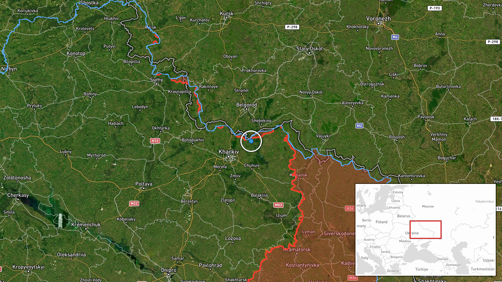
Ukraine's General Staff, posting on its official Telegram channel (@GeneralStaffZSU), reported that Ukrainian units repelled 13 attacks by Russian forces on the Southern Slobozhansky (Pivdenno-Slobozhanskyi) axis in Kharkiv Oblast. The report, timed 21 October 2026 at 05:04 UTC, names settlements including Ternova, Izbytske, Starytsia, Blahodatne, Symynivka, Vovchanski Khutory, Zakharivka, Okhrimivka, Volokhivske, Vilkhuvatka and Chuhunivka. The map pin is placed on Ternova, which the statement lists first among the affected localities. The wording describes the actions as attacks by the enemy on areas around these settlements, not as outcomes at any single point. No casualty or equipment figures were included in the summary provided.
Context and assessment
The Southern Slobozhansky direction runs along the northeastern approaches to Kharkiv city and has been a recurring area of ground activity since 2022. The settlements named here sit in the border belt and rural hinterland, where frontline reporting often covers many small villages in a single update rather than one clearly defined engagement. The related events show a continuous pattern in the preceding day. On 20 October at 19:03 UTC, Ukrainian reporting described 12 Russian attacks toward ten settlements, with four still ongoing, centered on Vovchanski Khutory. That report overlaps with the current one, suggesting a sustained tempo of assaults rather than a single isolated surge. Several jet-powered Geran-3 drones were logged over or heading toward Kharkiv in the early hours of 21 October, which indicates parallel pressure on the city itself. Operationally, a high count of small-scale attacks across many villages may point to probing or sustained assault along a broad front, though the data alone cannot establish the intent or the scale of any single attack.
Sources and confidence
Only one channel is cited: the official Telegram account of the Ukrainian General Staff. No independent outlet, Russian source, or local authority in the data corroborates the count of 13 attacks or the list of settlements. The confidence score of 8.0 reflects a credible, official primary source with a clear, specific claim, offset by the absence of cross-confirmation and the self-reported nature of the figures. Confidence would rise with confirmation from regional Ukrainian officials, independent monitoring, or geolocated footage of activity in the named villages. It would fall if subsequent updates revised the count or if the named settlements were contradicted by other reporting.
Location
The pin is placed on Ternova, a settlement in Kharkiv Oblast, at coordinates 50.1923 N, 36.6748 E, with settlement-level precision. The statement names a cluster of roughly eleven villages, so the pin represents the first listed locality rather than a precise point of action. The area lies in the northeast of Ukraine, close to the Russian border and the Kharkiv urban agglomeration, in gently rolling steppe farmland. Local geography in this belt is dominated by agricultural land, small river valleys and a dispersed village pattern.
Related events nearby
- Russian forces made 12 attacks on Ukrainian positions in the Southern Slobozhansky direction toward ten settle2026-10-20 19:03 UTC · Combat · Vovchanski Khutory, Kharkiv Oblast, Ukraine
- Ukrainian air monitoring: 1 Russian jet-powered Shahed (Geran-3) drone over Kharkiv.2026-10-21 02:43 UTC · Drone Transit · Kharkiv, Ukraine
- Ukrainian air monitoring: 1 Russian jet-powered Shahed (Geran-3) drone heading toward Kharkiv.2026-10-21 02:19 UTC · Drone Transit · Kharkiv, Ukraine
- Ukrainian air monitoring: 1 Russian jet-powered Shahed (Geran-3) drone over Kharkiv.2026-10-21 02:17 UTC · Drone Transit · Kharkiv, Ukraine
- Ukrainian air monitoring: 1 Russian jet-powered Shahed (Geran-3) drone over Kharkiv.2026-10-21 02:16 UTC · Drone Transit · Kharkiv, Ukraine
▶ View this event on the live map

Intel Mapper aggregates open-source reports from monitored Telegram and X channels, geolocates them, cross-checks duplicates across sources and assigns a confidence score. Entries are updated as new confirmations arrive. Read how we verify events.