Ukrainian air monitoring reports a Russian jet-powered Geran-3 drone over Kharkiv
What happened
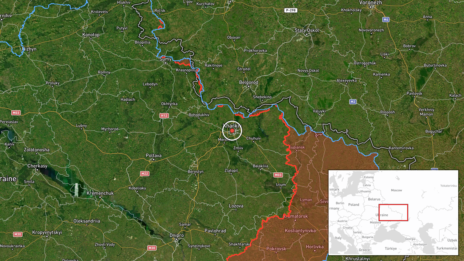
Ukraine's air monitoring channel on Telegram, @kpszsu, reported on 21 October 2026 at 02:16 UTC that one Russian jet-powered Shahed-type drone, identified as the Geran-3, was over Kharkiv. The original Ukrainian-language message describes a jet-powered unmanned aerial vehicle at or near Kharkiv, approaching from the north. The notice is a short air-alert style report. It does not describe impact, casualties, damage, or any interception. The event is coded as a drone transit, with the location placed at the city of Kharkiv in northeastern Ukraine. Attribution to Russia rests on the channel's wording and the drone type, which matches the Shahed series Russia has used against Ukrainian targets for several years. Two closely timed follow-up notices, at 02:17 and 02:19 UTC, appear among the related events.
Context and assessment
Kharkiv, Ukraine's second-largest city, lies close to the Russian border and has been a recurring target of air attacks since the full-scale invasion. The related events show a dense sequence on 20 and 21 October 2026. On 20 October, Ukrainian monitoring logged a guided glide bomb heading toward eastern Kharkiv Oblast at 05:53 UTC, a ballistic missile toward Kharkiv Oblast at 07:41 UTC, and a Shahed-type drone toward Kharkiv at 08:58 UTC. The pre-dawn drone notices on 21 October continue that pattern. Mixing drones, ballistic missiles and glide bombs over a short window is consistent with sustained pressure on a single area rather than isolated launches. A jet-powered variant such as the Geran-3 is generally faster than propeller-driven Shahed models, which may complicate interception with older air defense. Operationally, these transits may be aimed at energy, logistics or defense targets in or around the city, but the data provided does not establish a target.
Sources and confidence
The report comes from one Telegram channel, @kpszsu, which is an official Ukrainian air monitoring account. Its record of timely alerts gives it considerable weight, but this event is recorded with a source count of one and no independent confirmation in the data. The confidence score of 8.0 reflects that reliability balanced against the single-source basis and the absence of any impact or interception detail. Confidence would rise with corroboration from the Ukrainian Air Force, Kharkiv regional authorities, or wire services, or with reports of interception or impact. It would fall if the channel corrected or withdrew the notice, or if later official statements contradicted the drone type or location.
Location
The location is recorded at settlement level, using central Kharkiv coordinates of approximately 49.99 N, 36.23 E, with high location confidence. The point reflects the city rather than a specific facility, so it should not be read as a precise target. Kharkiv sits in northeastern Ukraine on flat steppe terrain near the Russian border, at the confluence of the Lopan and Kharkiv rivers. Its dense urban core, industrial districts and rail links are notable features in the surrounding area.
Related events nearby
- Ukrainian air monitoring: 1 Russian jet-powered Shahed (Geran-3) drone over Kharkiv.2026-10-21 02:43 UTC · Drone Transit · Kharkiv, Ukraine
- Ukrainian air monitoring: 1 Russian jet-powered Shahed (Geran-3) drone heading toward Kharkiv.2026-10-21 02:19 UTC · Drone Transit · Kharkiv, Ukraine
- Ukrainian air monitoring: 1 Russian jet-powered Shahed (Geran-3) drone over Kharkiv.2026-10-21 02:17 UTC · Drone Transit · Kharkiv, Ukraine
- Ukrainian air monitoring: 1 Russian Shahed-type drone heading toward Kharkiv.2026-10-20 08:58 UTC · Drone Transit · Kharkiv, Ukraine
- Ukrainian air monitoring: 1 Russian ballistic missile heading toward Kharkiv Oblast.2026-10-20 07:41 UTC · Ballistic Missile · Kharkiv Oblast, Ukraine
▶ View this event on the live map

Intel Mapper aggregates open-source reports from monitored Telegram and X channels, geolocates them, cross-checks duplicates across sources and assigns a confidence score. Entries are updated as new confirmations arrive. Read how we verify events.