Ukrainian air monitoring reports jet-powered Shahed (Geran-3) drone heading toward Kharkiv
What happened
At 02:19 UTC on 21 October 2026, the Telegram channel @kpszsu, which relays Ukrainian air monitoring reports, posted that one Russian jet-powered Shahed-type drone, identified as a Geran-3, was heading toward Kharkiv. The original Ukrainian text, a short post with a jet-drone icon, reads as a jet UAV bound for Kharkiv from the south. The report gives no launch site, no impact details and no casualty information. Two earlier posts at 02:16 and 02:17 UTC described the same drone type over Kharkiv itself, so this entry most likely marks a continuing track rather than a separate aircraft. The channel is the sole source for this entry, and its wording describes the drone's heading and type rather than any effect on the ground.
Context and assessment
Kharkiv, Ukraine's second-largest city, lies close to the Russian border and has been a repeated target of cross-border strikes since 2022, so drone activity there is routinely monitored. The entries in this sequence show a dense pattern over roughly 21 hours. On 20 October, a Shahed-type drone was reported heading toward Kharkiv at 08:58 UTC, a ballistic missile toward Kharkiv Oblast at 07:41, and a guided glide bomb toward eastern Kharkiv Oblast at 05:53. The overnight Geran-3 reports then placed a jet-powered drone over the city and on its approach. Operationally, mixing drones, ballistic missiles and glide bombs across the same oblast is consistent with layered attack packages designed to stretch air defenses. Faster jet-powered drones are generally harder to intercept than propeller-driven variants, which may be why the type is being tracked closely. These are inferences from the reporting pattern, not confirmed intent.
Sources and confidence
This entry rests on one Telegram channel, @kpszsu, which relays Ukrainian air monitoring alerts. It has no independent cross-confirmation in the data provided, and the 8.0 confidence score reflects a clear, specific and internally consistent report from a channel that typically posts such alerts, offset by the absence of a second source. Confidence would rise with corroboration from other Ukrainian air monitoring feeds, Kharkiv regional or city officials, or open-source trackers that record the same flight path. It would fall if later reporting showed the drone was intercepted elsewhere, misidentified, or part of a different track. The sequence of related reports from the same channel adds some internal consistency but not independent verification.
Location
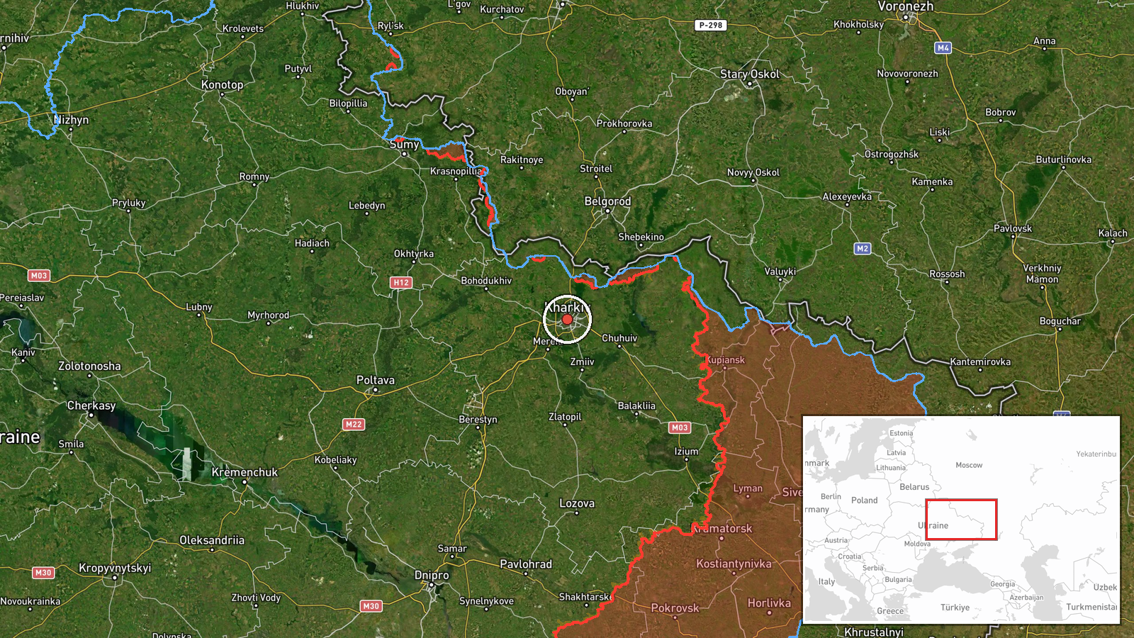
The coordinates, 49.99 N and 36.23 E, correspond to Kharkiv city at settlement-level precision, so the point marks the city rather than any specific facility. Kharkiv lies in northeastern Ukraine, a short distance from the Russian border and the wider Kharkiv Oblast. The city sits on flat steppe terrain at the confluence of the Lopan and Kharkiv rivers. The reported 'from the south' heading refers to direction of approach only and does not identify a launch point.
Related events nearby
- Ukrainian air monitoring: 1 Russian jet-powered Shahed (Geran-3) drone over Kharkiv.2026-10-21 02:43 UTC · Drone Transit · Kharkiv, Ukraine
- Ukrainian air monitoring: 1 Russian jet-powered Shahed (Geran-3) drone over Kharkiv.2026-10-21 02:17 UTC · Drone Transit · Kharkiv, Ukraine
- Ukrainian air monitoring: 1 Russian jet-powered Shahed (Geran-3) drone over Kharkiv.2026-10-21 02:16 UTC · Drone Transit · Kharkiv, Ukraine
- Ukrainian air monitoring: 1 Russian Shahed-type drone heading toward Kharkiv.2026-10-20 08:58 UTC · Drone Transit · Kharkiv, Ukraine
- Ukrainian air monitoring: 1 Russian ballistic missile heading toward Kharkiv Oblast.2026-10-20 07:41 UTC · Ballistic Missile · Kharkiv Oblast, Ukraine
▶ View this event on the live map

Intel Mapper aggregates open-source reports from monitored Telegram and X channels, geolocates them, cross-checks duplicates across sources and assigns a confidence score. Entries are updated as new confirmations arrive. Read how we verify events.