Ukrainian Air Force reports one Russian Banderol cruise missile heading toward Pavlohrad
What happened
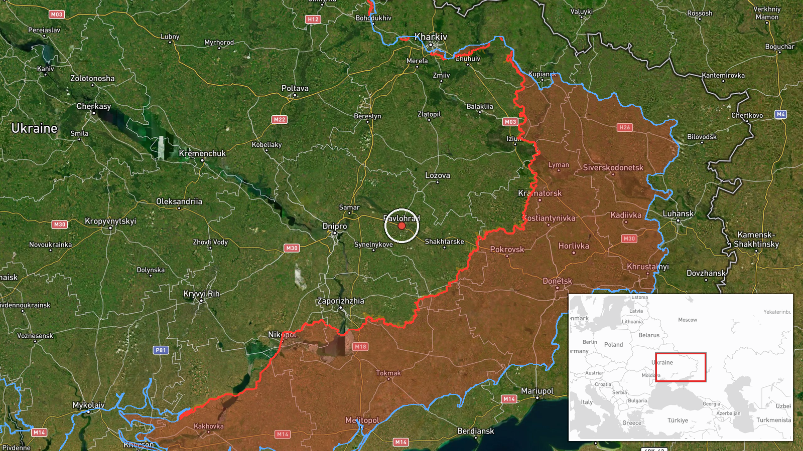
The Ukrainian Air Force's Telegram channel (@kpszsu) reported on 23 October 2026 at 06:20 UTC that one Russian Banderol mini cruise missile was heading toward Pavlohrad in Dnipropetrovsk Oblast. The original post is a short Ukrainian-language alert, reading in translation as 'Banderol' to Pavlohrad, with a rocket emoji and no further detail on flight path, altitude, interception or impact. The event is classed as a cruise missile attack attributed to Russia, but no launch origin is recorded. The report describes a heading, not a confirmed strike, so this entry does not establish whether the missile reached the city or was intercepted.
Context and assessment
Pavlohrad lies in the Dnipropetrovsk region, a central Ukrainian corridor that regularly appears in Russian long-range strike reporting because of its rail links, industrial sites and proximity to Dnipro. The related events show a dense pattern over the previous 24 hours. On 22 October at 08:06 UTC, two or more Banderol mini cruise missiles were reported heading toward Dnipro, followed by jet-powered Shahed (Geran-3) drone groups toward Dnipro at 08:07 and again at 05:47 on 23 October. A Shahed group was also reported passing Slavhorod heading west on 22 October at 17:01. Further south, a guided glide bomb was reported toward Zaporizhzhya at 09:25 on 22 October. Operationally, a single Banderol on a settlement-level heading may be a probe, a stray element of a wider raid, or a deliberate attempt to stretch air defence across several oblasts. The mix of missiles and drones aimed at the same region within roughly a day is consistent with coordinated salvos, though this single entry cannot confirm intent or whether this missile is linked to the Dnipro group.
Sources and confidence
All available reporting comes from one channel, the Ukrainian Air Force monitoring account on Telegram (@kpszsu). No second channel, wire service, regional military administration or impact report appears in the data. The confidence score of 8.0 reflects an official monitoring source, a specific weapon designation and a clearly named settlement, offset by the single-source status and the absence of any outcome reporting. Confidence would rise with corroboration from regional authorities, wire confirmation, or reports of impact or interception. It would fall if the designation were revised, the target were corrected, or later reporting contradicted the heading.
Location
The location is set at settlement level, using the named city of Pavlohrad at approximately 48.53 N, 35.87 E, with high location confidence. The coordinates reflect the city rather than any specific facility, since the alert names no site. The setting is the flat steppe of central Ukraine, with river valleys draining toward the Dnipro basin to the west. Pavlohrad is a rail junction and has industrial enterprises, which are generally known features of the city, though the report does not name any target within it.
Related events nearby
- Ukrainian air monitoring: 1 Russian guided glide bomb (KAB) heading toward Zaporizhzhya.2026-10-22 09:25 UTC · Airstrike · Zaporizhzhya, Ukraine
- Ukrainian air monitoring: 2+ Russian jet-powered Shahed (Geran-3) drones passing Slavhorod, heading west.2026-10-22 17:01 UTC · Drone Transit · Slavhorod, Ukraine
- Ukrainian air monitoring: 1 Russian jet-powered Shahed (Geran-3) drone over Dnipro.2026-10-23 06:58 UTC · Drone Transit · Dnipro, Ukraine
- Ukrainian air monitoring: 1 Russian jet-powered Shahed (Geran-3) drone heading toward Dnipro.2026-10-23 06:44 UTC · Drone Transit · Dnipro, Ukraine
- Ukrainian air monitoring: 2+ Russian jet-powered Shahed (Geran-3) drones heading toward Dnipro.2026-10-23 05:47 UTC · Drone Transit · Dnipro, Ukraine
▶ View this event on the live map

Intel Mapper aggregates open-source reports from monitored Telegram and X channels, geolocates them, cross-checks duplicates across sources and assigns a confidence score. Entries are updated as new confirmations arrive. Read how we verify events.