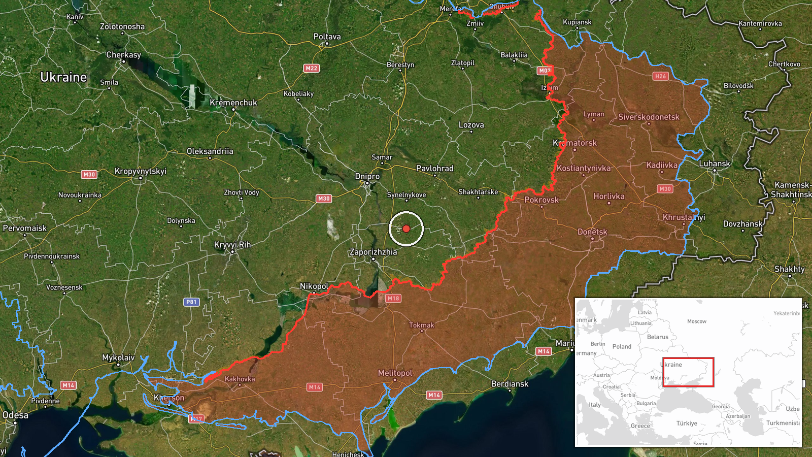
Jet-powered Shahed drones reported over Slavhorod, Dnipropetrovsk Oblast, moving west
What happened
Ukrainian air monitoring reported on 22 October 2026 at 17:01 UTC that two or more Russian jet-powered Shahed-type drones, identified in the post as Geran-3 models, were passing near Solone and past Slavhorod in Dnipropetrovsk Oblast, heading in a western direction. The single source, a Telegram channel attributed to Ukraine's Air Force, uses the phrase 'реактивні БпЛА' (jet-powered unmanned aerial vehicles) and describes a route rather than an impact point. The post reports no strikes, casualties or damage at either settlement. The 'two or more' wording indicates the count was not fixed, and the report gives no altitude, speed or final destination. The event is recorded as a transit observation rather than an attack.
Context and assessment
Slavhorod lies in northern Dnipropetrovsk Oblast, in a corridor that Russian long-range drones have crossed repeatedly on routes toward central and western Ukraine. The related events show a pattern over the previous two days. On 21 October, a single jet-powered Geran-3 was reported heading toward Zaporizhzhia, and on 22 October two further Shahed-type drones were reported over or toward Zaporizhzhia. Earlier that morning, a group of two or more jet-powered drones was reported heading toward Dnipro, which lies to the southeast of Slavhorod along the same general axis. The westward track reported here is consistent with drones moving across the region toward targets farther west, though the post does not name one. Ground combat was also active the day before, with the General Staff reporting multiple Russian assaults in Zaporizhzhia Oblast, which suggests that aerial and ground pressure are being applied in parallel across the front region. Operationally, reports of this kind mainly indicate the flight paths used by Shahed-type drones and the speed at which air defense alerts spread. They do not by themselves show what was targeted, and any link to specific strikes would require later reporting.
Sources and confidence
The event rests on one Telegram post from a channel attributed to Ukraine's Air Force, with no independent confirmation in the supplied data. Related entries in the same feed come from the same type of air monitoring source and report comparable drone movements on the same day, which supports the general picture but does not verify this specific transit. The confidence score of 8.0 is high because the channel is an official military monitoring source with a consistent record of such reports and the location is specific. It is not higher because the post is a single unverified channel, gives no count beyond 'two or more', and reports no independent visual, radar or wreckage evidence. Confidence would rise with corroboration from the Air Force's own press briefings, regional military administration statements, or open-source flight tracking. It would fall if later official reports did not mention drones over the area or described different routes.
Location
The location is recorded at settlement level for Slavhorod, Dnipropetrovsk Oblast, with coordinates at approximately 48.10 N, 35.52 E. The post also names the nearby village of Solone, which is used as a reference point for the route. The position is an approximate centre point for the settlement, not a specific site. The area is a mix of farmland and small settlements in the central-eastern steppe, with the Dnipro river system and its reservoirs lying to the west and south of the district. Such open terrain and the river corridor are typical features along which drones are reported as they pass.
Related events nearby
- Ukrainian air monitoring: 1 Russian Shahed-type drone heading toward Zaporizhzhia.2026-10-22 17:01 UTC · Drone Transit · Zaporizhzhia, Ukraine
- Ukrainian air monitoring: 1 Russian Shahed-type drone over Zaporizhzhia.2026-10-22 16:59 UTC · Drone Transit · Zaporizhzhia, Ukraine
- Ukrainian air monitoring: 1 Russian jet-powered Shahed (Geran-3) drone heading toward Zaporizhzhia.2026-10-21 18:02 UTC · Drone Transit · Zaporizhzhia, Ukraine
- Ukrainian General Staff reports one Russian attack toward Ternove, nine toward Rizdvianka, Dolynka, Hirke and 2026-10-21 19:06 UTC · Combat · Rizdvianka, Zaporizhzhia Oblast, Ukraine
- Ukrainian air monitoring: 2+ Russian jet-powered Shahed (Geran-3) drones heading toward Dnipro.2026-10-22 08:07 UTC · Drone Transit · Dnipro, Ukraine
▶ View this event on the live map

Intel Mapper aggregates open-source reports from monitored Telegram and X channels, geolocates them, cross-checks duplicates across sources and assigns a confidence score. Entries are updated as new confirmations arrive. Read how we verify events.