Ukrainian air monitoring reports one Russian Shahed-type drone heading toward Zaporizhzhia
What happened
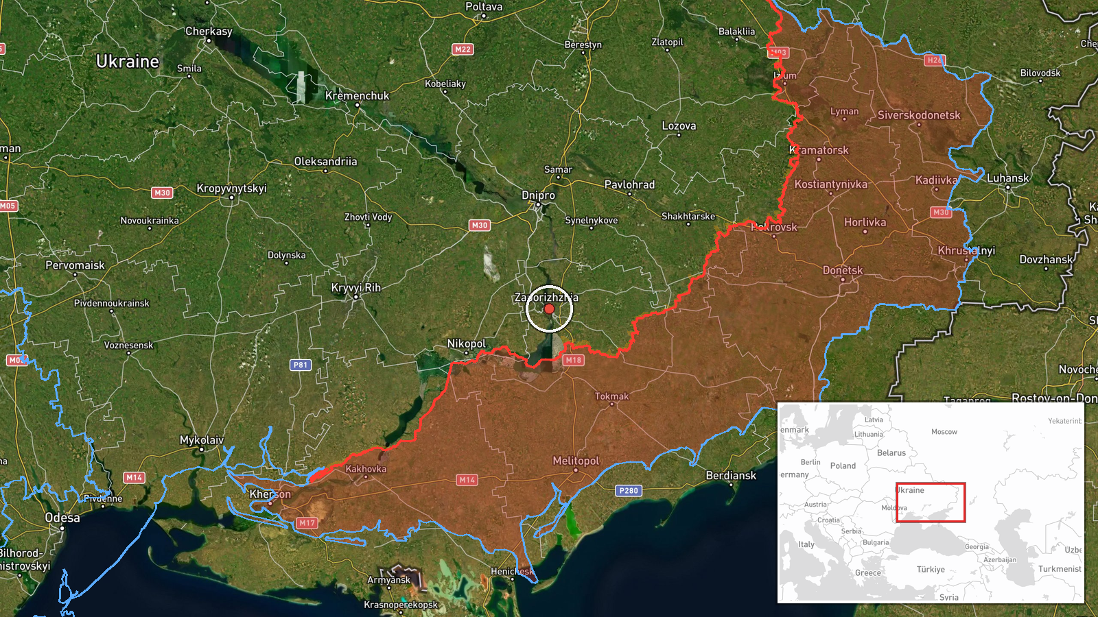
Ukrainian air monitoring reported one Russian Shahed-type drone heading toward Zaporizhzhia, a city in south-eastern Ukraine, at 17:01 UTC on 22 October 2026. The original Ukrainian-language post, which reads roughly as 'UAV toward Zaporizhzhia from the south,' describes the aircraft as approaching from the south and does not specify altitude, speed, or payload. The report was posted to the Telegram channel @kpszsu, which relays Ukrainian air monitoring alerts. The source material describes no impact, damage, or casualties, and no independent channel has reported on this track. The entry is classified as a drone transit rather than a strike.
Context and assessment
Zaporizhzhia has been a recurring target of Russian long-range drone activity, and the related events in this record show a sustained pattern. On 21 October, a jet-powered Shahed variant, identified in the source as the Geran-3, was reported heading toward the city, and a single drone was logged over Zaporizhzhia about two minutes before this report. Earlier that evening, at least two Geran-3 drones were reported passing through southern Dnipropetrovsk Oblast heading west, and a group was logged passing Slavhorod at the same timestamp as this entry. Those tracks suggest a corridor of inbound and transiting aircraft across central and southern Ukraine rather than an isolated launch. The same evening, Russian tactical aviation reportedly released guided aerial bombs against southeastern Dnipropetrovsk Oblast near Nikopol, indicating that air activity was coordinated across several sectors of the front. Operationally, a single drone heading toward a city may be a reconnaissance or decoy element, a pathfinder, or part of a larger wave being tracked in segments, and the data alone cannot distinguish these possibilities. Repeated single-aircraft transits in the same area can precede larger salvos, so follow-on reports deserve close attention.
Sources and confidence
The record rests on one channel: the Telegram account @kpszsu, which relays Ukrainian air monitoring alerts. No second outlet, official statement, or independent monitor has confirmed this specific track, so the source count stands at one. The confidence score of 8.0 is relatively high for a single-source entry because the channel is consistently used in the record and the report is a routine monitoring alert rather than a claim of damage. The score would fall with contradictory tracking data or a retraction, and would rise with corroboration from another monitoring account, a regional military administration statement, or reporting of a drone event in Zaporizhzhia.
Location
The location is recorded at settlement precision, centred on Zaporizhzhia city at approximately 47.84 N, 35.14 E, with high location confidence. The coordinates reflect the city as a whole rather than a specific facility, since the source names only the city. Zaporizhzhia lies on the Dnipro River in south-eastern Ukraine, with dense urban districts, industrial zones on its edges, and open steppe farmland to the south. The Zaporizhzhia nuclear power plant lies further south-west, near Enerhodar, and is not the location referenced here.
Related events nearby
- Ukrainian air monitoring: 1 Russian Shahed-type drone over Zaporizhzhia.2026-10-22 16:59 UTC · Drone Transit · Zaporizhzhia, Ukraine
- Ukrainian air monitoring: 1 Russian jet-powered Shahed (Geran-3) drone heading toward Zaporizhzhia.2026-10-21 18:02 UTC · Drone Transit · Zaporizhzhia, Ukraine
- Ukrainian air monitoring: 2+ Russian jet-powered Shahed (Geran-3) drones passing southern Dnipropetrovsk Oblas2026-10-21 18:30 UTC · Drone Transit · southern Dnipropetrovsk Oblast, Ukraine
- Ukrainian air monitoring: 2+ Russian jet-powered Shahed (Geran-3) drones passing Slavhorod, heading west.2026-10-22 17:01 UTC · Drone Transit · Slavhorod, Ukraine
- Russian tactical aviation launched guided aerial bombs (KABs) against southeastern Dnipropetrovsk Oblast, per 2026-10-21 18:08 UTC · Airstrike · Near Nikopol, Dnipropetrovsk, Ukraine (front line,
▶ View this event on the live map

Intel Mapper aggregates open-source reports from monitored Telegram and X channels, geolocates them, cross-checks duplicates across sources and assigns a confidence score. Entries are updated as new confirmations arrive. Read how we verify events.