Ukrainian air monitoring reports one unidentified drone over Zaporizhzhia city
What happened
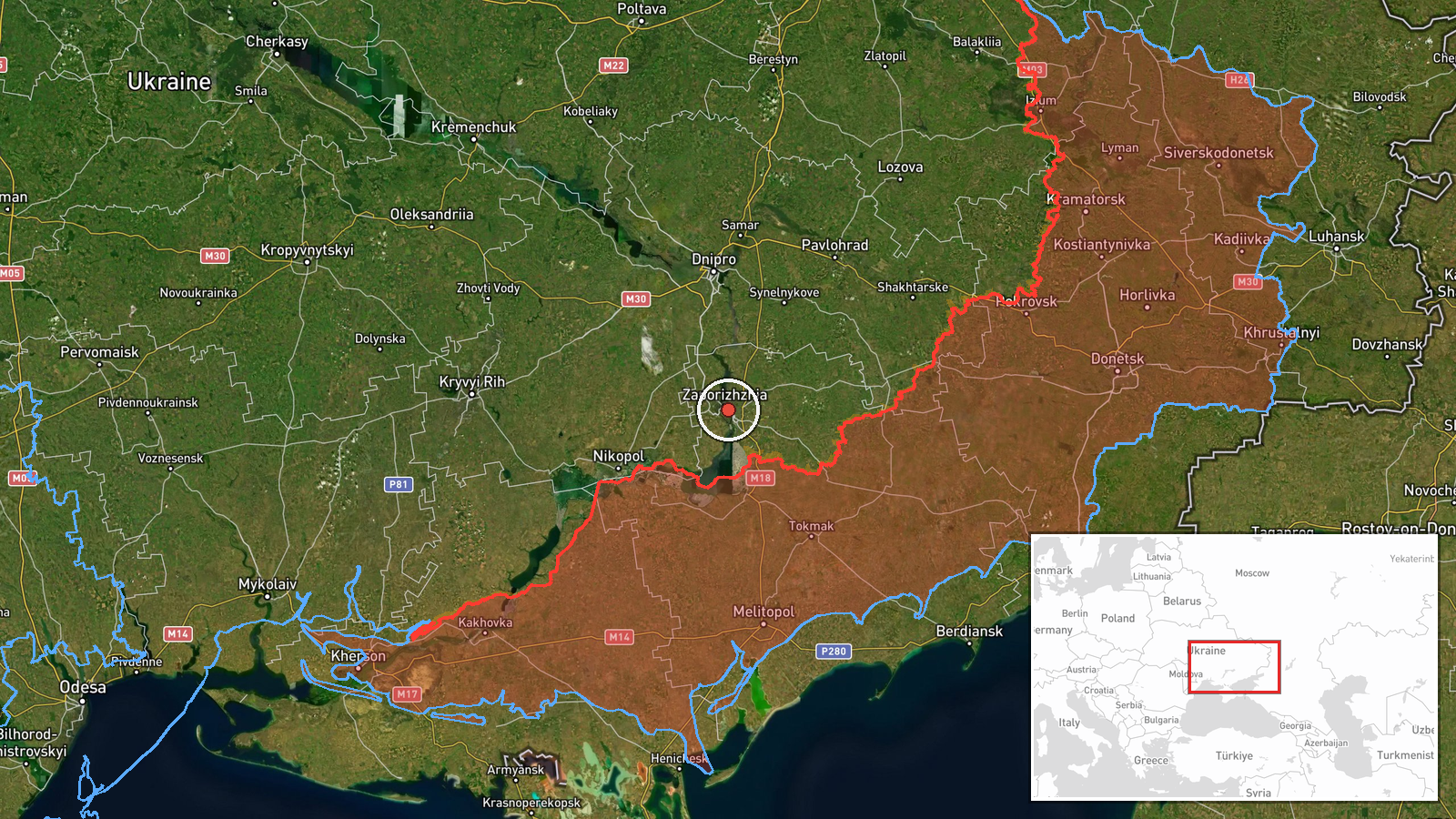
Ukraine's air-monitoring channel on Telegram, @kpszsu, reported on 22 October 2026 at 16:59 UTC that a single unmanned aerial vehicle was over the city of Zaporizhzhia. The original Ukrainian post is brief, reading in translation roughly 'UAV over the city,' and does not itself name a model. The event summary classifies the object as a Russian Shahed-type drone, a label that goes beyond the original wording and reflects the broader context of the feed rather than a confirmed identification. No impact, casualties, or damage are reported in the data. The entry is logged as a drone transit, meaning an airborne object observed over or moving through the area, not a confirmed strike.
Context and assessment
Zaporizhzhia is a major industrial and logistics city on the Dnipro River, sitting close to the southern front line in Zaporizhzhia Oblast and within practical reach of Russian long-range drones. The related events show a sequence on the southern axis over the previous day. At 18:02 UTC on 21 October, one jet-powered Geran-3 drone was reported heading toward Zaporizhzhia. About half an hour later, at 18:30, two or more Geran-3 drones were reported passing southern Dnipropetrovsk Oblast heading west. Earlier that evening, Russian tactical aviation reportedly launched guided aerial bombs against southeastern Dnipropetrovsk Oblast near Nikopol. Ground reports from Zaporizhzhia Oblast on 21 October describe Russian attacks toward Rizdvianka, Dolynka, Hirke, Yehorivka and Ternove, all reported repelled, alongside a Ukrainian strike on a command-observation post near Vyshneve. Operationally, this pattern suggests a sustained cycle of drone tracks crossing the southern approaches in sequence, possibly as probing or as part of a wider raid. A single track over the city following a larger group further east may indicate a drone routed toward the city, or a stray component of a broader wave. The data cannot distinguish these possibilities, and not every track leads to an impact.
Sources and confidence
The event rests on one channel, a Ukrainian air-monitoring Telegram feed, with no independent cross-confirmation in the data. The confidence score of 8.0 out of 10 reflects a clear, official-style original post and a settlement-level location, offset by single-channel reliance and the absence of impact reports or imagery. Confidence would rise with corroboration from local authorities, the regional military administration, or independently geolocated imagery. It would fall if the channel revised or retracted the report, or if the airborne object were later identified as something other than a drone.
Location
The coordinates, 47.84 N and 35.14 E, were assigned at settlement level and match the city of Zaporizhzhia, with location confidence rated high. The event is therefore tied to the city as a whole rather than to a specific facility or district. Zaporizhzhia lies on the Dnipro River, and the river and its reservoir system shape the urban layout. The surrounding oblast is largely flat steppe, with agricultural land and scattered settlements to the south and west, where the related events were reported.
Related events nearby
- Ukrainian air monitoring: 1 Russian Shahed-type drone heading toward Zaporizhzhia.2026-10-22 17:01 UTC · Drone Transit · Zaporizhzhia, Ukraine
- Ukrainian air monitoring: 1 Russian jet-powered Shahed (Geran-3) drone heading toward Zaporizhzhia.2026-10-21 18:02 UTC · Drone Transit · Zaporizhzhia, Ukraine
- Ukrainian air monitoring: 2+ Russian jet-powered Shahed (Geran-3) drones passing southern Dnipropetrovsk Oblas2026-10-21 18:30 UTC · Drone Transit · southern Dnipropetrovsk Oblast, Ukraine
- Ukrainian air monitoring: 2+ Russian jet-powered Shahed (Geran-3) drones passing Slavhorod, heading west.2026-10-22 17:01 UTC · Drone Transit · Slavhorod, Ukraine
- Russian tactical aviation launched guided aerial bombs (KABs) against southeastern Dnipropetrovsk Oblast, per 2026-10-21 18:08 UTC · Airstrike · Near Nikopol, Dnipropetrovsk, Ukraine (front line,
▶ View this event on the live map

Intel Mapper aggregates open-source reports from monitored Telegram and X channels, geolocates them, cross-checks duplicates across sources and assigns a confidence score. Entries are updated as new confirmations arrive. Read how we verify events.