Ukrainian air monitoring reports one Russian Shahed-type drone heading toward Kharkiv
What happened
Ukraine's air monitoring channel on Telegram, @kpszsu, reported at 07:29 UTC on 23 October 2026 that one Russian Shahed-type drone was heading toward Kharkiv. The original Ukrainian-language post, translated, reads roughly as a UAV toward Kharkiv from the northeast, and the English summary carries the same heading. The report describes a transit, not an impact. It says nothing about explosions, damage, casualties, or whether the drone was intercepted or came down. The post identifies the aircraft only as Shahed-type, so the specific variant is not established. Because this was a live monitoring notice, the picture could change quickly as the track develops.
Context and assessment
Kharkiv is Ukraine's second-largest city and a regional center, located in the northeast only about 30 kilometres from the Russian border. That proximity has made it a recurring target for long-range drones, glide bombs and cruise missiles throughout the war. The same monitoring feed shows a dense sequence in the preceding day. On 22 October at 08:46 UTC, two or more jet-powered Shahed-type drones, identified as Geran-3, were reported heading toward Kharkiv. On 23 October, a guided glide bomb was reported over Kharkiv Oblast at 00:19, and two or more Geran-3 drones were reported over the city at 03:13. A Banderol mini cruise missile was reported heading toward Zmiiv, a settlement in Kharkiv Oblast, at 06:09. Taken together, this suggests sustained pressure on the city and surrounding area across several weapon types. A single drone trailing a larger raid could be a follow-on element, or it could be probing air defenses. The data alone does not establish which, and a lone transit report should not be read as evidence of a specific intent.
Sources and confidence
All information comes from one Telegram channel, @kpszsu, which is the official monitoring account associated with Ukraine's Air Force. No independent outlet, wire service or second channel in the dataset reports this specific track, so cross-confirmation is absent. The confidence score of 8.0 reflects the official attribution of the channel and the high precision of the location, offset by single-source reliance and the lack of any independent or impact reporting. Confidence would rise with corroboration from regional military administration statements, subsequent air-alert records, or independent flight-tracking evidence. It would fall if the alert were updated, withdrawn, or contradicted by later official reporting.
Location
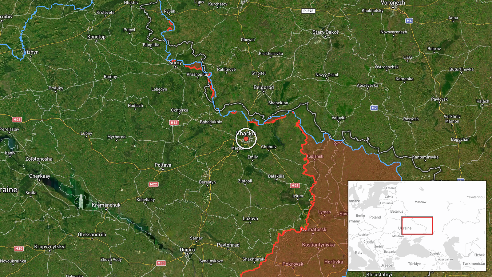
The coordinates correspond to the centre of Kharkiv city, and the location was assigned at settlement precision with high confidence, so the point represents the city as a whole rather than a specific facility. Kharkiv lies in northeastern Ukraine, on the Kharkiv and Lopan rivers, with the Russian border and Belgorod region lying to the north and northeast. The surrounding area is largely flat steppe with dense urban development in the city and its suburbs.
Related events nearby
- Ukrainian air monitoring: 2+ Russian jet-powered Shahed (Geran-3) drones heading toward Kharkiv.2026-10-23 07:52 UTC · Drone Transit · Kharkiv, Ukraine
- Ukrainian air monitoring: 2+ Russian jet-powered Shahed (Geran-3) drones passing Kharkiv Oblast, heading north2026-10-23 07:39 UTC · Drone Transit · Kharkiv Oblast, Ukraine
- Ukrainian air monitoring: 1 Russian Shahed-type drone heading toward Kharkiv.2026-10-23 06:49 UTC · Drone Transit · Kharkiv, Ukraine
- Ukrainian air monitoring: 2+ Russian jet-powered Shahed (Geran-3) drones over Kharkiv.2026-10-23 03:13 UTC · Drone Transit · Kharkiv, Ukraine
- Ukrainian air monitoring: 1 Russian guided glide bomb (KAB) over Kharkiv Oblast.2026-10-23 00:19 UTC · Airstrike · Kharkiv Oblast, Ukraine
▶ View this event on the live map

Intel Mapper aggregates open-source reports from monitored Telegram and X channels, geolocates them, cross-checks duplicates across sources and assigns a confidence score. Entries are updated as new confirmations arrive. Read how we verify events.