Russian Geran-3 jet drone reported over Dnipropetrovsk Oblast near Yuriivka, heading northwest
What happened
On 23 October 2026, at about 11:19 UTC, the Telegram channel @kpszsu, which carries Ukrainian Air Force air monitoring updates, reported one Russian jet-powered Shahed (Geran-3) drone moving past Yuriivka in Dnipropetrovsk Oblast, central-eastern Ukraine, on a northwest heading. The original Ukrainian wording, 'Реактивний БпЛА повз Юріївку', describes a jet-powered unmanned aerial vehicle passing the settlement, and it does not mention any impact, casualties or damage. The report is a transit notice only. It was published as a single channel post with no accompanying imagery in the record provided, and the summary's phrase 'Ukrainian air monitoring' is an editorial paraphrase of that channel's routine alert format.
Context and assessment
Dnipropetrovsk Oblast is a recurring target area in the Russian strike campaign, and the city of Dnipro sits at its industrial and transport core. The related events show a dense pattern on the same morning. A jet-powered Geran-3 was logged over Dnipro at 06:58 and heading toward the city at 06:44, passed Synelnykove heading toward Dnipro at 09:36, and a guided glide bomb (KAB) was reported heading toward the oblast at 08:35 and again at 11:00. The sequence suggests repeated sorties crossing the region in waves, with glide bombs and jet drones tracked in parallel. The Geran-3 is generally described as faster and harder to intercept than the older piston-engine Shahed, so transit reports of this type give defenders less warning time. A northwest heading after passing Yuriivka could indicate a route that bypasses the city, a redirection after interception, or a path toward another target further from the front. The report alone does not establish which of these applies.
Sources and confidence
Only one source, the @kpszsu Telegram channel, reported this transit, and no independent outlet, second monitoring feed or Ukrainian official statement in the record corroborates it. The confidence score of 8.0 is low, reflecting a single unverified channel, a transit-only report with no outcome, and a location given at regional precision. Confidence would rise if other air monitoring channels or regional authorities confirmed the track, if impact or interception reports appeared in the same window, or if geolocated imagery placed the drone near Yuriivka. It would fall if later updates contradicted the heading or identified the object as a different system.
Location
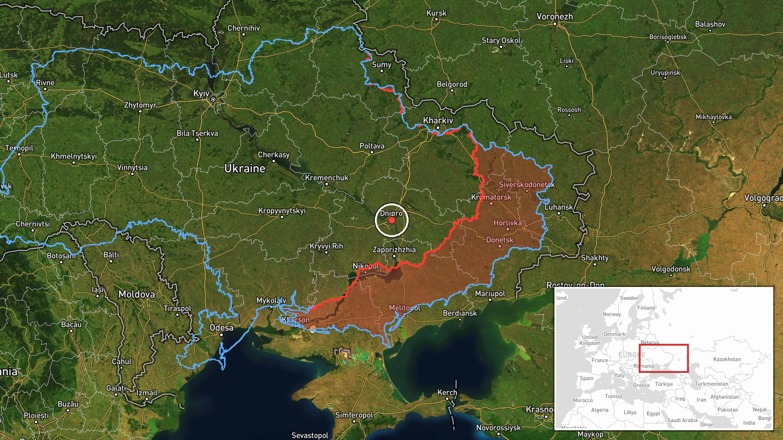
The record gives a regional-level location, Dnipropetrovsk Oblast, and the source names the village of Yuriivka. The coordinates (48.46 N, 35.05 E) lie very close to the city of Dnipro rather than to Yuriivka, so they are a placeholder rather than a precise fix. Dnipropetrovsk Oblast is largely flat steppe drained by the Dnipro River, which runs through the regional centre. The river valley, rail lines and major highways in this corridor are notable features that shape flight paths and strike routing in the area.
Related events nearby
- Ukrainian air monitoring: 1 Russian guided glide bomb (KAB) heading toward Dnipropetrovsk Oblast.2026-10-23 11:00 UTC · Airstrike · Dnipropetrovsk Oblast, Ukraine
- Ukrainian air monitoring: 1 Russian jet-powered Shahed (Geran-3) drone passing Synelnykove, heading toward Dni2026-10-23 09:36 UTC · Drone Transit · Dnipro, Ukraine
- Ukrainian air monitoring: 1 Russian guided glide bomb (KAB) heading toward Dnipropetrovsk Oblast.2026-10-23 08:35 UTC · Airstrike · Dnipropetrovsk Oblast, Ukraine
- Ukrainian air monitoring: 1 Russian jet-powered Shahed (Geran-3) drone over Dnipro.2026-10-23 06:58 UTC · Drone Transit · Dnipro, Ukraine
- Ukrainian air monitoring: 1 Russian jet-powered Shahed (Geran-3) drone heading toward Dnipro.2026-10-23 06:44 UTC · Drone Transit · Dnipro, Ukraine
▶ View this event on the live map

Intel Mapper aggregates open-source reports from monitored Telegram and X channels, geolocates them, cross-checks duplicates across sources and assigns a confidence score. Entries are updated as new confirmations arrive. Read how we verify events.