Russian jet-powered Shahed drone reported transiting Zhytomyr Oblast heading west
What happened
Ukrainian air monitoring reported one Russian jet-powered Shahed-type drone, identified in the source as a Geran-3, passing near Brusiliv in Zhytomyr Oblast at about 11:50 UTC on 23 October 2026, travelling in a westerly direction. The report was published in Ukrainian on the Telegram channel @kpszsu, and its wording is brief: a jet-powered drone flying past Brusiliv in Zhytomyr region toward the west. The message does not mention impacts, casualties, debris, or ground effects, and none are reported in this entry. The event is classed as a drone transit rather than a strike, so the record documents a flight path, not a detonation.
Context and assessment
Zhytomyr Oblast lies in northwestern Ukraine, north of Kyiv region and close to the Belarus border, and it lies on routes that Russian long-range drones have used when travelling toward western Ukraine. The related entries show a dense sequence of transit reports for the area over roughly nineteen hours: a jet-powered drone heading toward Zhytomyr at 16:57 UTC on 22 October, further drones heading toward the city at 00:18 and a Shahed-type drone over the oblast at 03:10 on 23 October, then a jet-powered drone moving from the oblast toward Ozerne at 11:38, and another heading toward Zhytomyr at 11:58. Taken together, the pattern suggests repeated flights through or near the region rather than a single isolated sortie. The westward heading here is consistent with drones moving deeper into western Ukraine or toward targets beyond the monitoring area. Such transits are commonly associated with reconnaissance, saturation attempts, or efforts to draw air defence responses, but transit reports alone do not establish intent. The jet-powered Geran-3 variant is generally understood to be faster than the piston-engine Shahed, which may shorten warning windows for local authorities. These inferences are hypotheses, not confirmed findings.
Sources and confidence
The entry rests on one Telegram channel, @kpszsu, which is widely associated with Ukraine's Air Force and used for routine air monitoring alerts. No independent outlet, wire service, or second channel in the provided data corroborates this transit, and the related entries come from the same channel. The confidence score of 8.0 reflects the official, routine nature of the source and its consistent reporting, but it is held below the maximum because the claim is single-source and includes no geolocated track or imagery. Confidence would rise with independent corroboration, such as regional military administration statements, radar-derived flight tracks, or verified sightings. It would fall if the channel issued a correction or if later updates contradicted the heading or drone type.
Location
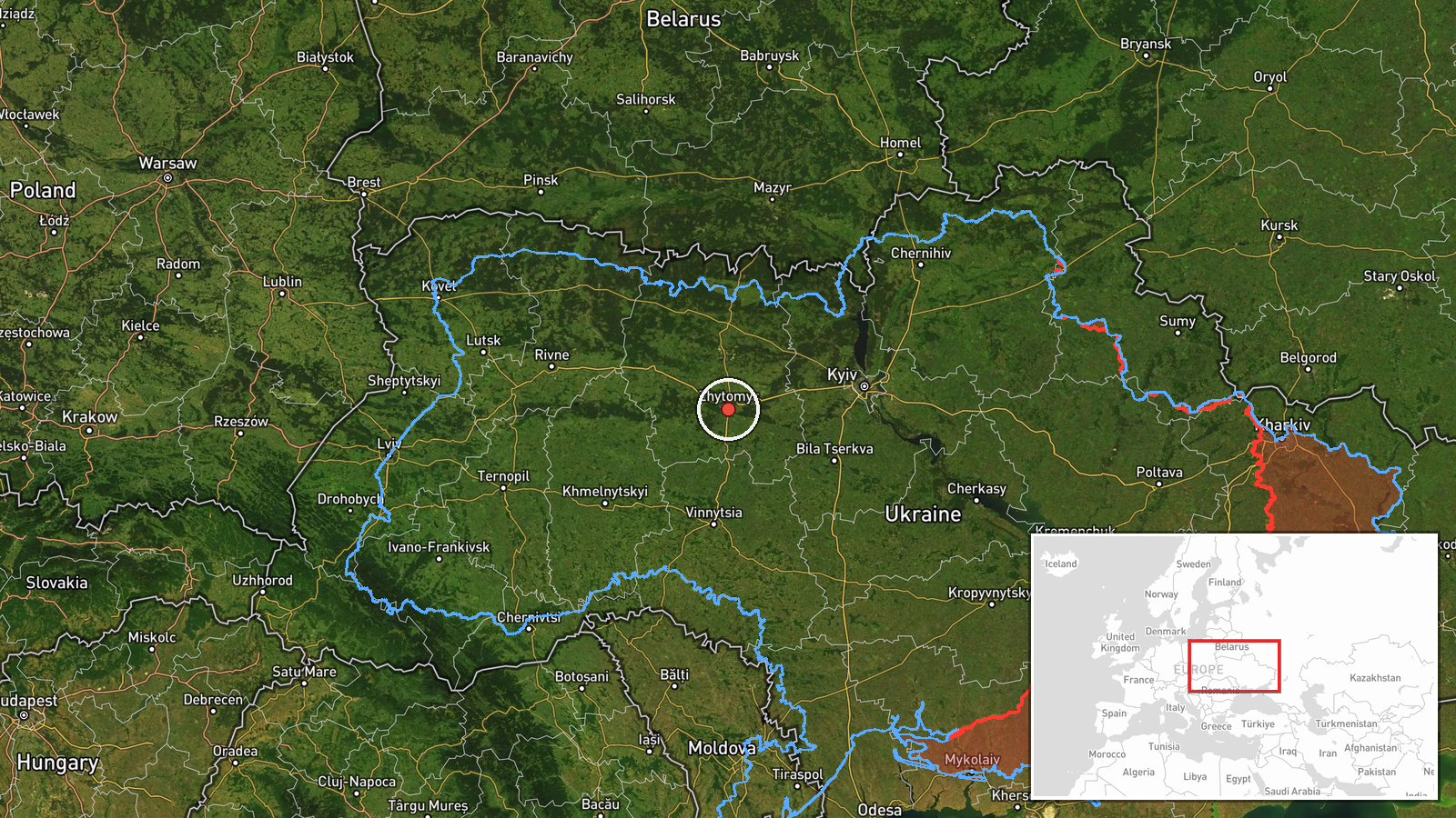
The place name Brusiliv is taken from the original Ukrainian text, which describes the drone passing the settlement. The coordinates, 50.25 N and 28.66 E, are region-level and low confidence, so the point marks the general Brusiliv area rather than a precisely observed position. The surrounding terrain is typical of northwestern Ukraine, with farmland, forest belts, and low rolling ground, and the Teteriv river system flows through the wider oblast. Treat the map pin as approximate.
Related events nearby
- Ukrainian air monitoring: 1 Russian jet-powered Shahed (Geran-3) drone heading toward Zhytomyr.2026-10-23 11:58 UTC · Drone Transit · Zhytomyr, Ukraine
- Ukrainian air monitoring: 1 Russian Shahed-type drone over Zhytomyr Oblast.2026-10-23 03:10 UTC · Drone Transit · Zhytomyr Oblast, Ukraine
- Ukrainian air monitoring: 1 Russian jet-powered Shahed (Geran-3) drone heading toward Zhytomyr.2026-10-23 00:18 UTC · Drone Transit · Zhytomyr, Ukraine
- Ukrainian air monitoring: 1 Russian jet-powered Shahed (Geran-3) drone heading toward Zhytomyr.2026-10-22 16:57 UTC · Drone Transit · Zhytomyr, Ukraine
- Ukrainian air monitoring: 1 Russian jet-powered Shahed (Geran-3) drone from Zhytomyr Oblast toward Ozerne.2026-10-23 11:38 UTC · Drone Transit · Ozerne, Ukraine
▶ View this event on the live map

Intel Mapper aggregates open-source reports from monitored Telegram and X channels, geolocates them, cross-checks duplicates across sources and assigns a confidence score. Entries are updated as new confirmations arrive. Read how we verify events.