Ukrainian air monitoring reports jet-powered Shahed drone heading toward Zhytomyr from north
What happened
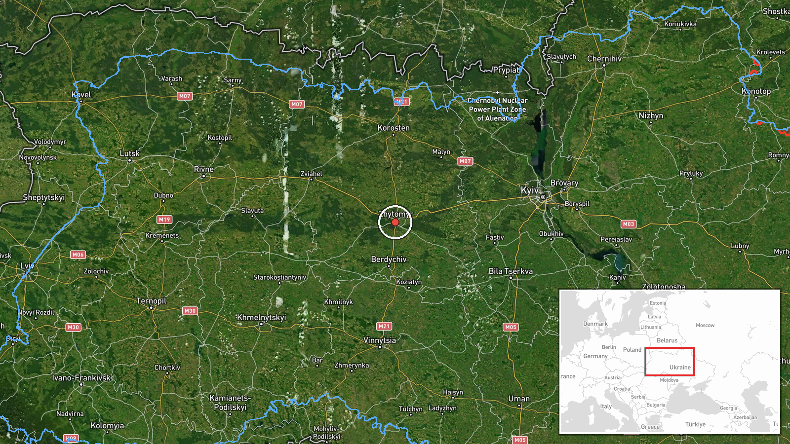
Ukrainian air monitoring reported at 16:57 UTC on 22 October 2026 that one Russian jet-powered Shahed-type drone, described in the report as a Geran-3, was heading toward Zhytomyr from the north. The original post, written in Ukrainian, is brief and gives a course and a target city without describing any impact, casualties or damage. It does not say whether the drone was later intercepted, lost from tracking or struck anything. The only attributed source is the Telegram channel @kpszsu, which relays official air-threat monitoring. The event is logged as a drone transit, with Russia listed as the actor on the basis of the drone type, not on any claim of responsibility.
Context and assessment
Zhytomyr sits on the Teteriv River in northern central Ukraine, roughly 140 kilometres west of Kyiv, and it is a regional administrative centre with rail and road links that run toward the capital and the western regions. The city also lies close to Korosten, a railway junction that appears repeatedly in the same monitoring stream. Related reports from the same channel on 21 and 22 October describe two or more Geran-3 drones passing northern Zhytomyr Oblast and heading west, followed by single drones tracked toward Zon and toward Korosten at 08:09 UTC, and then toward Korosten again at 16:58 UTC, one minute after this report. Taken together, the pattern suggests a sequence of individual drones moving through the oblast over more than a day rather than a single isolated incident. Operationally, repeated transits along the same northern corridor may indicate routing toward targets further west or the testing of air-defence coverage, but the monitoring reports do not show intent, and any such reading remains an inference.
Sources and confidence
Only one channel has reported this event, the Telegram account @kpszsu, so there is no independent cross-confirmation at this stage. The confidence score of 8.0 reflects the official-style monitoring origin and the consistency of the drone type and direction across several linked reports, but it stops short of the top of the scale because it rests on a single channel and no subsequent confirmation was found. Confidence would rise with corroboration from additional Ukrainian official channels, regional military administration statements, or open-source flight tracking. It would fall if later updates contradicted the drone's heading or if the reports were revised as corrected.
Location
The location is recorded at settlement level for Zhytomyr city, with coordinates of approximately 50.25 north and 28.66 east, which matches the city centre rather than a specific facility. The city is set in the wooded lowlands of the Polissia region, with the Teteriv River running through it and a mix of urban districts, industrial areas and farmland in the surrounding oblast. The north-to-west corridor described in the reports runs over this rural terrain, which is where the tracked drones were recorded.
Related events nearby
- Ukrainian air monitoring: 1 Russian jet-powered Shahed (Geran-3) drone passing Zon, heading toward Zhytomyr Ob2026-10-22 07:18 UTC · Drone Transit · Zhytomyr Oblast, Ukraine
- Ukrainian air monitoring: 1 Russian jet-powered Shahed (Geran-3) drone heading toward Zhytomyr.2026-10-22 07:18 UTC · Drone Transit · Zhytomyr, Ukraine
- Ukrainian air monitoring: 2+ Russian jet-powered Shahed (Geran-3) drones passing northern Zhytomyr Oblast, hea2026-10-22 17:54 UTC · Drone Transit · northern Zhytomyr Oblast, Ukraine
- Ukrainian air monitoring: 2+ Russian jet-powered Shahed (Geran-3) drones passing northern Zhytomyr Oblast, hea2026-10-21 18:25 UTC · Drone Transit · northern Zhytomyr Oblast, Ukraine
- Ukrainian air monitoring: 2+ Russian jet-powered Shahed (Geran-3) drones passing Korosten, heading west.2026-10-22 17:30 UTC · Drone Transit · Korosten, Ukraine
▶ View this event on the live map

Intel Mapper aggregates open-source reports from monitored Telegram and X channels, geolocates them, cross-checks duplicates across sources and assigns a confidence score. Entries are updated as new confirmations arrive. Read how we verify events.