Jet-powered Shahed drones reported transiting northern Zhytomyr Oblast heading west
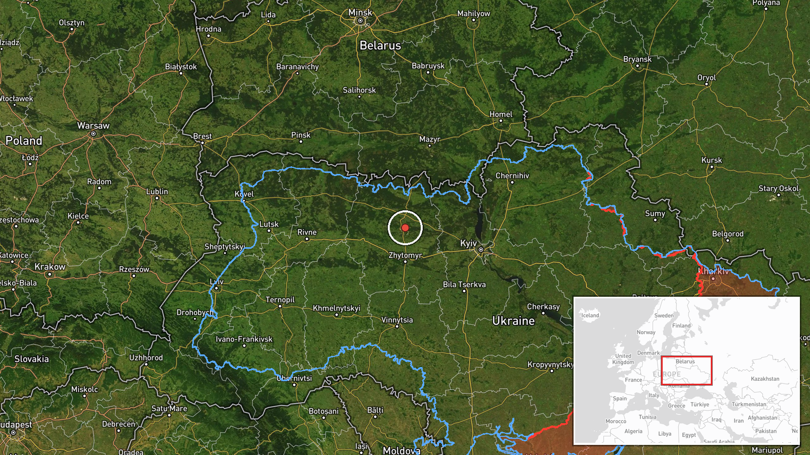
What happened
Ukraine's air monitoring channel on Telegram, @kpszsu, reported on 21 October 2026 at 18:25 UTC that two or more Russian jet-powered Shahed drones, designated Geran-3 in the post, were passing through northern Zhytomyr Oblast on a westward course. The original Ukrainian-language message was broader, describing jet-type unmanned aircraft over northern Kyiv, Zhytomyr and Rivne oblasts heading west, while the structured summary narrows the report to Zhytomyr. The wording describes a transit observation rather than a strike, and no impact, casualties or damage are reported. The post gives no exact coordinates, so the event is recorded at regional level. Earlier reports the same day describe single drones near Korosten and Cherniakhiv, followed by further sightings in the north of the oblast. The information comes from a single channel.
Context and assessment
Zhytomyr Oblast sits between Kyiv and the Belarusian border, and its northern districts lie along the corridor that long-range drones often use when moving from Russian and Belarusian airspace toward western and central Ukraine. Korosten, a major rail junction, is one of the reference points named in the day's reports, and infrastructure of this kind is a recurring interest in air-defence and warning messages. The related events show a sustained pattern rather than a single pass: five separate sightings between 03:28 and 15:46 UTC, mostly single drones, four of them logged as heading west and one as heading southwest. Such repetition suggests drones were moving through the area in sequence, which may reflect a launch wave, a rerouting of flight paths, or decoy activity, though transit reports alone cannot establish intent. The jet-powered Geran-3 variant generally flies faster than the older piston-engine Shahed design, which tends to shorten warning times for local authorities. These points are inferences from the pattern and should be treated as provisional.
Sources and confidence
The report rests on one Telegram channel, @kpszsu, with no cross-confirmation in the data provided, which is why the source count is 1 and the confidence score is 8.0 with no correction recorded. The score reflects an official-style monitoring channel with a consistent track record, but single-channel transit reports carry limits on heading, drone count and exact position. Confidence would rise with corroboration from national air-force statements, regional military administrations, other monitoring accounts, or matching reports of the same drones at neighbouring points. It would fall if the channel corrected the count or heading, or if independent observers reported different routes.
Location
The location is recorded at regional level, centred on northern Zhytomyr Oblast, with a low location confidence because the post names no settlement or grid reference. The coordinates are an approximate area point rather than a pinned position. The area is part of the Polissia lowlands, characterised by forests, wetlands, and rivers such as the Teteriv, with Korosten and Cherniakhiv as the nearest named reference points.
Related events nearby
- Ukrainian air monitoring: 2+ Russian jet-powered Shahed (Geran-3) drones passing northern Zhytomyr Oblast, hea2026-10-21 15:46 UTC · Drone Transit · northern Zhytomyr Oblast, Ukraine
- Ukrainian air monitoring: 1 Russian jet-powered Shahed (Geran-3) drone passing northern Zhytomyr Oblast, headi2026-10-21 12:14 UTC · Drone Transit · northern Zhytomyr Oblast, Ukraine
- Ukrainian air monitoring: 1 Russian jet-powered Shahed (Geran-3) drone passing northern Zhytomyr Oblast, headi2026-10-21 11:13 UTC · Drone Transit · northern Zhytomyr Oblast, Ukraine
- Ukrainian air monitoring: 1 Russian jet-powered Shahed (Geran-3) drone heading toward Korosten.2026-10-21 03:28 UTC · Drone Transit · Korosten, Ukraine
- Ukrainian air monitoring: 1 Russian jet-powered Shahed (Geran-3) drone passing Cherniakhiv, heading west.2026-10-21 04:26 UTC · Drone Transit · Cherniakhiv, Ukraine
▶ View this event on the live map

Intel Mapper aggregates open-source reports from monitored Telegram and X channels, geolocates them, cross-checks duplicates across sources and assigns a confidence score. Entries are updated as new confirmations arrive. Read how we verify events.