Single jet-powered Geran-3 drone reported passing Cherniakhiv in Zhytomyr Oblast, heading west
What happened
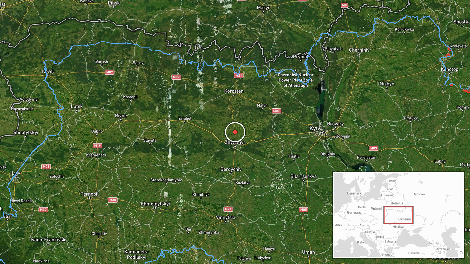
Ukrainian air monitoring reported one Russian jet-powered Shahed, designated Geran-3, passing the settlement of Cherniakhiv in Zhytomyr Oblast on a westward course at about 04:26 UTC on 21 October 2026. The original Ukrainian-language post, published on the Telegram channel @kpszsu, describes a jet-powered unmanned aerial vehicle moving past the settlement toward the west and gives no details on altitude, speed, or any impact. The report does not mention explosions, damage, or casualties. The event is classified as a drone transit rather than a strike, and the wording reflects a tracking update, not a confirmed attack on the town.
Context and assessment
Cherniakhiv lies in the northern part of Zhytomyr Oblast, in the Polissia lowlands, an area that has repeatedly appeared in Ukrainian air alerts as drones move across the north-west of the country. The surrounding reports form a pattern. Between 04:44 and 12:18 UTC on 20 October, monitoring channels logged several single or small groups of the same Geran-3 type moving through Zhytomyr Oblast, including a group of two or more from Kyiv Oblast, a track past the Chornobyl Exclusion Zone, a sighting near Kozyatyn, one near Zon, and one heading toward Zhytomyr city. The Cherniakhiv report, roughly fourteen hours after the first of these, is notable because it records a westward heading rather than the toward-Zhytomyr framing used in the earlier posts. Operationally, such transit reports most likely reflect radar tracking and the regional air-alert system rather than knowledge of a specific target. Repeated transits through the same oblast may indicate drones routed along corridors that pass over or near several settlements, though the data alone cannot confirm the intended destinations. The Geran-3 is generally described as a jet-powered development of the Shahed design, which typically flies faster than earlier piston-engine variants.
Sources and confidence
The event rests on one source, the Telegram channel @kpszsu, which is associated with Ukraine's air monitoring reporting. No second outlet, official statement, or independent observer has been identified in the provided data reporting the same track through Cherniakhiv. The confidence score of 8.0 reflects a credible, routine-format official-style channel with a precise settlement reference, offset slightly for the absence of cross-confirmation. Confidence would rise with corroboration from another Ukrainian air force post, regional military administration alerts, or a matching track in the related Zhytomyr Oblast entries. It would fall if later updates revised the heading, the drone type, or the timing, or if the post was withdrawn or corrected.
Location
The location is a settlement-level match: Cherniakhiv is the named populated place in the original post, and the coordinates, about 50.454 N and 28.667 E, are set to that settlement with high location confidence. The report describes the drone as passing the settlement rather than striking it, so the point marks the reported position of the track rather than a damage site. The town sits in Zhytomyr Oblast in the Polissia region, a flat, forested and marshy landscape with many rivers and wetlands, and it lies within reach of the northern Zhytomyr corridor.
Related events nearby
- Ukrainian air monitoring: 1 Russian jet-powered Shahed (Geran-3) drone heading toward Zhytomyr.2026-10-20 12:18 UTC · Drone Transit · Zhytomyr, Ukraine
- Ukrainian air monitoring: 1 Russian jet-powered Shahed (Geran-3) drone passing Zon, heading toward Zhytomyr Ob2026-10-20 12:16 UTC · Drone Transit · Zhytomyr Oblast, Ukraine
- Ukrainian air monitoring: 2+ Russian jet-powered Shahed (Geran-3) drones from Kyiv Oblast toward Zhytomyr Obla2026-10-20 08:13 UTC · Drone Transit · Zhytomyr Oblast, Ukraine
- Ukrainian air monitoring: 1 Russian jet-powered Shahed (Geran-3) drone passing Chornobyl Exclusion Zone, headi2026-10-20 07:29 UTC · Drone Transit · Zhytomyr Oblast, Ukraine
- Ukrainian air monitoring: 2+ Russian jet-powered Shahed (Geran-3) drones passing northern Zhytomyr Oblast, hea2026-10-20 13:40 UTC · Drone Transit · northern Zhytomyr Oblast, Ukraine
▶ View this event on the live map

Intel Mapper aggregates open-source reports from monitored Telegram and X channels, geolocates them, cross-checks duplicates across sources and assigns a confidence score. Entries are updated as new confirmations arrive. Read how we verify events.