Jet-powered Shahed drones reported transiting northern Zhytomyr Oblast on a westward heading
What happened
Ukraine's air monitoring channel on Telegram, @kpszsu, reported on 20 October 2026 at 13:40 UTC that jet-powered unmanned aerial vehicles were over the northern parts of Kyiv, Zhytomyr and Rivne oblasts, moving on a western course. The original post, written in Ukrainian, uses the term 'реактивні БпЛА' (jet-powered UAVs) and gives no count. The event summary specifies at least two Russian Geran-3 drones passing northern Zhytomyr Oblast. The post names no impact sites, casualties or damage, and it does not say where the drones were launched. Air monitoring posts of this kind track flight paths rather than strikes, so the report should be read as a transit notice only.
Context and assessment
Northern Zhytomyr Oblast sits on a common corridor for Shahed-type drones moving from northern and central Ukraine toward the west and northwest, and the region includes Korosten, a rail and logistics hub. The related events show a sustained pattern. Between 16:11 UTC on 19 October and 13:40 UTC on 20 October, the monitoring feed logged repeated transits of one or more drones from northern Kyiv Oblast toward northern Zhytomyr Oblast, with separate entries at 18:12, 00:45, 06:46 and 10:31, the last one naming Korosten as the direction of travel. The repetition suggests a continuing flow of drones on a similar axis rather than a single isolated flight. The Geran-3 is a jet-powered variant generally understood to be faster than the piston-engined Geran-2, which would shorten warning times for ground defenses along the route. Operationally, a westward track through this region may indicate either a deliberate route toward targets farther west or the use of this corridor to draw air defense assets. Neither reading can be confirmed from a transit report alone, and the destination of these drones is not stated in the data.
Sources and confidence
The report comes from a single channel, Telegram @kpszsu, and no other outlet in the dataset corroborates it. The confidence score of 8.0 reflects the channel's established role in publishing Ukrainian air monitoring alerts and the consistency of its wording with related entries. It is not higher because the post gives no drone count, no independent confirmation from radar or official statements, and no timestamp for the observation itself beyond the posting time. Confidence would rise with corroboration from a second Ukrainian air force source, regional military administration statements, or reports of debris or impacts. It would fall if the related entries prove to be duplicates or if later updates revise the track or count.
Location
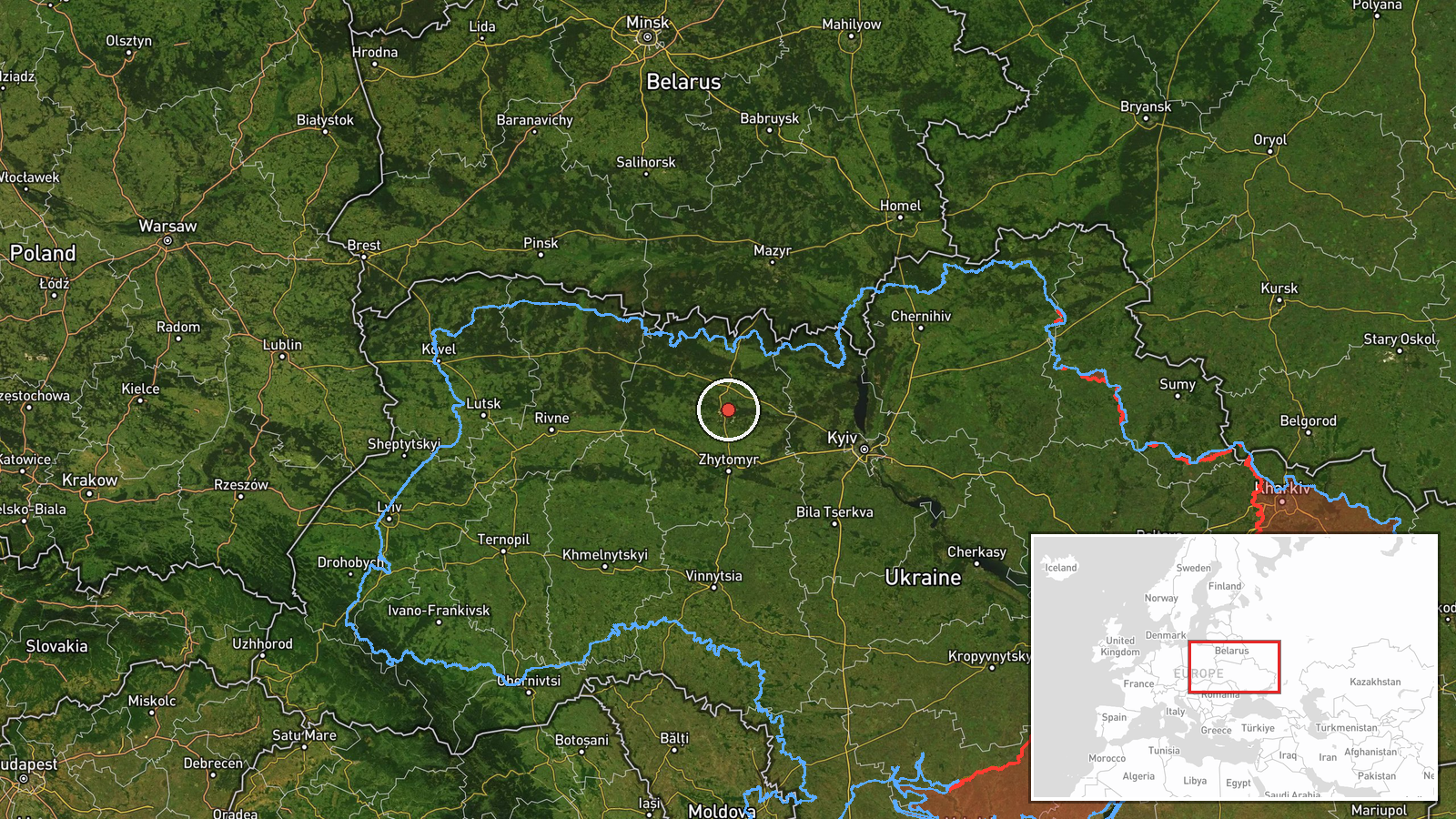
The coordinates, 50.795 N and 28.66 E, are a region-level approximation placed near the centre of northern Zhytomyr Oblast, not a specific settlement or facility. The post refers to a broad area covering northern Kyiv, Zhytomyr and Rivne oblasts, so the point marks a general zone rather than a flight path. The landscape there is largely flat to gently rolling, with forest and marsh belts associated with the Polissia lowlands. Korosten, a city in the same oblast, is mentioned in one related entry and lies a short distance from this point.
Related events nearby
- Ukrainian air monitoring: 2+ Russian jet-powered Shahed (Geran-3) drones passing northern Zhytomyr Oblast, hea2026-10-20 06:46 UTC · Drone Transit · northern Zhytomyr Oblast, Ukraine
- Ukrainian air monitoring: 1 Russian jet-powered Shahed (Geran-3) drone from northern Kyiv Oblast toward northe2026-10-20 00:45 UTC · Drone Transit · northern Zhytomyr Oblast, Ukraine
- Ukrainian air monitoring: 2+ Russian jet-powered Shahed (Geran-3) drones heading toward northern Zhytomyr Obla2026-10-19 18:12 UTC · Drone Transit · northern Zhytomyr Oblast, Ukraine
- Ukrainian air monitoring: 1 Russian jet-powered Shahed (Geran-3) drone from northern Kyiv Oblast toward northe2026-10-19 16:11 UTC · Drone Transit · northern Zhytomyr Oblast, Ukraine
- Ukrainian air monitoring: 1 Russian jet-powered Shahed (Geran-3) drone heading toward Korosten.2026-10-20 10:31 UTC · Drone Transit · Korosten, Ukraine
▶ View this event on the live map

Intel Mapper aggregates open-source reports from monitored Telegram and X channels, geolocates them, cross-checks duplicates across sources and assigns a confidence score. Entries are updated as new confirmations arrive. Read how we verify events.