2+ Geran-3 jet-powered drones reported transiting northern Zhytomyr Oblast, heading southwest
What happened
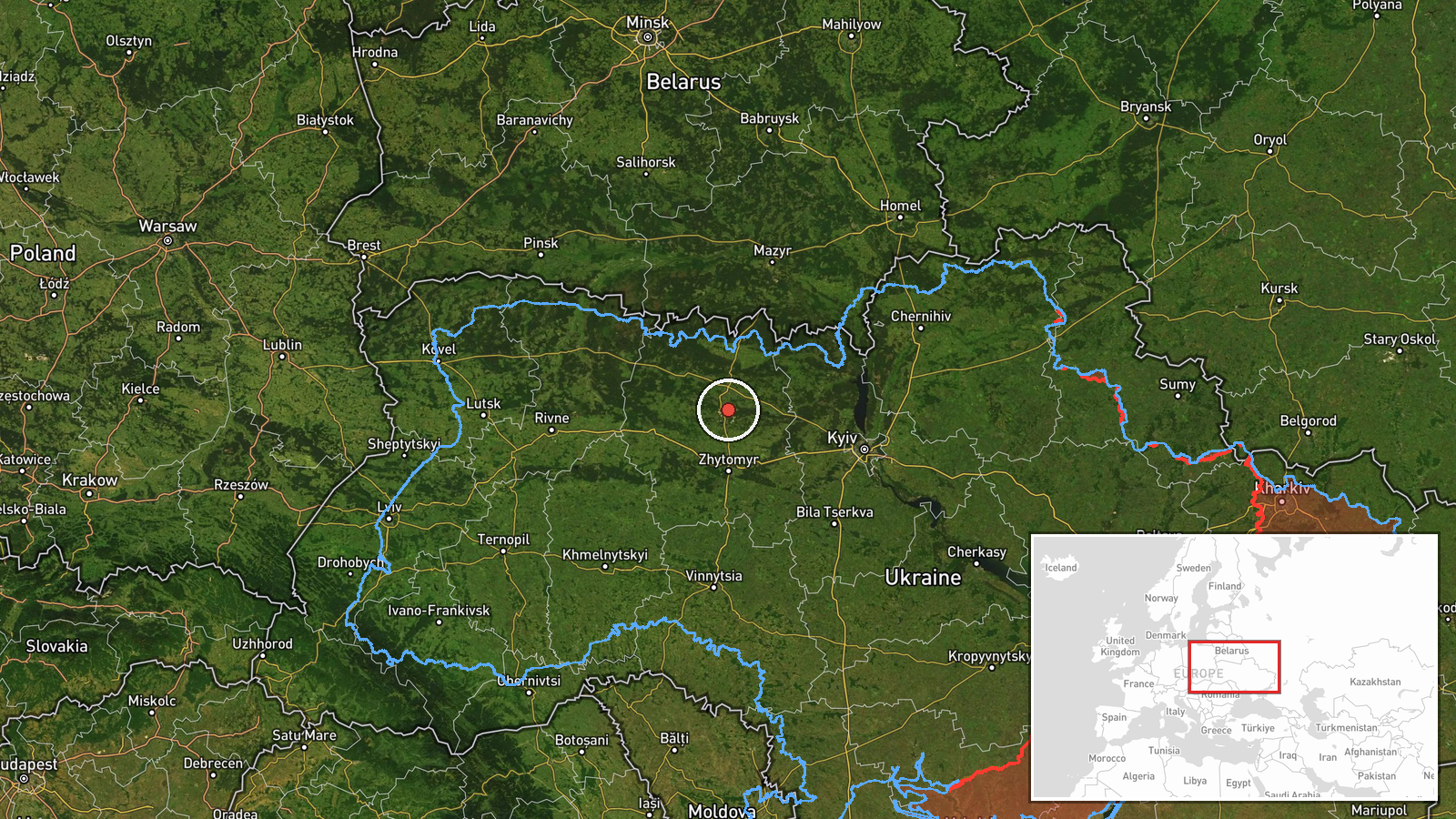
A Ukrainian air monitoring report posted on Telegram by the channel @kpszsu at 15:46 UTC on 21 October 2026 states that two or more Russian jet-powered Shahed (Geran-3) drones were passing through northern Zhytomyr Oblast, moving on a southwest heading. The original Ukrainian-language wording refers to reactive UAVs (реактивні БпЛА) in the west and north of Zhytomyr region heading in a southwestern direction. The report does not describe any impact, damage, casualties or intended target. The location is recorded at oblast level rather than at a specific settlement, and the event is classed as a drone transit rather than a strike. Only one source is listed, so the detail rests on a single channel's monitoring statement.
Context and assessment
Northern Zhytomyr Oblast lies on the routes that Russian long-range drones have repeatedly used to move across northern Ukraine, between the Belarus border and the Kyiv approaches. Earlier on the same day, the monitoring channel logged single Geran-3 drones near Korosten at 03:28 UTC, passing Cherniakhiv at 04:26 UTC heading west, and passing northern Zhytomyr Oblast heading west at 11:13 and 12:14 UTC. A further report at 15:37 UTC described a drone heading toward Zhytomyr city, followed by the 15:46 UTC report of two or more drones moving through the north. The sequence shows a steady pattern of individual transits that grew in number through the afternoon and shifted from a westward to a southwestward heading. Operationally, this may suggest drones being routed through the region toward western Ukraine or toward targets further southwest, though the data does not confirm either destination. Changes in heading and group size can also reflect rerouting, decoy use, or simply the monitoring picture changing as new sightings arrive, so the pattern should be read as indicative rather than conclusive.
Sources and confidence
The event rests on one reporting channel, Telegram @kpszsu, which is widely associated with official Ukrainian military communications. No second independent channel, wire service or official statement is included in the data for this specific report. The 8.0 confidence score reflects a credible, specific and time-stamped source, offset by the single-channel basis and the absence of cross-confirmation. Confidence would rise with corroboration from another Ukrainian air command post, regional administration statements, or reporting from independent monitoring groups that track drone flight paths. It would fall if the channel revised the drone count, retracted the transit, or if later reports identified the objects as a different type or as non-hostile aircraft.
Location
The location is an oblast-level approximation. The coordinates (about 50.80 N, 28.66 E) sit within northern Zhytomyr Oblast rather than at a named settlement, and the location confidence is low because the source does not name a precise position. The area is part of the Polissia lowlands, characterised by forests, wetlands and river valleys, including the Teteriv basin. The region borders Belarus to the north and Chernihiv Oblast to the northeast, which affects how drones can enter and leave the area.
Related events nearby
- Ukrainian air monitoring: 1 Russian jet-powered Shahed (Geran-3) drone passing northern Zhytomyr Oblast, headi2026-10-21 12:14 UTC · Drone Transit · northern Zhytomyr Oblast, Ukraine
- Ukrainian air monitoring: 1 Russian jet-powered Shahed (Geran-3) drone passing northern Zhytomyr Oblast, headi2026-10-21 11:13 UTC · Drone Transit · northern Zhytomyr Oblast, Ukraine
- Ukrainian air monitoring: 1 Russian jet-powered Shahed (Geran-3) drone heading toward Korosten.2026-10-21 03:28 UTC · Drone Transit · Korosten, Ukraine
- Ukrainian air monitoring: 1 Russian jet-powered Shahed (Geran-3) drone passing Cherniakhiv, heading west.2026-10-21 04:26 UTC · Drone Transit · Cherniakhiv, Ukraine
- Ukrainian air monitoring: 1 Russian jet-powered Shahed (Geran-3) drone heading toward Zhytomyr; 2+ Russian jet2026-10-21 15:37 UTC · Drone Transit · Zhytomyr, Ukraine
▶ View this event on the live map

Intel Mapper aggregates open-source reports from monitored Telegram and X channels, geolocates them, cross-checks duplicates across sources and assigns a confidence score. Entries are updated as new confirmations arrive. Read how we verify events.