Air monitoring reports one Shahed-type drone passing Putyvl in Sumy Oblast, heading west
What happened
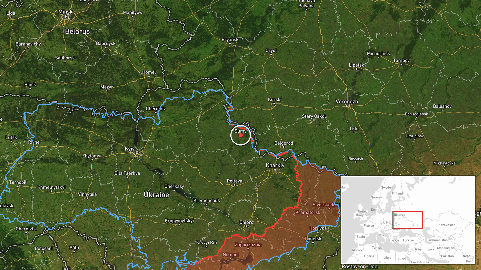
Ukrainian air monitoring reported one Russian Shahed-type drone passing Putyvl, a town in Sumy Oblast in northeastern Ukraine, on a westward heading at about 11:57 UTC on 23 October 2026. The original post, published on the Telegram channel @kpszsu, is a short Ukrainian-language note with a drone icon: 'БпЛА повз Путивль на Сумщині у західному напрямку', which translates roughly as a UAV passing Putyvl in Sumy region in a western direction. The wording names no impact, no debris site and no casualties. It describes a transit observed by monitoring rather than a confirmed strike. The post is attributed to Russia on the basis of the Shahed-type designation, which is the common name for Iranian-designed Geran loitering munitions used by Russian forces.
Context and assessment
Sumy Oblast borders Russia and has been a recurring axis of cross-border activity, so drone movements across it are routinely tracked. This single transit sits within a busy morning on the same oblast. Earlier on 23 October, air monitoring logged a Shahed-type drone heading toward Sumy itself at 00:19 UTC. At 07:43 UTC another Shahed-type drone was reported moving from Sumy Oblast toward Hlukhiv, and a further drone was noted heading toward Zaporizhzhia, which suggests several long-range platforms were active across northern and southern Ukraine at once. Ground activity was also recorded in the same window, including artillery shelling of seven Sumy Oblast settlements and airstrikes on Lužky and Khotin, plus a guided glide bomb reported heading toward northeastern Sumy Oblast at 11:01 UTC. Operationally, a westbound drone crossing this area may indicate a route toward targets farther west or a reconnaissance or decoy function, but a single transit report cannot establish intent or target.
Sources and confidence
The only source for this event is the Telegram channel @kpszsu, which carries Ukrainian Air Force monitoring updates. No second outlet or independent observer has been identified in the provided data, so cross-confirmation is absent. The confidence score of 8.0 reflects a single-channel report with a plausible, routinely published format and no corroborating impact information. It would rise if later Ukrainian official statements, regional military administration reports, or independent tracking data confirmed the drone's path through Putyvl. It would fall if follow-up updates contradicted the heading or if the drone were later reported as shot down elsewhere or as a different aircraft.
Location
The location is an approximate regional placement. The report names Putyvl, but the coordinates supplied, 50.91 N and 34.80 E, lie close to Sumy city rather than Putyvl, which sits farther west near the Seym river valley. The precision is therefore recorded as region level with low location confidence. The area is gently rolling farmland and forest belt in the Sumy plateau, close to the Russian frontier, with the Seym river and its floodplain as the main hydrographic feature nearby.
Related events nearby
- Ukrainian air monitoring: 1 Russian Shahed-type drone heading toward Sumy.2026-10-23 00:19 UTC · Drone Transit · Sumy, Ukraine
- Ukrainian air monitoring: 1 Russian guided glide bomb (KAB) heading toward northeastern Sumy Oblast.2026-10-23 11:01 UTC · Airstrike · northeastern Sumy Oblast, Ukraine
- Russian artillery shelled seven Sumy Oblast settlements, and airstrikes hit Lužky and Khotin; no casualty figu2026-10-23 05:02 UTC · Artillery · Lužky, Sumy Oblast, Ukraine
- Russian forces attacked twice near Ulanove and Korchakivka on the Northern Slobozhanskyi axis and tried to adv2026-10-23 05:03 UTC · Combat · Ulanove, Ukraine
- Ukrainian air monitoring: 1 Russian Shahed-type drone from Sumy Oblast toward Hlukhiv; 1 Russian Shahed-type d2026-10-23 07:43 UTC · Drone Transit · Hlukhiv, Ukraine
▶ View this event on the live map

Intel Mapper aggregates open-source reports from monitored Telegram and X channels, geolocates them, cross-checks duplicates across sources and assigns a confidence score. Entries are updated as new confirmations arrive. Read how we verify events.