Ukrainian air monitoring reports jet-powered Shahed drones transiting northern Chernihiv Oblast
What happened
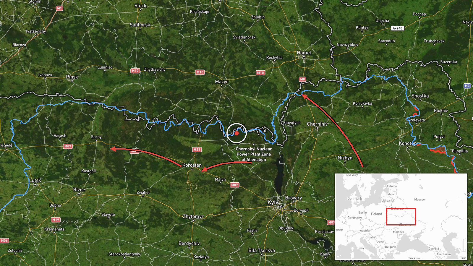
Ukraine's air monitoring channel reported on October 23, 2026, at about 12:21 UTC, that several groups of Russian jet-powered Shahed (Geran-3) drones were moving through northern Ukraine. The Telegram post, published by @kpszsu, described three separate groups: one of at least two drones passing near the settlement of Nova and heading toward northern Chernihiv Oblast, another of at least two drones moving from northern Kyiv Oblast toward northern Zhytomyr Oblast, and a third of at least two drones from northern Zhytomyr Oblast toward northern Rivne Oblast. The original Ukrainian text describes the first group as arriving from Bryansk region, though the English summary records only its position near Nova. The post reports movement only, with no impacts or targets stated.
Context and assessment
The northern corridor of Ukraine, spanning Chernihiv, Zhytomyr, and Rivne oblasts, has become a recurring path for long-range drones moving westward from Russian and Belarusian border areas. The related events on the same day show a consistent track. Earlier in the night, single and small groups were logged over Snovsk and Dobrianka, both in northern Chernihiv Oblast. A group was reported moving from Bryansk toward northern Chernihiv at 06:48 UTC, and later reports placed drones near Berezna and the city of Chernihiv at 10:40 and 10:57 UTC. Taken together, the pattern suggests drones are being routed along a northern axis rather than attacking a single fixed point. Operationally, such transit can be consistent with reconnaissance, decoy activity, or attempts to stretch air defense coverage across several oblasts, though the data does not confirm which purpose applies. The mention of Rivne in the final group indicates the flight path extends toward the far northwest, a direction that can be read as a longer-range movement rather than a local strike.
Sources and confidence
The event rests on one Telegram channel, @kpszsu, which carries official Ukrainian air monitoring updates. No second outlet or independent reporting appears in the supplied data, so cross-confirmation is absent. The confidence score of 8.0 reflects the channel's official role and the internal consistency of the related reports from the same morning. It would rise if radar data, a government statement, or regional military administrations corroborated the sightings. It would fall if later updates contradicted the routes or if the channel revised the reports.
Location
The coordinates are a region-level point for northern Chernihiv Oblast, not a specific settlement, and the location confidence is recorded as low. The post names several places, including Nova, but the map point does not mark any single one of them. Northern Chernihiv borders Belarus and Bryansk region of Russia, with Polissia forests, wetlands, and river valleys such as the Desna basin shaping the terrain across the area.
Related events nearby
- Ukrainian air monitoring: 2+ Russian jet-powered Shahed (Geran-3) drones from Bryansk (Russia) toward northern2026-10-23 06:48 UTC · Drone Transit · northern Chernihiv Oblast, Ukraine
- Ukrainian air monitoring: 1 Russian jet-powered Shahed (Geran-3) drone passing Dobrianka, heading southwest.2026-10-23 00:28 UTC · Drone Transit · Dobrianka, Ukraine
- Ukrainian air monitoring: 2+ Russian jet-powered Shahed (Geran-3) drones over Snovsk.2026-10-23 00:18 UTC · Drone Transit · Snovsk, Ukraine
- Ukrainian air monitoring: 1 Russian jet-powered Shahed (Geran-3) drone from Chernihiv Oblast toward Berezna.2026-10-23 10:40 UTC · Drone Transit · Berezna, Ukraine
- Ukrainian air monitoring: 1 Russian jet-powered Shahed (Geran-3) drone heading toward Chernihiv.2026-10-23 10:57 UTC · Drone Transit · Chernihiv, Ukraine
▶ View this event on the live map

Intel Mapper aggregates open-source reports from monitored Telegram and X channels, geolocates them, cross-checks duplicates across sources and assigns a confidence score. Entries are updated as new confirmations arrive. Read how we verify events.